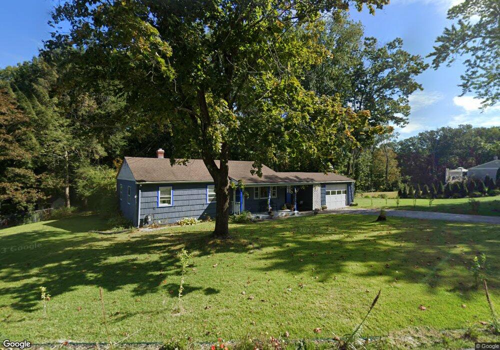
104 Philip Lauter Ave Windham, CT 06226
Estimated Value: $229,000 - $258,064
3
Beds
1
Bath
912
Sq Ft
$271/Sq Ft
Est. Value
About This Home
This home is located at 104 Philip Lauter Ave, Windham, CT 06226 and is currently estimated at $247,516, approximately $271 per square foot. 104 Philip Lauter Ave is a home located in Windham County with nearby schools including Windham High School, Oak Grove Montessori School, and St Mary St Joseph School.
Ownership History
Date
Name
Owned For
Owner Type
Purchase Details
Closed on
May 4, 2016
Sold by
Ameer Joseph A
Bought by
Espittia Igor C
Current Estimated Value
Home Financials for this Owner
Home Financials are based on the most recent Mortgage that was taken out on this home.
Original Mortgage
$80,000
Outstanding Balance
$34,451
Interest Rate
2.96%
Mortgage Type
New Conventional
Estimated Equity
$213,065
Purchase Details
Closed on
Nov 23, 2004
Sold by
Kaplitz Paul H Est and The Savings Institue
Bought by
Ameer Joseph A
Home Financials for this Owner
Home Financials are based on the most recent Mortgage that was taken out on this home.
Original Mortgage
$114,400
Interest Rate
5.8%
Mortgage Type
Purchase Money Mortgage
Create a Home Valuation Report for This Property
The Home Valuation Report is an in-depth analysis detailing your home's value as well as a comparison with similar homes in the area
Home Values in the Area
Average Home Value in this Area
Purchase History
| Date | Buyer | Sale Price | Title Company |
|---|---|---|---|
| Espittia Igor C | $100,000 | -- | |
| Ameer Joseph A | $143,000 | -- |
Source: Public Records
Mortgage History
| Date | Status | Borrower | Loan Amount |
|---|---|---|---|
| Open | Ameer Joseph A | $80,000 | |
| Previous Owner | Ameer Joseph A | $114,400 | |
| Previous Owner | Ameer Joseph A | $28,600 |
Source: Public Records
Tax History Compared to Growth
Tax History
| Year | Tax Paid | Tax Assessment Tax Assessment Total Assessment is a certain percentage of the fair market value that is determined by local assessors to be the total taxable value of land and additions on the property. | Land | Improvement |
|---|---|---|---|---|
| 2025 | $5,295 | $143,040 | $32,380 | $110,660 |
| 2024 | $5,301 | $143,040 | $32,380 | $110,660 |
| 2023 | $4,129 | $87,110 | $28,160 | $58,950 |
| 2022 | $4,068 | $87,110 | $28,160 | $58,950 |
| 2021 | $4,363 | $87,110 | $28,160 | $58,950 |
| 2020 | $4,354 | $87,110 | $28,160 | $58,950 |
| 2019 | $4,283 | $87,110 | $28,160 | $58,950 |
| 2017 | $3,551 | $74,580 | $21,720 | $52,860 |
| 2015 | $3,288 | $71,510 | $21,720 | $49,790 |
| 2014 | $3,106 | $71,510 | $21,720 | $49,790 |
Source: Public Records
Map
Nearby Homes
- 27 Aspen Place
- 59 Lynwood Dr
- 29 Kathleen Dr Unit 5E
- 23 Circle Dr
- 59 Chestnut St
- 89 Spring St
- 41 Spring St
- 23 Liberty Dr Unit 23
- 2 Pequot Square Unit 2
- 129 Valley St
- 19 Eastbrook Heights Unit C
- 335 Pleasant St
- 61 Oak St
- 54 Meadowbrook Ln
- 295 Jackson St
- 0 Storrs Rd Unit 2 170571015
- 31 Adeline Place
- 39 Jacobs Hill Rd
- 50 South St
- 38 Elm St
- 104 Lauter Ave
- 92 Lauter Ave
- 124 Lauter Ave
- 109 Lauter Ave
- 101 Lauter Ave
- 84 Lauter Ave
- 89 Lauter Ave
- 78 Philip Lauter Ave
- 12 Robin Rd
- 134 Lauter Ave
- 81 Lauter Ave
- 339 Mansfield Ave
- 329 Mansfield Ave
- 349 Mansfield Ave
- 33 Robin Rd
- 73 Lauter Ave
- 70 Lauter Ave
- 321 Mansfield Ave
- 355 Mansfield Ave
- 29 Robin Rd