Estimated Value: $168,000 - $192,000
3
Beds
2
Baths
1,168
Sq Ft
$156/Sq Ft
Est. Value
About This Home
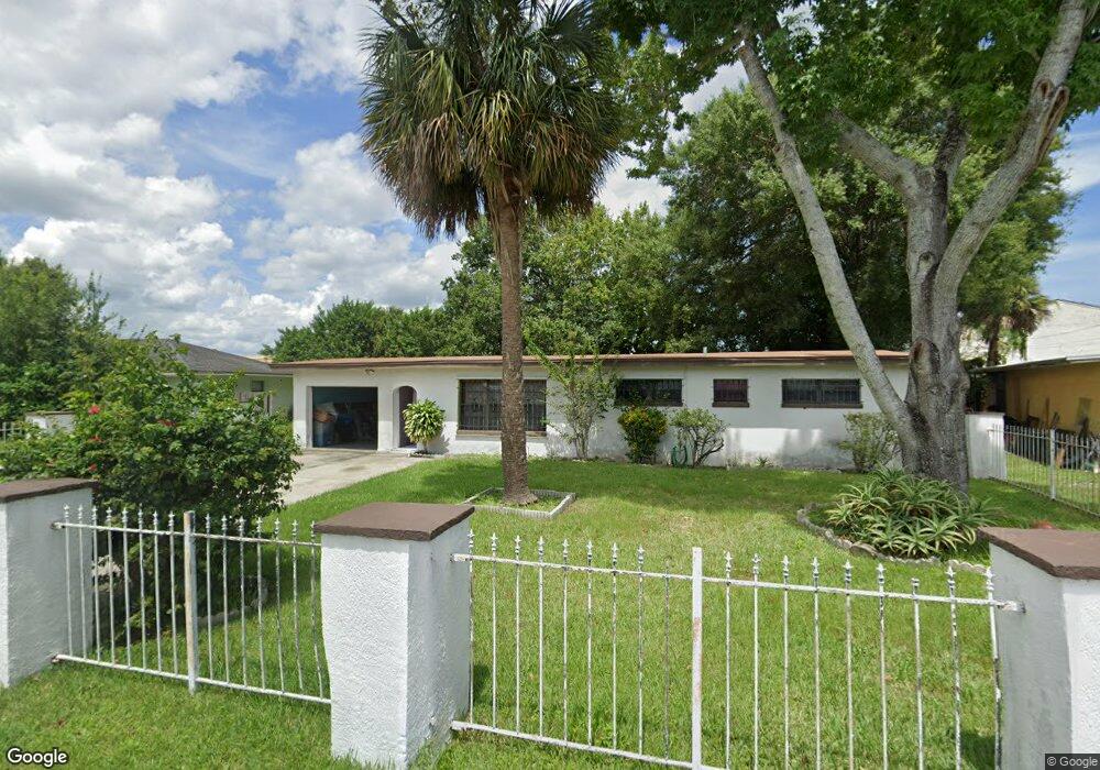
This home is located at 104 Polaris St, Cocoa, FL 32922 and is currently estimated at $182,204, approximately $155 per square foot. 104 Polaris St is a home located in Brevard County with nearby schools including Endeavour Elementary Magnet, Ronald McNair Magnet Middle School, and Rockledge Senior High School.
Ownership History
Date
Name
Owned For
Owner Type
Purchase Details
Closed on
Jul 16, 2025
Sold by
Edwards Lottie Mae
Bought by
Edwards Lottie Mae and Davis Shawnta
Current Estimated Value
Purchase Details
Closed on
Jan 14, 1997
Sold by
Dept Housing & Urban Dev
Bought by
Edwards James and Edwards Lottie M
Purchase Details
Closed on
Oct 15, 1996
Sold by
Clerk Circuit Court
Bought by
Citicorp Mtg Inc
Purchase Details
Closed on
Sep 13, 1996
Sold by
Citicorp Mtg Inc
Bought by
Housing & Urban Dev
Create a Home Valuation Report for This Property
The Home Valuation Report is an in-depth analysis detailing your home's value as well as a comparison with similar homes in the area
Home Values in the Area
Average Home Value in this Area
Purchase History
| Date | Buyer | Sale Price | Title Company |
|---|---|---|---|
| Edwards Lottie Mae | $100 | None Listed On Document | |
| Edwards Lottie Mae | $100 | None Listed On Document | |
| Edwards James | $39,500 | -- | |
| Citicorp Mtg Inc | -- | -- | |
| Housing & Urban Dev | -- | -- |
Source: Public Records
Tax History Compared to Growth
Tax History
| Year | Tax Paid | Tax Assessment Tax Assessment Total Assessment is a certain percentage of the fair market value that is determined by local assessors to be the total taxable value of land and additions on the property. | Land | Improvement |
|---|---|---|---|---|
| 2025 | $830 | $55,060 | -- | -- |
| 2024 | $812 | $53,510 | -- | -- |
| 2023 | $812 | $51,960 | $0 | $0 |
| 2022 | $840 | $50,450 | $0 | $0 |
| 2021 | $821 | $48,990 | $0 | $0 |
| 2020 | $793 | $48,320 | $0 | $0 |
| 2019 | $766 | $47,240 | $0 | $0 |
| 2018 | $642 | $46,360 | $0 | $0 |
| 2017 | $630 | $45,410 | $0 | $0 |
| 2016 | $614 | $44,480 | $12,000 | $32,480 |
| 2015 | $1,012 | $38,950 | $12,000 | $26,950 |
| 2014 | $937 | $37,310 | $12,000 | $25,310 |
Source: Public Records
Map
Nearby Homes
- 128 Aurora St
- 145 Ruth Ave
- 1237 Holmes St
- 535 S Kentucky Ave
- Xxxx S Fiske Blvd
- 824 Temple St
- 465 Sorrento Dr
- 1515 Peachtree St Unit 18
- 919 Fern Ave
- 220 Sorrento Dr
- 1103 Bellefonte Ave
- 735 Sorrento Dr
- 305 Prospect Ave
- 351 Pine Ave
- 826 Ferndale Ave
- 406 N Fiske Blvd
- Xxxx Fiske
- 1628 Sue Dr Unit B
- 935 S Varr Ave
- 406 Prospect Ave
- 102 Polaris St
- 106 Polaris St
- 105 Polaris St
- 1231 W King St
- 108 Polaris St
- 1231 King St
- 109 Explorer St
- 112 Explorer St
- 108 Aurora St
- 1261 W King St Unit 1283
- 1287 King St
- 1261 W King St Unit 1265
- 1265 W King St Unit 1271-1273
- 111 Polaris St
- 1236 S Thor
- 1236 Thor Ave
- 1229 W King St
- 110 Polaris St
- 110 Aurora St
- 116 Explorer St