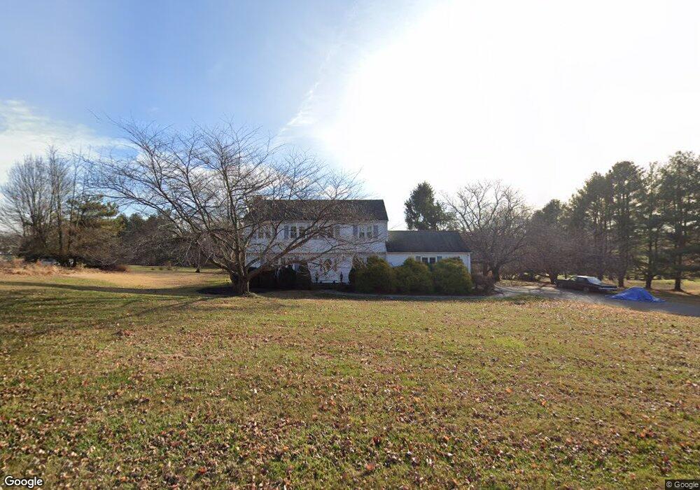
104 Robin Way Neshanic Station, NJ 08853
Readington NeighborhoodEstimated Value: $607,000 - $761,000
--
Bed
--
Bath
2,152
Sq Ft
$306/Sq Ft
Est. Value
About This Home
This home is located at 104 Robin Way, Neshanic Station, NJ 08853 and is currently estimated at $659,101, approximately $306 per square foot. 104 Robin Way is a home located in Hunterdon County with nearby schools including Hunterdon Central Regional High School District.
Ownership History
Date
Name
Owned For
Owner Type
Purchase Details
Closed on
Dec 2, 1989
Sold by
Walter James R and Walter Robin L
Bought by
Malinowski Vincent and Malinowski Debra
Current Estimated Value
Create a Home Valuation Report for This Property
The Home Valuation Report is an in-depth analysis detailing your home's value as well as a comparison with similar homes in the area
Home Values in the Area
Average Home Value in this Area
Purchase History
| Date | Buyer | Sale Price | Title Company |
|---|---|---|---|
| Malinowski Vincent | $220,000 | -- |
Source: Public Records
Tax History Compared to Growth
Tax History
| Year | Tax Paid | Tax Assessment Tax Assessment Total Assessment is a certain percentage of the fair market value that is determined by local assessors to be the total taxable value of land and additions on the property. | Land | Improvement |
|---|---|---|---|---|
| 2025 | $12,072 | $460,600 | $137,900 | $322,700 |
| 2024 | $11,971 | $460,600 | $137,900 | $322,700 |
| 2023 | $11,971 | $460,600 | $137,900 | $322,700 |
| 2022 | $11,662 | $460,600 | $137,900 | $322,700 |
| 2021 | $10,581 | $460,600 | $137,900 | $322,700 |
| 2020 | $10,786 | $354,700 | $153,600 | $201,100 |
| 2019 | $10,581 | $354,700 | $153,600 | $201,100 |
| 2018 | $10,414 | $354,700 | $153,600 | $201,100 |
| 2017 | $10,173 | $354,700 | $153,600 | $201,100 |
| 2016 | $9,932 | $354,700 | $153,600 | $201,100 |
| 2015 | $9,772 | $354,700 | $153,600 | $201,100 |
| 2014 | $9,651 | $354,700 | $153,600 | $201,100 |
Source: Public Records
Map
Nearby Homes
- 247 Summer Rd
- 816 Rt 202
- 200 Milkweed Ct Unit 200
- 499 Barton Ln
- 35 Lehigh Rd
- 34 Lehigh Rd
- 103 Oak Crest Dr
- 9 Higginsville Rd
- 6 Van Fleet Rd
- 17 Apple Tree Rd
- 407 Olive St
- 205 Hockenbury Rd
- 1053 Hillcrest Dr
- 825 Parsonage Hill Rd
- 18 Flintlock Rd
- 30 Plennert Rd
- 861 Princeton Ct
- 1 Meadow Run Way
- 29 Bressler Rd
- 872 Amwell Rd