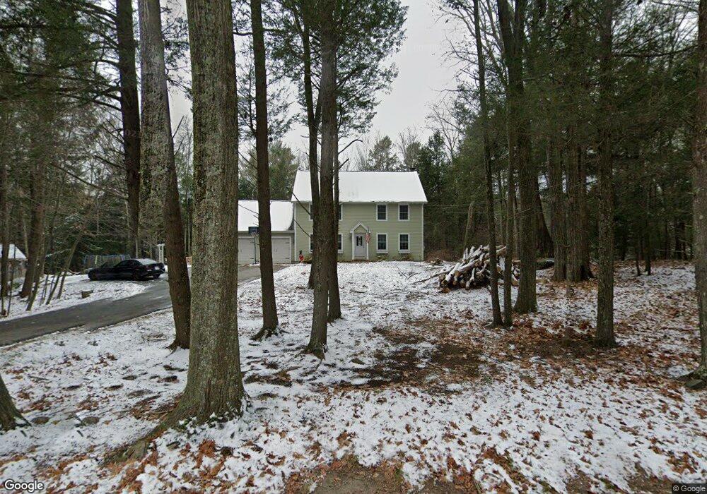
104 Route 198 Woodstock Valley, CT 06282
Outlying Woodstock NeighborhoodEstimated Value: $526,068 - $575,000
3
Beds
3
Baths
2,240
Sq Ft
$243/Sq Ft
Est. Value
About This Home
This home is located at 104 Route 198, Woodstock Valley, CT 06282 and is currently estimated at $545,267, approximately $243 per square foot. 104 Route 198 is a home located in Windham County with nearby schools including Woodstock Elementary School and Woodstock Middle School.
Ownership History
Date
Name
Owned For
Owner Type
Purchase Details
Closed on
Dec 21, 2016
Sold by
Roy David A and Roy Corey M
Bought by
Brown Michael A and Brown Stephanie M
Current Estimated Value
Home Financials for this Owner
Home Financials are based on the most recent Mortgage that was taken out on this home.
Original Mortgage
$297,979
Interest Rate
3.57%
Mortgage Type
New Conventional
Purchase Details
Closed on
Nov 3, 2008
Sold by
Odden Karl J and Aleman Alyson R
Bought by
Roy David A and Roy Corey M
Home Financials for this Owner
Home Financials are based on the most recent Mortgage that was taken out on this home.
Original Mortgage
$301,500
Interest Rate
5.83%
Mortgage Type
Purchase Money Mortgage
Purchase Details
Closed on
Dec 28, 2005
Sold by
Johndrow Scott R and Milanese Luke D
Bought by
Odden Karl J
Home Financials for this Owner
Home Financials are based on the most recent Mortgage that was taken out on this home.
Original Mortgage
$307,000
Interest Rate
6.39%
Mortgage Type
Purchase Money Mortgage
Create a Home Valuation Report for This Property
The Home Valuation Report is an in-depth analysis detailing your home's value as well as a comparison with similar homes in the area
Home Values in the Area
Average Home Value in this Area
Purchase History
| Date | Buyer | Sale Price | Title Company |
|---|---|---|---|
| Brown Michael A | $295,000 | -- | |
| Roy David A | $335,000 | -- | |
| Odden Karl J | $385,000 | -- |
Source: Public Records
Mortgage History
| Date | Status | Borrower | Loan Amount |
|---|---|---|---|
| Open | Brown Stephanie M | $341,676 | |
| Closed | Odden Karl J | $297,979 | |
| Previous Owner | Odden Karl J | $308,605 | |
| Previous Owner | Odden Karl J | $301,500 | |
| Previous Owner | Odden Karl J | $307,000 |
Source: Public Records
Tax History Compared to Growth
Tax History
| Year | Tax Paid | Tax Assessment Tax Assessment Total Assessment is a certain percentage of the fair market value that is determined by local assessors to be the total taxable value of land and additions on the property. | Land | Improvement |
|---|---|---|---|---|
| 2024 | $6,354 | $275,800 | $30,000 | $245,800 |
| 2023 | $6,181 | $275,800 | $30,000 | $245,800 |
| 2022 | $5,750 | $275,800 | $30,000 | $245,800 |
| 2021 | $5,954 | $233,500 | $30,000 | $203,500 |
| 2020 | $5,113 | $208,700 | $30,000 | $178,700 |
| 2019 | $5,113 | $208,700 | $30,000 | $178,700 |
| 2018 | $5,113 | $208,700 | $30,000 | $178,700 |
| 2017 | $5,071 | $208,700 | $30,000 | $178,700 |
| 2016 | $4,724 | $196,500 | $38,400 | $158,100 |
| 2015 | $4,590 | $196,500 | $38,400 | $158,100 |
| 2014 | $4,539 | $196,500 | $38,400 | $158,100 |
Source: Public Records
Map
Nearby Homes
- 28 Route 198
- 359 Barlow Cemetery Rd
- Lot 4A Weeks Rd
- 223 Barlow Cemetery Rd
- 89 John Perry Rd
- 6 Nahaco Hill Ln
- 5 Nahaco Hill Ln
- 211 Old Colony Rd
- 62 Crooked Trail
- 41 Millbridge Rd
- 402 Perrin Rd
- 47 Little Bungee Hill Rd
- 118 Ashford Rd Unit 6
- 25 Barlow Cemetery Rd
- 23 Little Bungee Hill Rd
- 19 Hiawatha Heights
- Lot 0 Kozey Rd
- 21 Old Sawmill Rd
- 70 Laurel Hill Dr
- 56 Laurel Hill Dr
- 104 Route 198
- 104 Route 198
- 104 Route 198
- 104 Route 198
- 104 Route 198
- 104 Route 198
- lot 13 Route 198
- lot 11 Route 198
- lot 9 Route 198
- lot 7 Route 198
- lot 5 Route 198
- 13 Eastford Rd
- 103 Route 198
- 119 Route 198
- 149 Hawkins Rd
- 169 Hawkins Rd
- Lot #8 Eastford Rd
- 113 Eastford Rd
- 109 Eastford Rd
- 133 Route 198