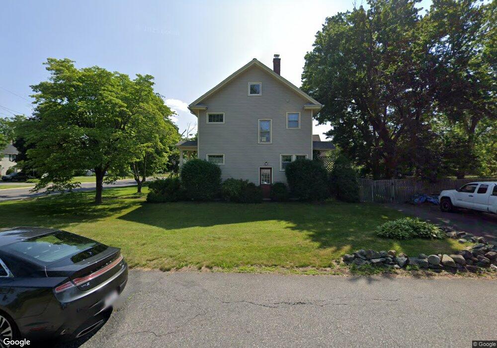
104 Springfield St Wilbraham, MA 01095
Estimated Value: $349,206 - $464,000
3
Beds
2
Baths
1,400
Sq Ft
$279/Sq Ft
Est. Value
About This Home
This home is located at 104 Springfield St, Wilbraham, MA 01095 and is currently estimated at $390,552, approximately $278 per square foot. 104 Springfield St is a home located in Hampden County with nearby schools including Minnechaug Regional High School, Springfield International Charter School, and Wilbraham & Monson Academy.
Ownership History
Date
Name
Owned For
Owner Type
Purchase Details
Closed on
Apr 29, 2003
Sold by
Westman Daniel T and Westman Lori M
Bought by
Moriarty Patrick S
Current Estimated Value
Home Financials for this Owner
Home Financials are based on the most recent Mortgage that was taken out on this home.
Original Mortgage
$161,100
Outstanding Balance
$69,252
Interest Rate
5.64%
Mortgage Type
Purchase Money Mortgage
Estimated Equity
$321,300
Purchase Details
Closed on
Apr 1, 2002
Sold by
Difazio Stacy M
Bought by
Westman Daniel T and Westman Lori M
Home Financials for this Owner
Home Financials are based on the most recent Mortgage that was taken out on this home.
Original Mortgage
$126,000
Interest Rate
6.88%
Mortgage Type
Purchase Money Mortgage
Purchase Details
Closed on
Nov 1, 1994
Sold by
Coolidge Curtis A and Coolidge Katherine K
Bought by
Landers Brendan M and Landers Stacey D
Create a Home Valuation Report for This Property
The Home Valuation Report is an in-depth analysis detailing your home's value as well as a comparison with similar homes in the area
Home Values in the Area
Average Home Value in this Area
Purchase History
| Date | Buyer | Sale Price | Title Company |
|---|---|---|---|
| Moriarty Patrick S | $179,000 | -- | |
| Westman Daniel T | $158,000 | -- | |
| Landers Brendan M | $120,000 | -- |
Source: Public Records
Mortgage History
| Date | Status | Borrower | Loan Amount |
|---|---|---|---|
| Open | Landers Brendan M | $10,000 | |
| Open | Moriarty Patrick S | $161,100 | |
| Previous Owner | Landers Brendan M | $126,000 | |
| Previous Owner | Landers Brendan M | $115,500 |
Source: Public Records
Tax History Compared to Growth
Tax History
| Year | Tax Paid | Tax Assessment Tax Assessment Total Assessment is a certain percentage of the fair market value that is determined by local assessors to be the total taxable value of land and additions on the property. | Land | Improvement |
|---|---|---|---|---|
| 2025 | $4,738 | $265,000 | $87,100 | $177,900 |
| 2024 | $4,843 | $261,800 | $87,100 | $174,700 |
| 2023 | $4,653 | $249,600 | $87,100 | $162,500 |
| 2022 | $4,653 | $227,100 | $87,100 | $140,000 |
| 2021 | $4,521 | $196,900 | $95,700 | $101,200 |
| 2020 | $4,407 | $196,900 | $95,700 | $101,200 |
| 2019 | $4,295 | $197,000 | $95,700 | $101,300 |
| 2018 | $4,327 | $191,100 | $95,700 | $95,400 |
| 2017 | $4,204 | $191,100 | $95,700 | $95,400 |
| 2016 | $4,175 | $193,300 | $101,700 | $91,600 |
| 2015 | $4,036 | $193,300 | $101,700 | $91,600 |
Source: Public Records
Map
Nearby Homes
- 8 Patriot Ridge Ln
- 68 Monson Rd
- 2 Bayberry Dr Unit 51
- 760 Stony Hill Rd
- 767 Stony Hill Rd
- 763 Stony Hill Rd
- 28 Decorie Dr
- 14 Brookdale Dr
- 6 Hilltop Park
- 5 Edgewood Rd
- 1028 Tinkham Rd
- 12 Highridge Rd
- 474 Mountain Rd
- 6 Katie St
- 751 Ridge Rd
- 11 Wellfleet Dr
- 500 Springfield St
- 92 Sandalwood Dr
- 69 High Pine Cir
- 99 Sandalwood Dr Unit site 00
- 96 Springfield St
- 107 Springfield St
- 88 Springfield St
- 106 Springfield St
- 106 Springfield St
- 106 Springfield St Unit 1
- 99 Springfield St
- 84 Springfield St
- 95 Springfield St
- 111 Springfield St
- 89 Springfield St
- 4 Ripley St
- 5 Ripley St
- 6 Ripley St
- 80 Springfield St
- 2 Orlando St
- 81 Springfield St
- 7 Ripley St
- 8 Ripley St
- 4 Orlando St