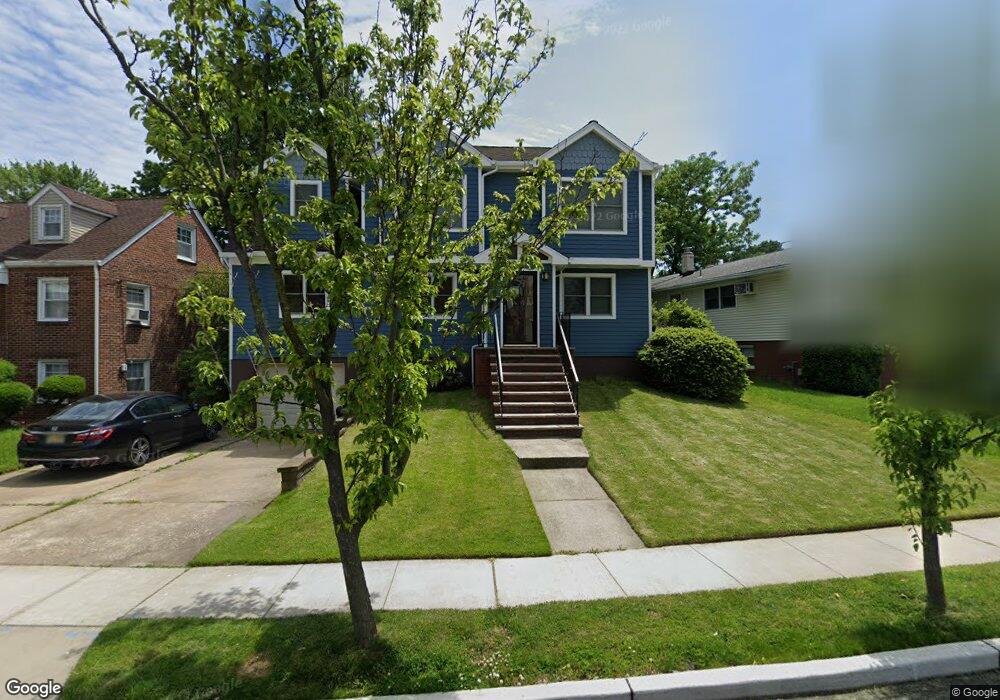
104 Summit Cir Little Ferry, NJ 07643
Estimated Value: $655,000 - $774,000
--
Bed
--
Bath
1,934
Sq Ft
$380/Sq Ft
Est. Value
About This Home
This home is located at 104 Summit Cir, Little Ferry, NJ 07643 and is currently estimated at $735,574, approximately $380 per square foot. 104 Summit Cir is a home located in Bergen County with nearby schools including Memorial Middle School, Academy of Greatness & Excellence, and George Washington School.
Ownership History
Date
Name
Owned For
Owner Type
Purchase Details
Closed on
Apr 29, 1996
Sold by
Sesty William
Bought by
Severino William and Serverino Amy
Current Estimated Value
Home Financials for this Owner
Home Financials are based on the most recent Mortgage that was taken out on this home.
Original Mortgage
$130,000
Outstanding Balance
$7,286
Interest Rate
7.82%
Estimated Equity
$728,288
Create a Home Valuation Report for This Property
The Home Valuation Report is an in-depth analysis detailing your home's value as well as a comparison with similar homes in the area
Home Values in the Area
Average Home Value in this Area
Purchase History
| Date | Buyer | Sale Price | Title Company |
|---|---|---|---|
| Severino William | $166,000 | -- |
Source: Public Records
Mortgage History
| Date | Status | Borrower | Loan Amount |
|---|---|---|---|
| Open | Severino William | $130,000 |
Source: Public Records
Tax History Compared to Growth
Tax History
| Year | Tax Paid | Tax Assessment Tax Assessment Total Assessment is a certain percentage of the fair market value that is determined by local assessors to be the total taxable value of land and additions on the property. | Land | Improvement |
|---|---|---|---|---|
| 2025 | $15,033 | $642,400 | $264,300 | $378,100 |
| 2024 | $14,870 | $600,100 | $236,400 | $363,700 |
| 2023 | $14,665 | $541,300 | $203,900 | $337,400 |
| 2022 | $14,665 | $498,300 | $183,600 | $314,700 |
| 2021 | $14,867 | $459,700 | $168,600 | $291,100 |
| 2020 | $14,390 | $443,600 | $166,100 | $277,500 |
| 2019 | $14,015 | $429,900 | $163,600 | $266,300 |
| 2018 | $13,831 | $419,000 | $161,100 | $257,900 |
| 2017 | $13,738 | $411,200 | $158,600 | $252,600 |
| 2016 | $13,562 | $404,600 | $156,100 | $248,500 |
| 2015 | $13,275 | $396,400 | $151,100 | $245,300 |
| 2014 | $11,249 | $426,900 | $239,500 | $187,400 |
Source: Public Records
Map
Nearby Homes
- 462 Liberty St Unit 462A Unit 101
- 468a Liberty St Unit 101
- 468 Liberty St Unit 201
- 46 Grand St
- 305 Phillips Ave
- 23 Grand St
- 38 Moonachie Rd Unit 315
- 85 Grove St
- 12 Brandt St
- 180 Main St
- 78 Poplar Ave
- 43 Kaufman Ave
- 1 Rossi Ct
- 46 John St
- 70 Main St Unit 1
- 25 Poplar Ave
- 169 Franklin St
- 48 Main St Unit 1
- 44 Grove St
- 418 Taylor Ave