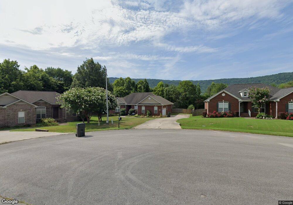
104 Tall Grass Cir NE Huntsville, AL 35811
Ryland NeighborhoodEstimated Value: $357,000 - $409,000
4
Beds
2
Baths
2,200
Sq Ft
$172/Sq Ft
Est. Value
About This Home
This home is located at 104 Tall Grass Cir NE, Huntsville, AL 35811 and is currently estimated at $377,537, approximately $171 per square foot. 104 Tall Grass Cir NE is a home located in Madison County with nearby schools including Central School, Madison County High School, and Union Chapel Christian Academy.
Ownership History
Date
Name
Owned For
Owner Type
Purchase Details
Closed on
May 29, 2009
Sold by
Lambert James E and Lambert Megan L
Bought by
Leigh Audrey
Current Estimated Value
Home Financials for this Owner
Home Financials are based on the most recent Mortgage that was taken out on this home.
Original Mortgage
$207,900
Outstanding Balance
$131,354
Interest Rate
4.77%
Mortgage Type
Purchase Money Mortgage
Estimated Equity
$246,183
Purchase Details
Closed on
Oct 31, 2005
Sold by
Fuller Andy L
Bought by
Lambert James E and Lambert Megan L
Home Financials for this Owner
Home Financials are based on the most recent Mortgage that was taken out on this home.
Original Mortgage
$163,650
Interest Rate
5.71%
Mortgage Type
New Conventional
Create a Home Valuation Report for This Property
The Home Valuation Report is an in-depth analysis detailing your home's value as well as a comparison with similar homes in the area
Home Values in the Area
Average Home Value in this Area
Purchase History
| Date | Buyer | Sale Price | Title Company |
|---|---|---|---|
| Leigh Audrey | -- | -- | |
| Lambert James E | -- | -- |
Source: Public Records
Mortgage History
| Date | Status | Borrower | Loan Amount |
|---|---|---|---|
| Open | Leigh Audrey | $207,900 | |
| Previous Owner | Lambert James E | $163,650 |
Source: Public Records
Tax History Compared to Growth
Tax History
| Year | Tax Paid | Tax Assessment Tax Assessment Total Assessment is a certain percentage of the fair market value that is determined by local assessors to be the total taxable value of land and additions on the property. | Land | Improvement |
|---|---|---|---|---|
| 2024 | $2,353 | $65,460 | $12,000 | $53,460 |
| 2023 | $2,353 | $65,460 | $12,000 | $53,460 |
| 2022 | $1,988 | $55,120 | $8,000 | $47,120 |
| 2021 | $1,785 | $49,560 | $8,000 | $41,560 |
| 2020 | $1,634 | $22,710 | $4,000 | $18,710 |
| 2019 | $1,583 | $22,010 | $4,000 | $18,010 |
| 2018 | $1,521 | $42,320 | $0 | $0 |
| 2017 | $1,483 | $41,280 | $0 | $0 |
| 2016 | $1,483 | $41,280 | $0 | $0 |
| 2015 | $1,483 | $41,280 | $0 | $0 |
| 2014 | $1,536 | $42,740 | $0 | $0 |
Source: Public Records
Map
Nearby Homes
- 217 Shadowbrook Ln NE
- 104 Early Morning Cir
- 3.8 Acres Townsend Dr SE
- 232 Shadowbrook Ln NE
- 118 Hollington Dr NE
- 213 Hollington Dr NE
- 208 Townsend Dr SE
- 1604 Calistoga Cir NE
- 137 Bridgestone Dr NE
- 2106 Kanteen St NE
- 2104 Kanteen St NE
- 2102 Kanteen St NE
- 2100 Kanteen St NE
- 1608 Calistoga Cir NE
- 1610 Calistoga Cir NE
- 1612 Calistoga Cir NE
- 101 Sunrise Cove Cir
- 1613 Calistoga Cir NE
- 149 Bridgestone Dr NE
- 1617 Calistoga Cir NE
- 106 Tall Grass Cir NE
- 102 Tall Grass Cir NE
- 105 Daybreak Way
- 103 Daybreak Way
- 153 Valleystone Rd NE
- 0 Tall Grass Cir Unit 1018985
- 100 Tall Grass Cir NE
- 103 Tall Grass Cir NE
- 157 Valley Stone Rd
- 105 Tall Grass Cir NE
- 107 Tall Grass Cir NE
- 101 Tall Grass Cir NE
- 106 Daybreak Way
- 101 Daybreak Way
- 145 Valley Stone Rd
- 152 Valley Stone Rd
- 142 Sanders Dr
- 150 Valley Stone Rd
- 148 Valley Stone Rd
- 156 Valley Stone Rd