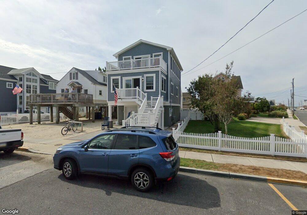
104 W Sherman Ave Strathmere, NJ 08248
Estimated Value: $721,000 - $1,997,000
Studio
--
Bath
1,128
Sq Ft
$1,273/Sq Ft
Est. Value
About This Home
This home is located at 104 W Sherman Ave, Strathmere, NJ 08248 and is currently estimated at $1,436,098, approximately $1,273 per square foot. 104 W Sherman Ave is a home with nearby schools including Ocean City Primary School, Ocean City Intermediate School, and Ocean City High School.
Ownership History
Date
Name
Owned For
Owner Type
Purchase Details
Closed on
Oct 21, 1998
Sold by
Cordrey Robert
Bought by
Garrity William and Garrity Alice
Current Estimated Value
Home Financials for this Owner
Home Financials are based on the most recent Mortgage that was taken out on this home.
Original Mortgage
$100,000
Outstanding Balance
$21,592
Interest Rate
6.74%
Estimated Equity
$1,414,506
Purchase Details
Closed on
Nov 17, 1989
Sold by
Repp Anna
Bought by
Cordrey Robert and Cordrey Sharon
Create a Home Valuation Report for This Property
The Home Valuation Report is an in-depth analysis detailing your home's value as well as a comparison with similar homes in the area
Home Values in the Area
Average Home Value in this Area
Purchase History
| Date | Buyer | Sale Price | Title Company |
|---|---|---|---|
| Garrity William | $125,000 | -- | |
| Cordrey Robert | $141,500 | -- |
Source: Public Records
Mortgage History
| Date | Status | Borrower | Loan Amount |
|---|---|---|---|
| Open | Garrity William | $100,000 |
Source: Public Records
Tax History
| Year | Tax Paid | Tax Assessment Tax Assessment Total Assessment is a certain percentage of the fair market value that is determined by local assessors to be the total taxable value of land and additions on the property. | Land | Improvement |
|---|---|---|---|---|
| 2025 | $8,735 | $523,400 | $259,500 | $263,900 |
| 2024 | $8,735 | $393,300 | $259,500 | $133,800 |
| 2023 | $8,295 | $393,300 | $259,500 | $133,800 |
| 2022 | $8,015 | $393,300 | $259,500 | $133,800 |
| 2021 | $5,718 | $393,300 | $259,500 | $133,800 |
| 2020 | $7,429 | $393,300 | $259,500 | $133,800 |
| 2019 | $7,249 | $393,300 | $259,500 | $133,800 |
| 2018 | $7,060 | $393,300 | $259,500 | $133,800 |
| 2017 | $6,981 | $393,300 | $259,500 | $133,800 |
| 2016 | $5,458 | $302,900 | $259,500 | $43,400 |
| 2015 | $5,313 | $302,900 | $259,500 | $43,400 |
| 2014 | $5,302 | $370,000 | $350,000 | $20,000 |
Source: Public Records
Map
Nearby Homes
- 18 E Randolph Ave
- 104 Prescott Ave
- 22 Williams Ave
- 17 E Vincent Ave
- 117 Taylor Ave
- 5732 Central 1st Ave Unit 1st
- 5724 Asbury Ave Unit 1
- 5734 Central Ave Unit 5734
- 1731 Route 9 Unit 98
- 1731 Route 9 Unit 11
- 1731 Route 9 Unit 149
- 30 S Inlet Dr Unit 1
- 5516 Asbury Ave Unit 18
- 5512 Asbury Ave
- 400 E 55th St Unit D
- 5441 Central Ave
- 2 W Katherine Ave
- 1731 U S 9 Unit 122
- 401 54th St Unit 401 54TH
- 2600 Landis Ave Unit North
- 100 W Sherman Ave
- 4 W Sherman Ave
- 513 S Bayview Dr
- 101 Randolph Ave
- 605 S Bayview Dr
- 1 W Randolph Ave
- 5 W Sherman Ave
- 507 S Bayview Dr Unit North
- 507-509 S Bayview Ave Unit South
- 2 W Seacliff Unit 1
- 2 W Seacliff Unit 2
- 2 W Seacliff Unit 3
- 2 W Seacliff
- 2 W Seacliff Unit B
- 512 S Bayview Dr
- 1 E Sherman Ave
- 1 W Sherman Ave
- 612 Bayview Dr
- 508 S Bayview Dr
- 505 S Bayview Dr
Your Personal Tour Guide
Ask me questions while you tour the home.