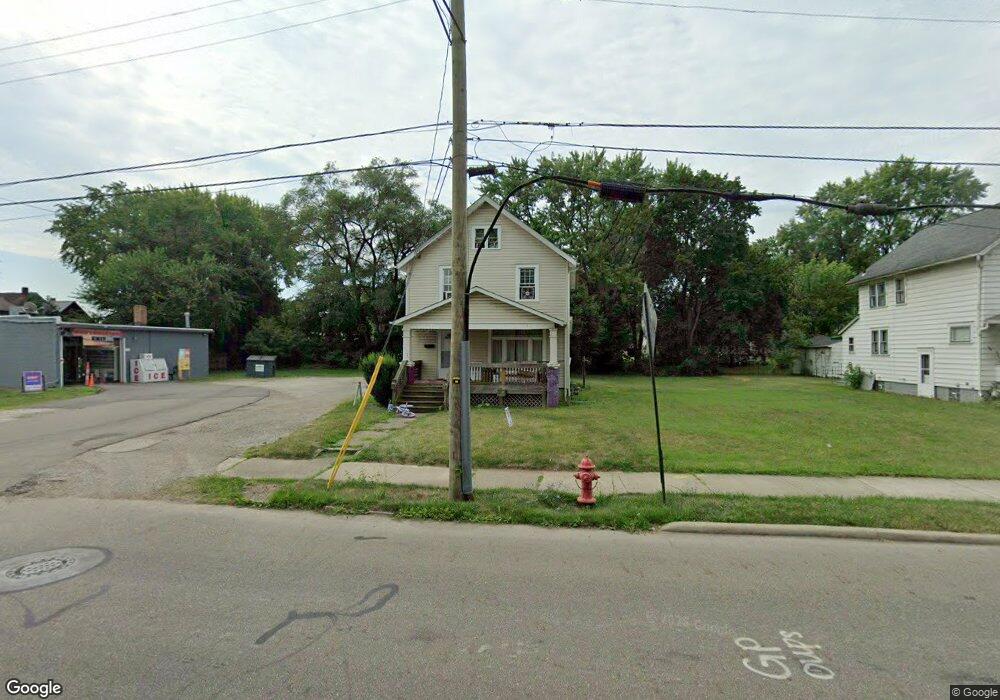
104 W Vine St Alliance, OH 44601
Estimated Value: $36,000 - $42,619
2
Beds
1
Bath
1,296
Sq Ft
$31/Sq Ft
Est. Value
About This Home
This home is located at 104 W Vine St, Alliance, OH 44601 and is currently estimated at $39,873, approximately $30 per square foot. 104 W Vine St is a home located in Stark County with nearby schools including Alliance Early Learning School, Alliance Intermediate School at Northside, and Alliance Middle School.
Ownership History
Date
Name
Owned For
Owner Type
Purchase Details
Closed on
Aug 23, 2024
Sold by
Marsili Eric C
Bought by
Warren Daniel
Current Estimated Value
Purchase Details
Closed on
Mar 20, 2024
Sold by
Marsili Jaci R
Bought by
Marsili Eric C
Purchase Details
Closed on
Mar 31, 2011
Sold by
Marsili Eric
Bought by
Warren Daniel
Home Financials for this Owner
Home Financials are based on the most recent Mortgage that was taken out on this home.
Original Mortgage
$32,000
Interest Rate
8%
Mortgage Type
Seller Take Back
Purchase Details
Closed on
Feb 9, 2011
Sold by
Fannie Mae
Bought by
Marsili Eric
Home Financials for this Owner
Home Financials are based on the most recent Mortgage that was taken out on this home.
Original Mortgage
$32,000
Interest Rate
8%
Mortgage Type
Seller Take Back
Purchase Details
Closed on
Aug 16, 2010
Sold by
Orzo Ronda Sue
Bought by
Federal National Mortgage Association
Purchase Details
Closed on
Jun 29, 2000
Sold by
Orzo Karen K
Bought by
Orzo Ronda Sue
Create a Home Valuation Report for This Property
The Home Valuation Report is an in-depth analysis detailing your home's value as well as a comparison with similar homes in the area
Home Values in the Area
Average Home Value in this Area
Purchase History
| Date | Buyer | Sale Price | Title Company |
|---|---|---|---|
| Warren Daniel | $35,000 | None Listed On Document | |
| Marsili Eric C | -- | None Listed On Document | |
| Warren Daniel | $35,000 | None Available | |
| Marsili Eric | $7,200 | Nova Title Agency Inc | |
| Federal National Mortgage Association | $20,000 | Attorney | |
| Orzo Ronda Sue | -- | -- |
Source: Public Records
Mortgage History
| Date | Status | Borrower | Loan Amount |
|---|---|---|---|
| Previous Owner | Warren Daniel | $32,000 |
Source: Public Records
Tax History Compared to Growth
Tax History
| Year | Tax Paid | Tax Assessment Tax Assessment Total Assessment is a certain percentage of the fair market value that is determined by local assessors to be the total taxable value of land and additions on the property. | Land | Improvement |
|---|---|---|---|---|
| 2025 | $519 | $12,150 | $7,530 | $4,620 |
| 2024 | -- | $12,150 | $7,530 | $4,620 |
| 2023 | $588 | $14,290 | $7,460 | $6,830 |
| 2022 | $592 | $14,290 | $7,460 | $6,830 |
| 2021 | $594 | $14,290 | $7,460 | $6,830 |
| 2020 | $540 | $12,150 | $6,480 | $5,670 |
| 2019 | $533 | $12,150 | $6,480 | $5,670 |
| 2018 | $536 | $12,150 | $6,480 | $5,670 |
| 2017 | $390 | $8,690 | $4,380 | $4,310 |
| 2016 | $393 | $8,690 | $4,380 | $4,310 |
| 2015 | $410 | $8,970 | $3,680 | $5,290 |
| 2014 | $458 | $9,560 | $3,920 | $5,640 |
| 2013 | $229 | $9,560 | $3,920 | $5,640 |
Source: Public Records
Map
Nearby Homes
- 124 E Wayne St
- 710 N Freedom Ave
- 11344 Walnut Ave NE
- 511 W Ely St
- 329 1/2 W Main St
- 163 W Market St
- 652 N Webb Ave
- 000 Meadowbrook Ave
- 0 Meadowbrook Ave
- 361 E Main St
- 132 S Haines Ave
- 345 W Market St
- 11310 Webb Ave NE
- 11680 Walnut Ave NE
- 0 Homestead Ave NE
- 356 E Broadway St
- 263 Franklin Ave
- 432 Johnson Ave
- 427 S Union Ave
- 142 S Seneca Ave