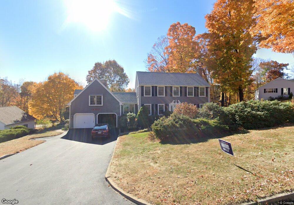
104 Weigands Dr New Britain, CT 06052
Estimated Value: $427,633 - $459,000
3
Beds
3
Baths
2,231
Sq Ft
$198/Sq Ft
Est. Value
About This Home
This home is located at 104 Weigands Dr, New Britain, CT 06052 and is currently estimated at $442,158, approximately $198 per square foot. 104 Weigands Dr is a home located in Hartford County with nearby schools including Lincoln School, Slade Middle School, and Raymond Hill School.
Ownership History
Date
Name
Owned For
Owner Type
Purchase Details
Closed on
Apr 25, 2002
Sold by
Abate Carmine J and Abate Deborah A
Bought by
Price Daniel and Price Wai L
Current Estimated Value
Home Financials for this Owner
Home Financials are based on the most recent Mortgage that was taken out on this home.
Original Mortgage
$50,100
Interest Rate
7.05%
Create a Home Valuation Report for This Property
The Home Valuation Report is an in-depth analysis detailing your home's value as well as a comparison with similar homes in the area
Home Values in the Area
Average Home Value in this Area
Purchase History
| Date | Buyer | Sale Price | Title Company |
|---|---|---|---|
| Price Daniel | $215,000 | -- |
Source: Public Records
Mortgage History
| Date | Status | Borrower | Loan Amount |
|---|---|---|---|
| Closed | Price Daniel | $50,100 | |
| Previous Owner | Price Daniel | $12,000 |
Source: Public Records
Tax History Compared to Growth
Tax History
| Year | Tax Paid | Tax Assessment Tax Assessment Total Assessment is a certain percentage of the fair market value that is determined by local assessors to be the total taxable value of land and additions on the property. | Land | Improvement |
|---|---|---|---|---|
| 2025 | $9,048 | $230,930 | $65,660 | $165,270 |
| 2024 | $9,143 | $230,930 | $65,660 | $165,270 |
| 2023 | $8,840 | $230,930 | $65,660 | $165,270 |
| 2022 | $7,772 | $157,010 | $30,240 | $126,770 |
| 2021 | $7,772 | $157,010 | $30,240 | $126,770 |
| 2020 | $7,929 | $157,010 | $30,240 | $126,770 |
| 2019 | $7,929 | $157,010 | $30,240 | $126,770 |
| 2018 | $7,929 | $157,010 | $30,240 | $126,770 |
| 2017 | $8,297 | $164,290 | $30,800 | $133,490 |
| 2016 | $8,297 | $164,290 | $30,800 | $133,490 |
| 2015 | $8,050 | $164,290 | $30,800 | $133,490 |
| 2014 | $8,050 | $164,290 | $30,800 | $133,490 |
Source: Public Records
Map
Nearby Homes
- 28 Weigands Dr
- 8 Hickory Hill Rd
- 78 Victoria Rd
- 71 Pennsylvania Ave
- 106 Barnes St
- 565 Lincoln St
- 423 Monroe St
- 33 Colt St
- 212 Lincoln St
- 96 Garden St
- 817 W Main St
- 112 Lincoln St
- 30 Westerly St
- 62 Cedarwood Rd
- 66 Lincoln St
- 256 Hart St
- 43 Westerly St
- 23 Ledyard Rd
- 100 Shuttle Meadow Ave
- 76 N Mountain Rd Unit B
- 94 Weigands Dr
- 90 Streamside Ln
- 110 Weigands Dr
- 104 Streamside Ln
- 84 Weigands Dr
- 114 Streamside Ln
- 7 Canal St
- 93 Wiegands Dr
- 93 Weigands Dr
- 10 Canal St
- 83 Weigands Dr
- 74 Weigands Dr
- 128 Streamside Ln
- 101 Streamside Ln
- 65 Streamside Ln
- 40 Streamside Ln
- 20 Canal St
- 25 Canal St
- 7 Weigands Dr
- 232 Birchwood Dr