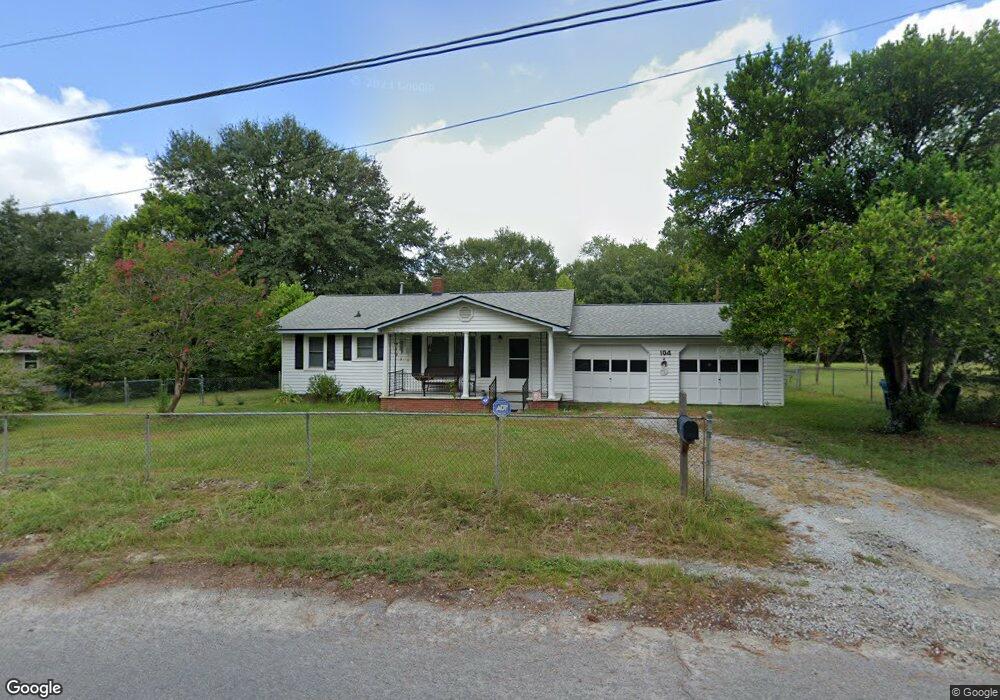
104 Whiteside Cir West Columbia, SC 29169
Estimated Value: $105,000 - $171,000
3
Beds
1
Bath
1,064
Sq Ft
$138/Sq Ft
Est. Value
About This Home
This home is located at 104 Whiteside Cir, West Columbia, SC 29169 and is currently estimated at $146,524, approximately $137 per square foot. 104 Whiteside Cir is a home located in Lexington County with nearby schools including Cayce Elementary, Cyril B. Busbee Creative Arts Academy, and Brookland-Cayce High School.
Ownership History
Date
Name
Owned For
Owner Type
Purchase Details
Closed on
Sep 5, 2014
Sold by
Martin Betty L and Williams Judy L
Bought by
Sanders Timothy A
Current Estimated Value
Home Financials for this Owner
Home Financials are based on the most recent Mortgage that was taken out on this home.
Original Mortgage
$78,850
Outstanding Balance
$60,476
Interest Rate
4.19%
Mortgage Type
New Conventional
Estimated Equity
$86,048
Purchase Details
Closed on
Sep 28, 2005
Sold by
Martin William W and Martin Betty L
Bought by
Williams Judy L and Villella Lynn D
Create a Home Valuation Report for This Property
The Home Valuation Report is an in-depth analysis detailing your home's value as well as a comparison with similar homes in the area
Home Values in the Area
Average Home Value in this Area
Purchase History
| Date | Buyer | Sale Price | Title Company |
|---|---|---|---|
| Sanders Timothy A | $83,000 | -- | |
| Williams Judy L | -- | -- |
Source: Public Records
Mortgage History
| Date | Status | Borrower | Loan Amount |
|---|---|---|---|
| Open | Sanders Timothy A | $78,850 |
Source: Public Records
Tax History Compared to Growth
Tax History
| Year | Tax Paid | Tax Assessment Tax Assessment Total Assessment is a certain percentage of the fair market value that is determined by local assessors to be the total taxable value of land and additions on the property. | Land | Improvement |
|---|---|---|---|---|
| 2024 | $680 | $3,205 | $640 | $2,565 |
| 2023 | $614 | $3,205 | $640 | $2,565 |
| 2022 | $620 | $3,205 | $640 | $2,565 |
| 2020 | $595 | $3,205 | $640 | $2,565 |
| 2019 | $622 | $3,294 | $640 | $2,654 |
| 2018 | $628 | $3,294 | $640 | $2,654 |
| 2017 | $603 | $3,294 | $640 | $2,654 |
| 2016 | $620 | $3,293 | $640 | $2,653 |
| 2014 | $143 | $3,693 | $720 | $2,973 |
| 2013 | -- | $3,690 | $720 | $2,970 |
Source: Public Records
Map
Nearby Homes
- 135 Silver Run Place
- 116 Silver Run Place
- 309 Hammond Ave
- 339 Gum Swamp Trail
- 349 Gum Swamp Trail
- 706 Westside Dr
- 212 Alexandria St
- 725 Brooks Ave
- 2312 Rainbow Dr
- 2405 Rainbow Dr
- 2024 Platt Springs Rd
- 1802 D Ave
- 153 Cavendish Dr
- 151 Cavendish Dr
- 157 Cavendish Dr
- 615 Dawn Dr
- 826 Jefferson St
- 215 Sandel Ln
- 207 Woodhaven Dr
- 1608 Crapps Ave
- 106 Whiteside Cir
- 108 Bonnie St
- 102 Whiteside Cir
- 108 Whiteside Cir
- 105 Whiteside Cir
- 107 Whiteside Cir
- 109 Whiteside Cir
- 604 Brooks Ave
- 112 Bonnie St
- 111 Whiteside Cir
- 2341 Thornton Ave
- 110 Whiteside Cir
- 2337 Thornton Ave
- 2337 Thorton Ave
- 113 Bonnie St
- 113 Whiteside Cir
- 2335 Thornton Ave
- 115 Whiteside Cir
- 112 Whiteside Cir
- 116 Bonnie St