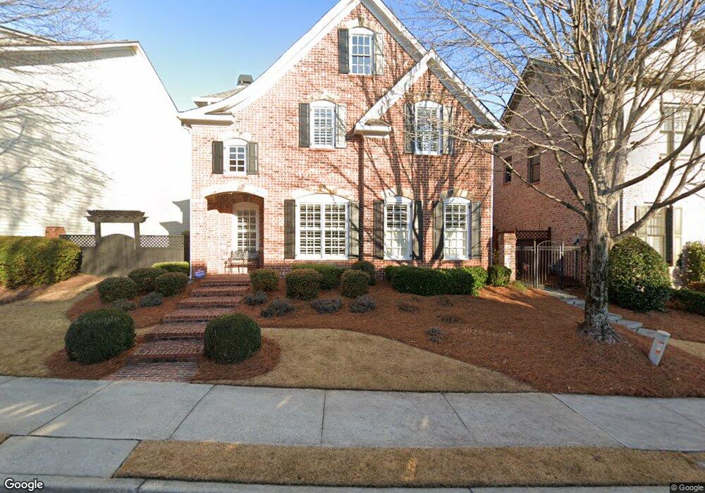
1040 Ambrose Ave Unit 1 Alpharetta, GA 30022
Estimated Value: $817,043 - $917,000
3
Beds
4
Baths
2,640
Sq Ft
$330/Sq Ft
Est. Value
About This Home
This home is located at 1040 Ambrose Ave Unit 1, Alpharetta, GA 30022 and is currently estimated at $871,011, approximately $329 per square foot. 1040 Ambrose Ave Unit 1 is a home located in Fulton County with nearby schools including New Prospect Elementary School, Webb Bridge Middle School, and Alpharetta High School.
Ownership History
Date
Name
Owned For
Owner Type
Purchase Details
Closed on
Feb 12, 2025
Sold by
Callahan James R
Bought by
Callahan James R and Callahan Kathleen Mary
Current Estimated Value
Purchase Details
Closed on
May 20, 2013
Sold by
Fink Samuel F
Bought by
Callahan James R
Purchase Details
Closed on
Sep 11, 2002
Sold by
Hjh/Milton Llc
Bought by
Fink Samuel F and Fink Alice M
Home Financials for this Owner
Home Financials are based on the most recent Mortgage that was taken out on this home.
Original Mortgage
$394,000
Interest Rate
6%
Mortgage Type
New Conventional
Create a Home Valuation Report for This Property
The Home Valuation Report is an in-depth analysis detailing your home's value as well as a comparison with similar homes in the area
Home Values in the Area
Average Home Value in this Area
Purchase History
| Date | Buyer | Sale Price | Title Company |
|---|---|---|---|
| Callahan James R | -- | -- | |
| Callahan James R | $425,000 | -- | |
| Fink Samuel F | $394,000 | -- |
Source: Public Records
Mortgage History
| Date | Status | Borrower | Loan Amount |
|---|---|---|---|
| Previous Owner | Fink Samuel F | $394,000 |
Source: Public Records
Tax History Compared to Growth
Tax History
| Year | Tax Paid | Tax Assessment Tax Assessment Total Assessment is a certain percentage of the fair market value that is determined by local assessors to be the total taxable value of land and additions on the property. | Land | Improvement |
|---|---|---|---|---|
| 2025 | $904 | $322,720 | $90,960 | $231,760 |
| 2023 | $904 | $263,880 | $62,800 | $201,080 |
| 2022 | $4,845 | $235,800 | $50,240 | $185,560 |
| 2021 | $896 | $201,160 | $47,200 | $153,960 |
| 2020 | $5,758 | $199,120 | $46,800 | $152,320 |
| 2019 | $893 | $195,640 | $46,000 | $149,640 |
| 2018 | $4,242 | $191,040 | $44,920 | $146,120 |
| 2017 | $4,792 | $180,000 | $42,120 | $137,880 |
| 2016 | $4,768 | $180,000 | $42,120 | $137,880 |
| 2015 | $5,620 | $180,000 | $42,120 | $137,880 |
| 2014 | $4,646 | $164,320 | $38,440 | $125,880 |
Source: Public Records
Map
Nearby Homes
- 615 Society St
- 530 Kearny St
- 725 High Hampton Run
- 8425 High Hampton Chase
- The Emaline Plan at Pinecone
- The Clementine Plan at Pinecone
- 202 Pinecone Place
- 0 N Point Pkwy Unit 7649723
- 0 N Point Pkwy Unit 10605589
- 3195 Waters Mill Dr
- The Benton I Plan at Ecco Park
- The Benton II Plan at Ecco Park
- The Barnsley I Plan at Ecco Park
- The Barnsley II Plan at Ecco Park
- 223 Downing Dr
- 352 Olmstead Way Unit 28
- 350 Olmstead Way Unit 29
- 342 Olmstead Way Unit 33
- 340 Olmstead Way Unit 34
- 362 Olmstead Way Unit 23
- 1030 Ambrose Ave
- 305 Society St Unit 1
- 1060 Ambrose Ave Unit 1
- 1020 Ambrose Ave
- 295 Society St
- 315 Society St Unit 1
- 1055 Ambrose Ave
- 1045 Ambrose Ave
- 1065 Ambrose Ave
- 325 Society St Unit 1
- 1070 Ambrose Ave
- 1010 Ambrose Ave
- 1035 Ambrose Ave
- 1075 Ambrose Ave
- 335 Society St Unit 1
- 1025 Ambrose Ave
- 1085 Ambrose Ave Unit 1
- 1000 Ambrose Ave
- 1015 Ambrose Ave
- 2050 Arminda Ct