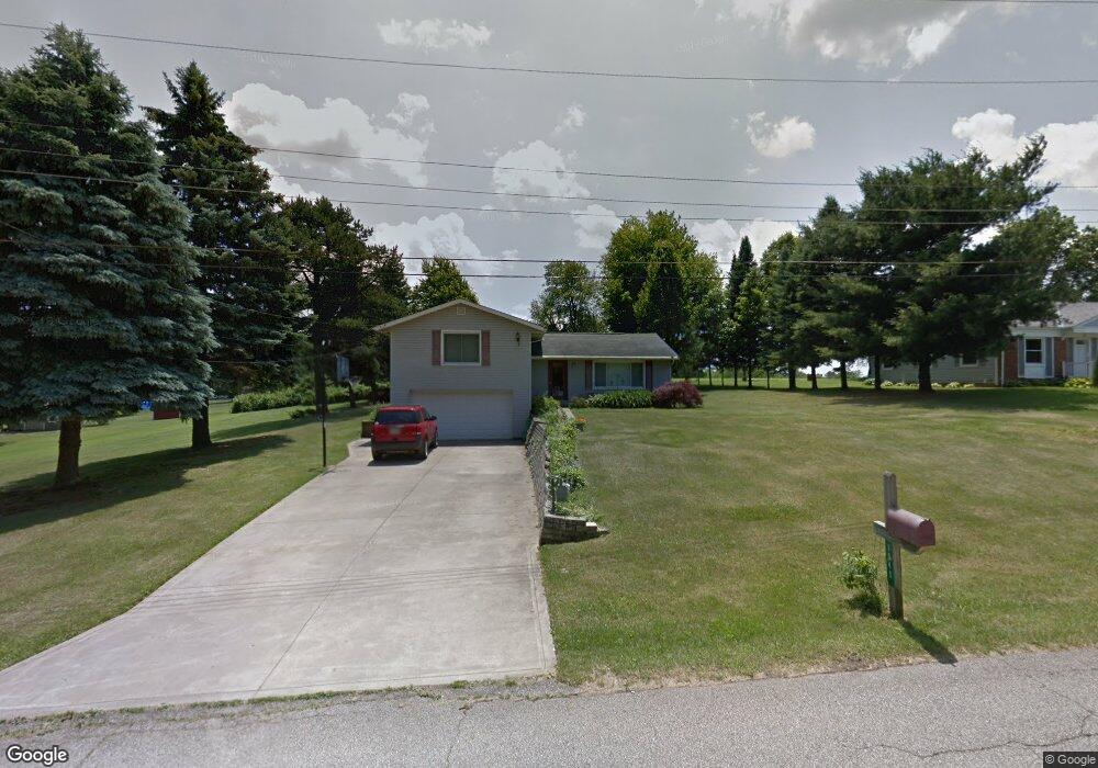
1040 Annfield Dr Mansfield, OH 44903
Estimated Value: $195,000 - $235,000
3
Beds
2
Baths
1,684
Sq Ft
$128/Sq Ft
Est. Value
About This Home
This home is located at 1040 Annfield Dr, Mansfield, OH 44903 and is currently estimated at $216,204, approximately $128 per square foot. 1040 Annfield Dr is a home located in Richland County with nearby schools including Madison High School and St. Mary Catholic School.
Ownership History
Date
Name
Owned For
Owner Type
Purchase Details
Closed on
Oct 28, 2005
Sold by
Smith Terry W and Smith Annette
Bought by
Anschutz Andrew R
Current Estimated Value
Home Financials for this Owner
Home Financials are based on the most recent Mortgage that was taken out on this home.
Original Mortgage
$115,450
Outstanding Balance
$62,326
Interest Rate
5.8%
Mortgage Type
Fannie Mae Freddie Mac
Estimated Equity
$153,878
Purchase Details
Closed on
Apr 25, 1996
Sold by
Worley Joseph L
Bought by
Smith Terry W and Smith Annette
Home Financials for this Owner
Home Financials are based on the most recent Mortgage that was taken out on this home.
Original Mortgage
$44,000
Interest Rate
7.91%
Mortgage Type
New Conventional
Purchase Details
Closed on
Oct 28, 1992
Sold by
Worley Robert O
Bought by
Worley Joseph L
Create a Home Valuation Report for This Property
The Home Valuation Report is an in-depth analysis detailing your home's value as well as a comparison with similar homes in the area
Home Values in the Area
Average Home Value in this Area
Purchase History
| Date | Buyer | Sale Price | Title Company |
|---|---|---|---|
| Anschutz Andrew R | $121,500 | Southern Title | |
| Smith Terry W | $55,000 | -- | |
| Worley Joseph L | -- | -- |
Source: Public Records
Mortgage History
| Date | Status | Borrower | Loan Amount |
|---|---|---|---|
| Open | Anschutz Andrew R | $115,450 | |
| Previous Owner | Smith Terry W | $44,000 |
Source: Public Records
Tax History Compared to Growth
Tax History
| Year | Tax Paid | Tax Assessment Tax Assessment Total Assessment is a certain percentage of the fair market value that is determined by local assessors to be the total taxable value of land and additions on the property. | Land | Improvement |
|---|---|---|---|---|
| 2024 | $2,546 | $51,490 | $10,980 | $40,510 |
| 2023 | $2,546 | $51,490 | $10,980 | $40,510 |
| 2022 | $2,224 | $39,830 | $9,660 | $30,170 |
| 2021 | $2,204 | $39,830 | $9,660 | $30,170 |
| 2020 | $2,220 | $39,830 | $9,660 | $30,170 |
| 2019 | $2,118 | $33,750 | $8,180 | $25,570 |
| 2018 | $1,981 | $33,750 | $8,180 | $25,570 |
| 2017 | $1,897 | $33,750 | $8,180 | $25,570 |
| 2016 | $1,853 | $31,110 | $7,770 | $23,340 |
| 2015 | $1,768 | $31,110 | $7,770 | $23,340 |
| 2014 | $1,762 | $31,110 | $7,770 | $23,340 |
| 2012 | $833 | $31,110 | $8,180 | $22,930 |
Source: Public Records
Map
Nearby Homes
- 1245 N Stewart Rd
- 1158 Delwood Rd
- 1150 Delwood Dr
- 1151 Beal Rd
- 920 Piper Rd
- 1585 Beal Rd
- 1106 Keller Dr Unit 1108
- 1292 Wolford Rd
- 1140 5th Ave
- 0 Wesley
- 0 Hoover Rd
- 735 Pennsylvania Ave
- 741 Yale Ave
- 1199 Evergreen Ave W
- 1183 Evergreen Ave W
- 1171 Hoover Rd
- 903 Mayflower Ave
- 1791 Beal Rd
- 683 Coachman Rd
- 671 Coachman Rd
- 1030 Annfield Dr
- 1020 Annfield Dr
- 1265 N Stewart Rd
- 1041 Annfield Dr
- 1049 Annfield Dr
- 1010 Annfield Dr
- 1285 N Stewart Rd
- 1235 N Stewart Rd
- 1295 N Stewart Rd
- 1000 Annfield Dr
- 1005 Annfield Dr
- 1270 N Stewart Rd
- 1219 N Stewart Rd
- 1040 Donnawood Dr
- 1305 N Stewart Rd
- 990 Annfield Dr
- 1246 N Stewart Rd
- 1260 N Stewart Rd
- 995 Annfield Dr Unit 999
- 1242 N Stewart Rd