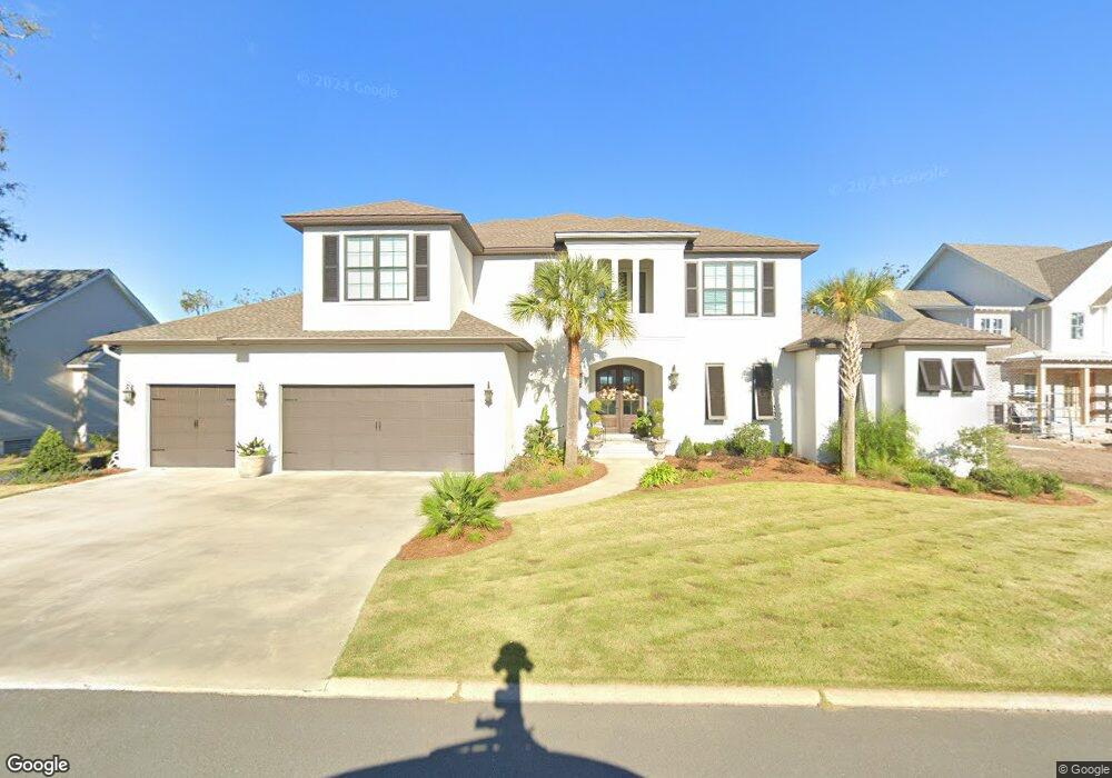
1040 Brockinton Dr Saint Simons Island, GA 31522
Estimated Value: $1,049,000 - $1,448,000
4
Beds
5
Baths
3,884
Sq Ft
$326/Sq Ft
Est. Value
About This Home
This home is located at 1040 Brockinton Dr, Saint Simons Island, GA 31522 and is currently estimated at $1,266,007, approximately $325 per square foot. 1040 Brockinton Dr is a home with nearby schools including Oglethorpe Point Elementary School, Glynn Middle School, and Glynn Academy.
Ownership History
Date
Name
Owned For
Owner Type
Purchase Details
Closed on
Feb 12, 2016
Sold by
Driggers Construction Co I
Bought by
Jones Todd E and Jones Jean M
Current Estimated Value
Home Financials for this Owner
Home Financials are based on the most recent Mortgage that was taken out on this home.
Original Mortgage
$123,675
Outstanding Balance
$6,177
Interest Rate
3.92%
Mortgage Type
New Conventional
Estimated Equity
$1,259,830
Create a Home Valuation Report for This Property
The Home Valuation Report is an in-depth analysis detailing your home's value as well as a comparison with similar homes in the area
Home Values in the Area
Average Home Value in this Area
Purchase History
| Date | Buyer | Sale Price | Title Company |
|---|---|---|---|
| Jones Todd E | $145,500 | -- |
Source: Public Records
Mortgage History
| Date | Status | Borrower | Loan Amount |
|---|---|---|---|
| Open | Jones Todd E | $123,675 |
Source: Public Records
Tax History Compared to Growth
Tax History
| Year | Tax Paid | Tax Assessment Tax Assessment Total Assessment is a certain percentage of the fair market value that is determined by local assessors to be the total taxable value of land and additions on the property. | Land | Improvement |
|---|---|---|---|---|
| 2025 | $8,995 | $358,680 | $100,000 | $258,680 |
| 2024 | $8,416 | $335,560 | $100,000 | $235,560 |
| 2023 | $6,269 | $335,560 | $100,000 | $235,560 |
| 2022 | $6,786 | $315,560 | $80,000 | $235,560 |
| 2021 | $6,993 | $270,600 | $76,000 | $194,600 |
| 2020 | $7,059 | $270,600 | $76,000 | $194,600 |
| 2019 | $2,109 | $76,000 | $76,000 | $0 |
| 2018 | $1,462 | $56,000 | $56,000 | $0 |
| 2017 | $1,462 | $56,000 | $56,000 | $0 |
| 2016 | $1,166 | $48,600 | $48,600 | $0 |
| 2015 | $996 | $48,600 | $48,600 | $0 |
| 2014 | $996 | $48,600 | $48,600 | $0 |
Source: Public Records
Map
Nearby Homes
- LOT 18 Canopy Ct
- LOT 3 Canopy Ct
- LOT 1 Canopy Ct
- LOT 24 Canopy Ct
- LOT 8 Canopy Ct
- 18 Canopy Ct
- 24 Canopy Ct
- 3 Canopy Ct
- 8 Canopy Ct
- 112 Brookfield Trace
- 110 Pirates Cove
- 258 Saint James Ave
- 131 Shadow Wood Bend
- 512 Brockinton S
- 129 Shadow Wood Bend
- 123 Shadow Wood Bend
- 622 Brockinton Point
- 361 Brockinton Marsh
- 712 Hamilton Landing Dr
- 104 Ashwood Way
- 1030 Brockinton Dr
- 1039 Brockinton Dr
- 1050 Brockinton Dr
- 1047 Brockinton Dr
- 1031 Brockinton Dr
- 1055 Brockinton Dr
- 101 Pirates Cove
- 102 Woodbrook Way
- 103 Pirates Cove
- 000 Pirates Cove
- Lot 74 Pirates Cove
- 100 Woodbrook Way
- 102 Pirates Cove
- 102 Pirates Cove
- 1058 Brockinton Dr
- 104 Woodbrook Way
- 1064 Brockinton Dr
- 1065 Brockinton Dr
- 1072 Brockinton Dr
- 106 Woodbrook Way