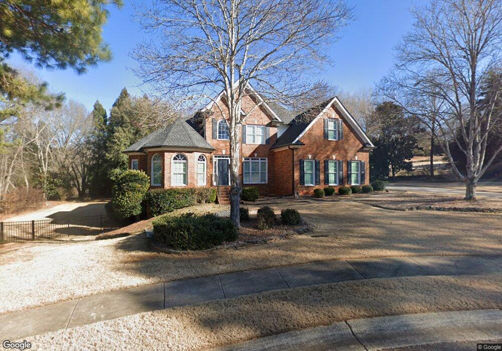
1040 Buckeye Pointe Athens, GA 30606
Estimated Value: $702,220 - $951,000
5
Beds
4
Baths
2,779
Sq Ft
$284/Sq Ft
Est. Value
About This Home
This home is located at 1040 Buckeye Pointe, Athens, GA 30606 and is currently estimated at $789,805, approximately $284 per square foot. 1040 Buckeye Pointe is a home located in Oconee County with nearby schools including Oconee County Elementary School, Oconee County Primary School, and Oconee County Middle School.
Ownership History
Date
Name
Owned For
Owner Type
Purchase Details
Closed on
May 6, 2019
Sold by
Broussard Charles T
Bought by
Malinak Chad Michael and Malinak Meredith B
Current Estimated Value
Home Financials for this Owner
Home Financials are based on the most recent Mortgage that was taken out on this home.
Original Mortgage
$360,000
Outstanding Balance
$313,210
Interest Rate
4%
Mortgage Type
New Conventional
Estimated Equity
$476,595
Purchase Details
Closed on
Aug 31, 1999
Sold by
Cliff Lewis Enterpri
Bought by
Broussard Charles T
Purchase Details
Closed on
May 5, 1998
Sold by
Lake Wellbrook Llc
Bought by
Cliff Lewis Enterpri
Create a Home Valuation Report for This Property
The Home Valuation Report is an in-depth analysis detailing your home's value as well as a comparison with similar homes in the area
Purchase History
| Date | Buyer | Sale Price | Title Company |
|---|---|---|---|
| Malinak Chad Michael | $450,000 | -- | |
| Broussard Charles T | $330,000 | -- | |
| Cliff Lewis Enterpri | $213,200 | -- |
Source: Public Records
Mortgage History
| Date | Status | Borrower | Loan Amount |
|---|---|---|---|
| Open | Malinak Chad Michael | $360,000 |
Source: Public Records
Tax History
| Year | Tax Paid | Tax Assessment Tax Assessment Total Assessment is a certain percentage of the fair market value that is determined by local assessors to be the total taxable value of land and additions on the property. | Land | Improvement |
|---|---|---|---|---|
| 2025 | $4,488 | $254,328 | $34,000 | $220,328 |
| 2024 | $4,488 | $235,919 | $34,500 | $201,419 |
| 2023 | $4,402 | $221,822 | $34,000 | $187,822 |
| 2022 | $4,281 | $200,114 | $34,000 | $166,114 |
| 2021 | $4,147 | $179,811 | $34,000 | $145,811 |
| 2020 | $4,098 | $177,429 | $38,000 | $139,429 |
| 2019 | $4,057 | $175,650 | $38,000 | $137,650 |
| 2018 | $3,688 | $156,380 | $38,000 | $118,380 |
| 2017 | $3,506 | $148,723 | $38,000 | $110,723 |
| 2016 | $3,492 | $148,120 | $38,000 | $110,120 |
| 2015 | $3,511 | $148,629 | $38,000 | $110,629 |
| 2014 | $3,491 | $144,462 | $38,000 | $106,462 |
| 2013 | -- | $141,224 | $38,000 | $103,224 |
Source: Public Records
Map
Nearby Homes
- 1270 Nona Dr
- 1090 Scarlet Oak Cir
- 2481 Lakewood Manor Dr
- 1141 Beverly Dr
- 2041 Lakewood Manor Dr
- 1271 Daniells Bridge Rd
- 1611 Crystal Hills Dr
- 1340 Old Epps Bridge Rd
- 8471 Macon Hwy
- 1542 Meadow Springs Dr
- 1051 Spartan Ln
- 2950 Stone Rd
- 381 Township Ln
- 1609 Meadow Lakes Dr
- 155 Ridgeview Dr
- 645 Parrish Pointe Dr
- 8660 Macon Hwy
- 1091 Barber Creek Dr
- 237 Towns Walk Dr
- 236 Towns Walk Dr
- 1170 Willow Ridge
- 1050 Buckeye Point
- 1050 Buckeye Pointe
- 1030 Buckeye Pointe
- 1150 Willow Ridge
- 1150 Willow Ridge
- 1190 Willow Ridge
- 1051 Buckeye Pointe
- 1041 Buckeye Pointe
- 1130 Willow Ridge
- 1090 Willow Ridge
- -- Willow Ridge
- 1110 Willow Ridge
- 1070 Willow Ridge
- 1020 Buckeye Pointe
- 1020 Buckeye Point
- 1090 Willow Ridge
- 1181 Willow Ridge
- 1050 Willow Ridge
- 1210 Willow Ridge
Your Personal Tour Guide
Ask me questions while you tour the home.