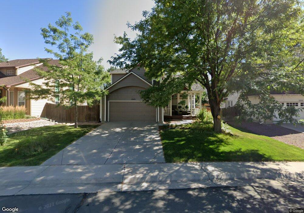
1040 E 131st Dr Thornton, CO 80241
Hunters Glen NeighborhoodEstimated Value: $627,000 - $676,000
4
Beds
4
Baths
2,968
Sq Ft
$217/Sq Ft
Est. Value
About This Home
This home is located at 1040 E 131st Dr, Thornton, CO 80241 and is currently estimated at $644,521, approximately $217 per square foot. 1040 E 131st Dr is a home located in Adams County with nearby schools including Hunters Glen Elementary School, Century Middle School, and Mountain Range High School.
Ownership History
Date
Name
Owned For
Owner Type
Purchase Details
Closed on
Mar 15, 2019
Sold by
Stone Jennifer J and Stone Charles E
Bought by
Weaver Julie B
Current Estimated Value
Home Financials for this Owner
Home Financials are based on the most recent Mortgage that was taken out on this home.
Original Mortgage
$340,000
Outstanding Balance
$296,478
Interest Rate
4.4%
Mortgage Type
New Conventional
Estimated Equity
$348,043
Purchase Details
Closed on
Dec 15, 2003
Sold by
Lauer Dave and Lauer Leann
Bought by
Stone Charles E and Stone Jennifer J
Home Financials for this Owner
Home Financials are based on the most recent Mortgage that was taken out on this home.
Original Mortgage
$100,000
Interest Rate
6.02%
Mortgage Type
Unknown
Purchase Details
Closed on
Sep 21, 1993
Sold by
Markborough Development
Bought by
Lauer David and Lauer Leann
Purchase Details
Closed on
Jul 21, 1993
Purchase Details
Closed on
Jan 22, 1993
Create a Home Valuation Report for This Property
The Home Valuation Report is an in-depth analysis detailing your home's value as well as a comparison with similar homes in the area
Home Values in the Area
Average Home Value in this Area
Purchase History
| Date | Buyer | Sale Price | Title Company |
|---|---|---|---|
| Weaver Julie B | $440,000 | Wfg National Title | |
| Stone Charles E | $257,500 | -- | |
| Lauer David | $152,900 | -- | |
| -- | $152,900 | -- | |
| -- | $66,500 | -- |
Source: Public Records
Mortgage History
| Date | Status | Borrower | Loan Amount |
|---|---|---|---|
| Open | Weaver Julie B | $340,000 | |
| Previous Owner | Stone Charles E | $100,000 |
Source: Public Records
Tax History
| Year | Tax Paid | Tax Assessment Tax Assessment Total Assessment is a certain percentage of the fair market value that is determined by local assessors to be the total taxable value of land and additions on the property. | Land | Improvement |
|---|---|---|---|---|
| 2025 | $3,992 | $41,760 | $7,960 | $33,800 |
| 2024 | $3,992 | $38,370 | $7,310 | $31,060 |
| 2023 | $3,951 | $42,280 | $7,370 | $34,910 |
| 2022 | $3,343 | $30,350 | $7,580 | $22,770 |
| 2021 | $3,454 | $30,350 | $7,580 | $22,770 |
| 2020 | $3,052 | $27,360 | $7,790 | $19,570 |
| 2019 | $3,058 | $27,360 | $7,790 | $19,570 |
| 2018 | $3,044 | $26,450 | $7,490 | $18,960 |
| 2017 | $2,767 | $26,450 | $7,490 | $18,960 |
| 2016 | $2,264 | $21,070 | $4,860 | $16,210 |
| 2015 | $2,261 | $21,070 | $4,860 | $16,210 |
| 2014 | $2,157 | $18,690 | $4,220 | $14,470 |
Source: Public Records
Map
Nearby Homes
- 1162 E 130th Ave Unit B
- 1672 E 131st Ct
- 12905 Lafayette St Unit H
- 7 Sandpiper Cir
- 13550 Washington St Unit 7C
- 0 128th & Washington St
- 12885 Vine St
- 12962 Grant Cir E Unit A
- 13012 Grant Cir E Unit A
- 12913 Grant Cir E Unit A
- 13023 Grant Cir E Unit C
- 2066 E 129th Ave
- 13000 Grant Cir W Unit B
- 13151 Grant Cir N Unit C
- 13508 Vine St
- 2263 E 129th Ave Unit 2263
- 58 Blue Heron Dr
- 56 Blue Heron Dr
- 2275 E 129th Ave
- 2297 E 128th Ave
- 1060 E 131st Dr
- 1020 E 131st Dr
- 1041 E 130th Place
- 1080 E 131st Dr
- 1061 E 130th Place
- 1010 E 131st Dr
- 1021 E 130th Place
- 1081 E 130th Place
- 1110 E 131st Dr
- 1009 E 131st Dr
- 1049 E 131st Dr
- 1011 E 130th Place
- 1069 E 131st Dr
- 1111 E 130th Place
- 1140 E 131st Dr
- 13191 Emerson St
- 1119 E 131st Dr
- 1151 E 130th Place
- 1052 E 130th Place
- 998 E 132nd Ave
Your Personal Tour Guide
Ask me questions while you tour the home.