Estimated Value: $218,000 - $261,000
2
Beds
2
Baths
1,120
Sq Ft
$210/Sq Ft
Est. Value
About This Home
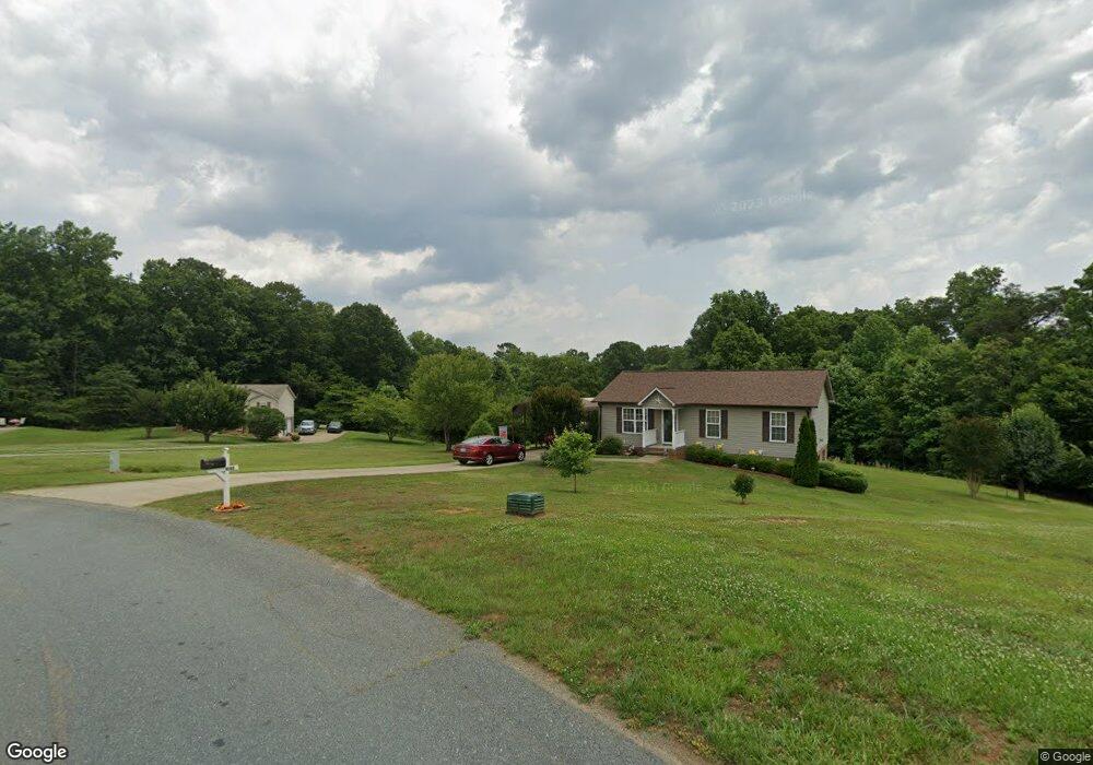
This home is located at 1040 Laurel Bluff Dr, King, NC 27021 and is currently estimated at $234,686, approximately $209 per square foot. 1040 Laurel Bluff Dr is a home located in Stokes County with nearby schools including Poplar Springs Elementary School, Chestnut Grove Middle, and West Stokes High.
Ownership History
Date
Name
Owned For
Owner Type
Purchase Details
Closed on
Feb 20, 2008
Sold by
Roberts Patricia A
Bought by
Bennet Thomas Allen and Bennett Barbara Toman
Current Estimated Value
Home Financials for this Owner
Home Financials are based on the most recent Mortgage that was taken out on this home.
Original Mortgage
$87,000
Interest Rate
5.46%
Mortgage Type
Purchase Money Mortgage
Purchase Details
Closed on
Mar 9, 2006
Sold by
Town & Country Builders Of Mount Airy In
Bought by
Roberts Patricia A
Home Financials for this Owner
Home Financials are based on the most recent Mortgage that was taken out on this home.
Original Mortgage
$25,000
Interest Rate
6.19%
Mortgage Type
Purchase Money Mortgage
Create a Home Valuation Report for This Property
The Home Valuation Report is an in-depth analysis detailing your home's value as well as a comparison with similar homes in the area
Home Values in the Area
Average Home Value in this Area
Purchase History
| Date | Buyer | Sale Price | Title Company |
|---|---|---|---|
| Bennet Thomas Allen | $87,000 | None Available | |
| Roberts Patricia A | $25,000 | None Available | |
| Town & Country Builders Of Mount Airy In | -- | None Available |
Source: Public Records
Mortgage History
| Date | Status | Borrower | Loan Amount |
|---|---|---|---|
| Open | Bennet Thomas Allen | $87,000 | |
| Previous Owner | Town & Country Builders Of Mount Airy In | $25,000 | |
| Previous Owner | Roberts Patricia A | $90,800 |
Source: Public Records
Tax History Compared to Growth
Tax History
| Year | Tax Paid | Tax Assessment Tax Assessment Total Assessment is a certain percentage of the fair market value that is determined by local assessors to be the total taxable value of land and additions on the property. | Land | Improvement |
|---|---|---|---|---|
| 2025 | $1,475 | $206,300 | $35,000 | $171,300 |
| 2024 | $1,475 | $141,700 | $28,000 | $113,700 |
| 2023 | $1,148 | $141,700 | $28,000 | $113,700 |
| 2022 | $1,049 | $141,700 | $28,000 | $113,700 |
| 2021 | $1,049 | $141,700 | $28,000 | $113,700 |
| 2020 | $909 | $122,900 | $25,000 | $97,900 |
| 2019 | $909 | $122,900 | $25,000 | $97,900 |
| 2018 | $909 | $122,900 | $25,000 | $97,900 |
| 2017 | $903 | $122,900 | $25,000 | $97,900 |
| 2016 | $874 | $118,900 | $25,000 | $93,900 |
| 2015 | $868 | $118,900 | $25,000 | $93,900 |
| 2014 | $909 | $118,900 | $25,000 | $93,900 |
Source: Public Records
Map
Nearby Homes
- 6064 S Nc Highway 66
- 100 Ridgecrest Dr
- 103 Jasper Ct
- 326 Kingscote Way
- 127 Plumtree Ct
- 108 Nova Ln
- 1041 Luke St
- 1255 Mountain View Rd
- 1739 Denny Rd
- 117 Northridge Dr
- 120 Kathleen Ct
- 1125 Woodbury Rd
- 5.25 Ac Capella Ridge Rd Unit 5.25 Ac
- 621 Southern Rd
- Lot 19 Glen Brooke Ln
- Lot 9 Brown Rd
- Lot 18 Glen Brooke Ln
- .64 Ac Kentland Dr Unit .64 Ac
- 109 Glen Brooke Ln
- 104 Belay Dr
- 1050 Laurel Bluff Dr
- 1030 Laurel Bluff Dr
- 1060 Laurel Bluff Dr
- 1045 Laurel Bluff Dr
- 1070 Laurel Bluff Dr
- 1055 Laurel Crest Rd
- 1065 Laurel Crest Rd
- 1080 Laurel Bluff Dr
- 1025 Laurel Bluff Dr
- 1045 Laurel Crest Rd
- 1075 Laurel Crest Rd
- 1020 Laurel Bluff Dr
- 1105 Laurel Bluff Dr
- 1035 Laurel Crest Rd
- 1085 Laurel Crest Rd
- 1015 Laurel Bluff Dr
- 1090 Laurel Bluff Dr
- 1025 Laurel Crest Rd
- 1060 Laurel Crest Rd
- 1115 Laurel Bluff Dr