Estimated Value: $137,290 - $449,000
--
Bed
--
Bath
--
Sq Ft
0.27
Acres
About This Home
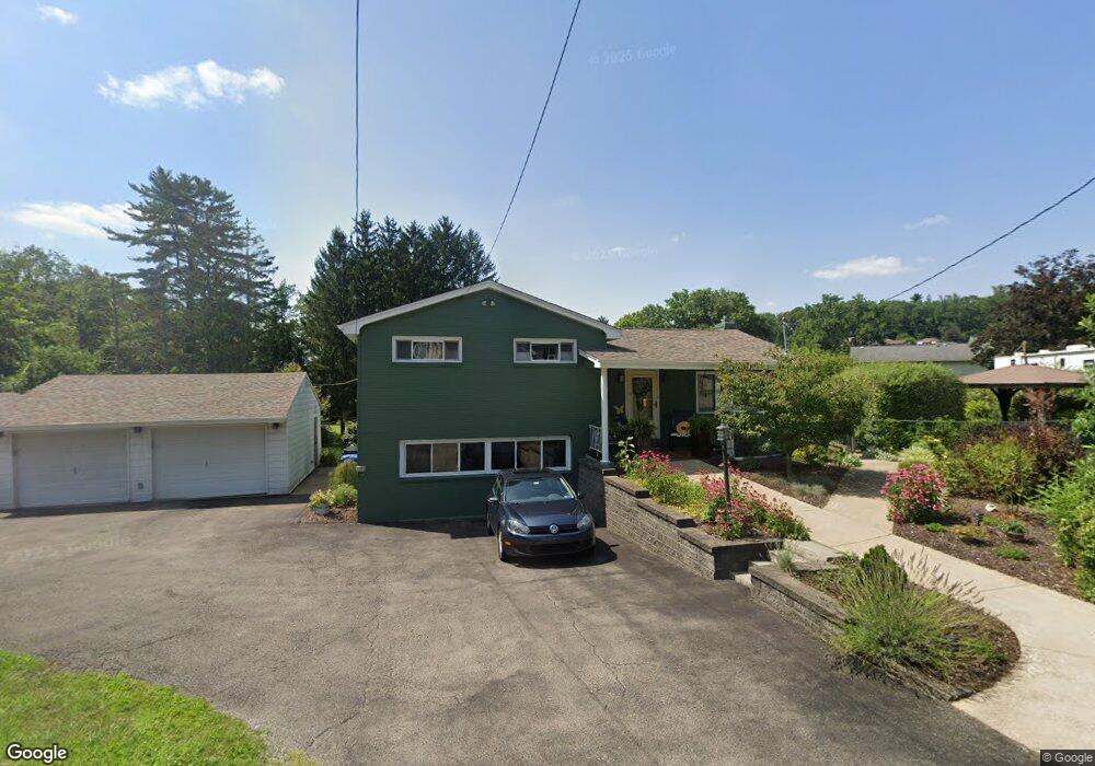
This home is located at 1040 Robbins Station Rd, Irwin, PA 15642 and is currently estimated at $319,323. 1040 Robbins Station Rd is a home located in Westmoreland County with nearby schools including Stewartsville Elementary School, Hillcrest Intermediate School, and Norwin Middle School.
Ownership History
Date
Name
Owned For
Owner Type
Purchase Details
Closed on
Jan 22, 2016
Sold by
Swankler Kimberly J
Bought by
Ieraci Cindy Y
Current Estimated Value
Home Financials for this Owner
Home Financials are based on the most recent Mortgage that was taken out on this home.
Original Mortgage
$150,228
Outstanding Balance
$118,652
Interest Rate
3.75%
Mortgage Type
FHA
Estimated Equity
$200,671
Purchase Details
Closed on
Sep 13, 2012
Sold by
Swankler James W and Swankler Kimberly J
Bought by
Swankler Kimberly J
Home Financials for this Owner
Home Financials are based on the most recent Mortgage that was taken out on this home.
Original Mortgage
$88,013
Interest Rate
3.95%
Mortgage Type
FHA
Purchase Details
Closed on
Apr 1, 2004
Sold by
Ballough Charles M and Ballough Rosemary
Bought by
Swankler James W and Swankler Kimberly J
Create a Home Valuation Report for This Property
The Home Valuation Report is an in-depth analysis detailing your home's value as well as a comparison with similar homes in the area
Home Values in the Area
Average Home Value in this Area
Purchase History
| Date | Buyer | Sale Price | Title Company |
|---|---|---|---|
| Ieraci Cindy Y | $153,000 | None Available | |
| Swankler Kimberly J | -- | None Available | |
| Swankler James W | -- | -- |
Source: Public Records
Mortgage History
| Date | Status | Borrower | Loan Amount |
|---|---|---|---|
| Open | Ieraci Cindy Y | $150,228 | |
| Previous Owner | Swankler Kimberly J | $88,013 |
Source: Public Records
Tax History Compared to Growth
Tax History
| Year | Tax Paid | Tax Assessment Tax Assessment Total Assessment is a certain percentage of the fair market value that is determined by local assessors to be the total taxable value of land and additions on the property. | Land | Improvement |
|---|---|---|---|---|
| 2025 | $321 | $2,440 | $1,680 | $760 |
| 2024 | $307 | $2,440 | $1,680 | $760 |
| 2023 | $290 | $2,440 | $1,680 | $760 |
| 2022 | $288 | $2,440 | $1,680 | $760 |
| 2021 | $288 | $2,440 | $1,680 | $760 |
| 2020 | $282 | $2,440 | $1,680 | $760 |
| 2019 | $275 | $2,440 | $1,680 | $760 |
| 2018 | $269 | $2,440 | $1,680 | $760 |
| 2017 | $263 | $2,440 | $1,680 | $760 |
| 2016 | $253 | $2,440 | $1,680 | $760 |
| 2015 | $253 | $2,440 | $1,680 | $760 |
| 2014 | $248 | $2,440 | $1,680 | $760 |
Source: Public Records
Map
Nearby Homes
- 1201 Robbins Station Rd
- 12220 Herold Dr
- 12106 Center St
- 12329 Herold Dr
- 12429 Adams Dr
- 12490 Adams Dr
- 12360 Church Dr
- 1754 Haflinger Dr
- 12509 Herold Dr
- 12440 Saint Nikolai Dr
- 12480 Saint Nikolai Dr
- 11490 Mckee Rd
- 260 Jennie Dr
- 12729 Deborah Dr
- 11343 Seminole Dr
- 2171 Robbins Station Rd
- 671 Mcmahon Dr
- 11580 Percheron Cir
- 11740 Dennis Cir
- 0 Ridge Rd
- 1040 Robbins Station Rd
- 3051 Sr
- 12220 Roth Dr
- 12230 Roth Dr
- 1041 Robbins Station Rd
- 12210 Roth Dr
- 12190 Roth Dr
- 12060 Mckee Rd
- 12062 Mckee Rd
- 12250 Roth Dr
- 12070 Mckee Rd
- 12219 Roth Dr
- 12229 Roth Dr
- 12209 Roth Dr
- 12209 Roth Dr
- 12189 Roth Dr
- 12199 Roth Dr
- 1161 Robbins Station Rd
- 12239 Roth Dr
- 12260 Roth Dr