10400 N T St Newkirk, OK 74647
Estimated payment $1,481/month
Total Views
8,240
80
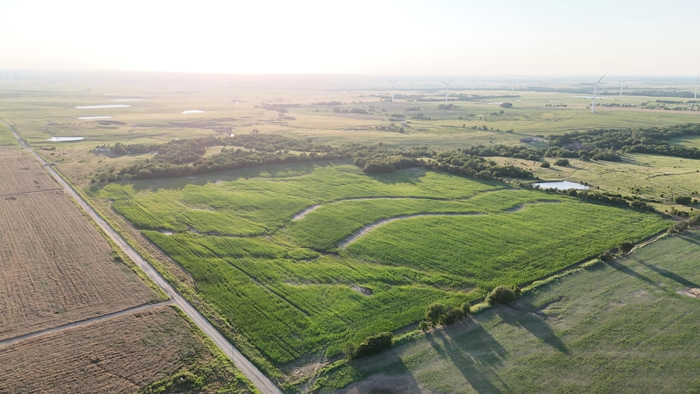
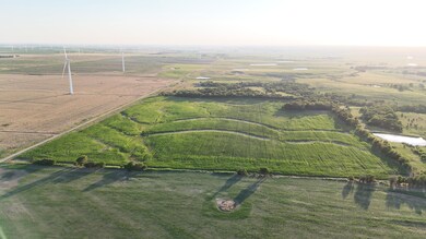
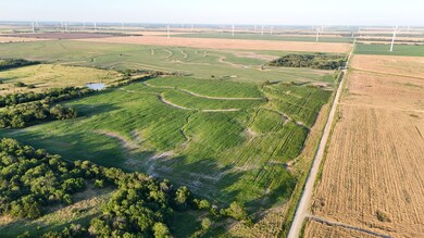
Acres
$3,250
Price per Acre
3,484,800
Sq Ft Lot
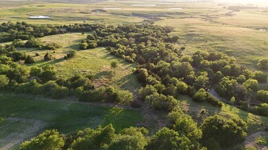
Highlights
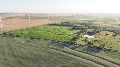
- Waterfront
- Corner Lot
- Pasture
- Pond
About This Lot
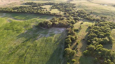
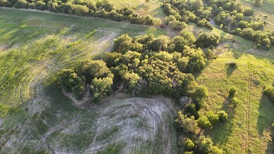
80+- acres to call your own. 40 acres in cultivation, 40 acres in pasture/creek bottom. Currently in Corn. Plentiful deer, quail, and pheasant! Old mobile home site established, perfect for bringing in a new structure and establishing your own getaway! 1 hour from Wichita, KS, 30 minutes to Ponca City, OK. Newkirk school district. Call me at (580) 352-2326 to see it today!
Listing Agent
Keller Williams Realty Select, Open Places Team License #182226 Listed on: 06/27/2025

Listing Provided By
Property Details
Property Type
- Land
Est. Annual Taxes
- $1,329
Lot Details
- Waterfront
- Property fronts a county road
- Barbed Wire
- Corner Lot
- Level Lot
- Few Trees
- Current uses include agriculture
- Potential uses include agriculture, grazing, hunting/fishing, homestead
Outdoor Features
- Pond
- Creek On Lot
- Wildlife includes whitetail deer, quails, pheasants
Additional Features
- Easements include access, electric, water lines
- Pasture
Map
Create a Home Valuation Report for This Property
The Home Valuation Report is an in-depth analysis detailing your home's value as well as a comparison with similar homes in the area
Home Values in the Area
Average Home Value in this Area
Tax History
| Year | Tax Paid | Tax Assessment Tax Assessment Total Assessment is a certain percentage of the fair market value that is determined by local assessors to be the total taxable value of land and additions on the property. | Land | Improvement |
|---|---|---|---|---|
| 2024 | $1,329 | $14,562 | $1,389 | $13,173 |
| 2023 | $1,329 | $14,138 | $1,389 | $12,749 |
| 2022 | $1,203 | $13,726 | $1,496 | $12,230 |
| 2021 | $1,202 | $13,726 | $1,496 | $12,230 |
| 2020 | $1,172 | $13,609 | $1,496 | $12,113 |
| 2019 | $1,155 | $13,213 | $1,496 | $11,717 |
| 2018 | $1,143 | $13,113 | $1,496 | $11,617 |
| 2017 | $246 | $3,315 | $1,496 | $1,819 |
| 2016 | $271 | $3,578 | $1,496 | $2,082 |
| 2015 | $202 | $3,542 | $1,496 | $2,046 |
| 2014 | $203 | $3,542 | $1,496 | $2,046 |
Source: Public Records
Property History
| Date | Event | Price | List to Sale | Price per Sq Ft | Prior Sale |
|---|---|---|---|---|---|
| 06/26/2025 06/26/25 | For Sale | $260,000 | +62.5% | -- | |
| 04/21/2015 04/21/15 | Sold | $160,000 | -20.0% | $141 / Sq Ft | View Prior Sale |
| 03/11/2015 03/11/15 | Pending | -- | -- | -- | |
| 02/06/2015 02/06/15 | For Sale | $199,900 | -- | $176 / Sq Ft |
Purchase History
| Date | Type | Sale Price | Title Company |
|---|---|---|---|
| Warranty Deed | $139,000 | Security Title Service | |
| Warranty Deed | $160,000 | None Available |
Source: Public Records
Mortgage History
| Date | Status | Loan Amount | Loan Type |
|---|---|---|---|
| Previous Owner | $80,000 | Unknown | |
| Closed | $0 | USDA |
Source: Public Records
Nearby Homes
- 0 W Bender Rd
- 0000 W Judo Rd
- 2 miles West Peckham Rd
- 0000 W Peckham Rd
- 0001 W Peckham Rd
- 0001 W Earth Rd
- 8242 N Main St
- 614 N Maple Ave
- 201 S Magnolia Ave
- 5756 322nd Rd
- 308 S Cedar Ave
- 126 S Main St
- 311 N H Ave
- 308 S Elm Ave
- 33614 Tower Rd
- 6868 Lindberg Ave
- 2339 282nd Rd
- 31778 53rd Rd
- 6797 312th Rd
- 9245 N Highway 177