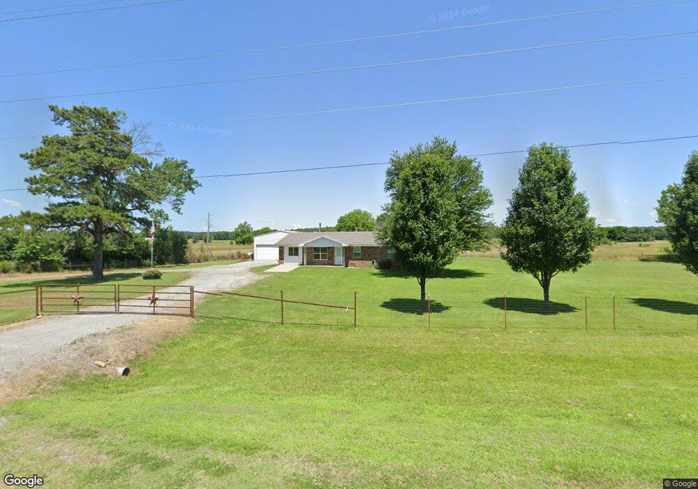
10401 SW Highway 270 Wilburton, OK 74578
Estimated Value: $132,219 - $253,000
3
Beds
2
Baths
1,352
Sq Ft
$139/Sq Ft
Est. Value
About This Home
This home is located at 10401 SW Highway 270, Wilburton, OK 74578 and is currently estimated at $188,305, approximately $139 per square foot. 10401 SW Highway 270 is a home located in Latimer County with nearby schools including Wilburton Elementary School and Wilburton High School.
Ownership History
Date
Name
Owned For
Owner Type
Purchase Details
Closed on
Feb 1, 2012
Sold by
Buff Andrew and Burch Alicia
Bought by
Baker Robert A
Current Estimated Value
Purchase Details
Closed on
Apr 6, 2009
Sold by
Citifinancial Mortgage Company Inc
Bought by
Buff Andrew and Buff Alicia
Home Financials for this Owner
Home Financials are based on the most recent Mortgage that was taken out on this home.
Original Mortgage
$22,306
Interest Rate
4.77%
Mortgage Type
Unknown
Purchase Details
Closed on
Oct 15, 2004
Sold by
Mindi William and Mindi Battles
Bought by
Stacey and Denell Cooley
Create a Home Valuation Report for This Property
The Home Valuation Report is an in-depth analysis detailing your home's value as well as a comparison with similar homes in the area
Home Values in the Area
Average Home Value in this Area
Purchase History
| Date | Buyer | Sale Price | Title Company |
|---|---|---|---|
| Baker Robert A | $18,500 | None Available | |
| Buff Andrew | $27,000 | Okloahoma Title & Closing Co | |
| Stacey | $45,000 | -- |
Source: Public Records
Mortgage History
| Date | Status | Borrower | Loan Amount |
|---|---|---|---|
| Previous Owner | Buff Andrew | $22,306 |
Source: Public Records
Tax History Compared to Growth
Tax History
| Year | Tax Paid | Tax Assessment Tax Assessment Total Assessment is a certain percentage of the fair market value that is determined by local assessors to be the total taxable value of land and additions on the property. | Land | Improvement |
|---|---|---|---|---|
| 2025 | $624 | $6,549 | $913 | $5,636 |
| 2024 | $624 | $6,237 | $870 | $5,367 |
| 2023 | $594 | $5,941 | $832 | $5,109 |
| 2022 | $564 | $5,657 | $778 | $4,879 |
| 2021 | $540 | $5,388 | $727 | $4,661 |
| 2020 | $508 | $5,132 | $679 | $4,453 |
| 2019 | $485 | $4,887 | $694 | $4,193 |
| 2018 | $463 | $4,655 | $694 | $3,961 |
| 2017 | $438 | $4,433 | $694 | $3,739 |
| 2016 | $423 | $4,222 | $694 | $3,528 |
| 2015 | -- | $2,779 | $694 | $2,085 |
| 2014 | $235 | $2,779 | $694 | $2,085 |
Source: Public Records
Map
Nearby Homes
- 0 SE 102nd Rd Unit 2537808
- 10868 SW Gowen Rd
- 0 Sunny Slope Dr
- 359 Burger Rd
- 43 Woodlawn Dr
- 00 Hwy 270
- 0 N 4190 Rd Unit 2526131
- 0 Phillips Rd
- 560 E Old Hwy 270
- 0 Old U S Highway 270
- 0 Emberton St
- 1509 Pawnee Ave
- 220 Willow Ln
- 1412 Pennsylvania Ave
- 6120 SW 1100th Ave
- 305 N 10th St
- 1401 Kali Inla Ave
- 10496 SW Ok-1
- 10496 Oklahoma 1
- 1038 Lehigh Ave
- 10343 SW Highway 270
- 10374 SW Highway 270
- 10422 SW 120th Rd
- 10536 SW Highway 270
- 0 SE 102nd Rd Unit 2337447
- 10179 SW Highway 270
- 10626 SW 120th Rd
- 0 Cambria Church Rd
- 10475 SW Gowen Rd
- 10195 SW Gowen Rd
- 10589 SW Gowen Rd
- 10528 SW Gowen Rd
- 10869 SW 270 Hwy
- 10809 SW Gowen Rd
- 10649 SW 117th Rd
- 1516 SW 1100th Ave
- 9818 SW 120th Rd
- 11000 SW 120th Rd
- 1388 SW 1100th Ave
- 10758 SW Gowen Rd