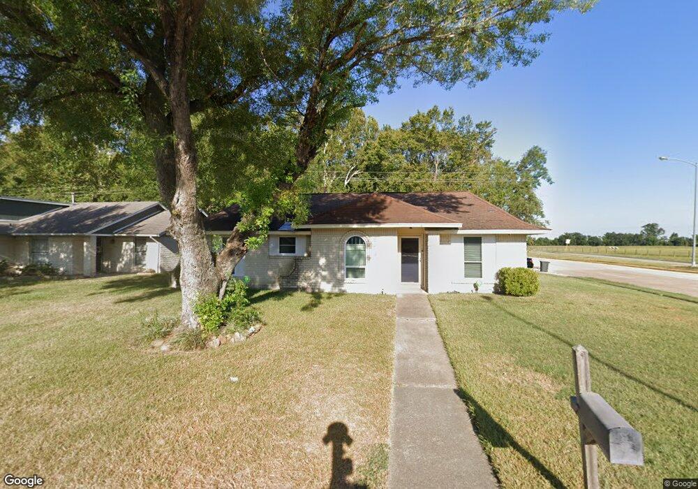
10402 Sweetbrook Dr Houston, TX 77038
North Houston NeighborhoodEstimated Value: $198,000 - $233,000
4
Beds
2
Baths
1,456
Sq Ft
$148/Sq Ft
Est. Value
About This Home
This home is located at 10402 Sweetbrook Dr, Houston, TX 77038 and is currently estimated at $216,178, approximately $148 per square foot. 10402 Sweetbrook Dr is a home located in Harris County with nearby schools including Griggs EC/PK/K, Stehlik Elementary School, and Stehlik Intermediate School.
Ownership History
Date
Name
Owned For
Owner Type
Purchase Details
Closed on
Mar 15, 2002
Sold by
Miller Cecil C
Bought by
Henderson Darrell D and Henderson Alneata K
Current Estimated Value
Home Financials for this Owner
Home Financials are based on the most recent Mortgage that was taken out on this home.
Original Mortgage
$78,850
Outstanding Balance
$37,071
Interest Rate
8.87%
Estimated Equity
$179,107
Purchase Details
Closed on
Dec 30, 1999
Sold by
Miller Cecil C
Bought by
Miller Cecil C and Miller Barbara G
Create a Home Valuation Report for This Property
The Home Valuation Report is an in-depth analysis detailing your home's value as well as a comparison with similar homes in the area
Home Values in the Area
Average Home Value in this Area
Purchase History
| Date | Buyer | Sale Price | Title Company |
|---|---|---|---|
| Henderson Darrell D | -- | Stewart Title | |
| Miller Cecil C | -- | -- |
Source: Public Records
Mortgage History
| Date | Status | Borrower | Loan Amount |
|---|---|---|---|
| Open | Henderson Darrell D | $78,850 |
Source: Public Records
Tax History Compared to Growth
Tax History
| Year | Tax Paid | Tax Assessment Tax Assessment Total Assessment is a certain percentage of the fair market value that is determined by local assessors to be the total taxable value of land and additions on the property. | Land | Improvement |
|---|---|---|---|---|
| 2025 | $2,017 | $196,742 | $33,660 | $163,082 |
| 2024 | $2,017 | $196,742 | $33,660 | $163,082 |
| 2023 | $2,017 | $199,657 | $33,660 | $165,997 |
| 2022 | $3,217 | $159,678 | $28,050 | $131,628 |
| 2021 | $3,050 | $135,692 | $28,050 | $107,642 |
| 2020 | $2,952 | $130,069 | $28,050 | $102,019 |
| 2019 | $2,791 | $120,375 | $28,050 | $92,325 |
| 2018 | $1,011 | $111,839 | $12,870 | $98,969 |
| 2017 | $2,235 | $111,839 | $12,870 | $98,969 |
| 2016 | $2,032 | $94,317 | $12,870 | $81,447 |
| 2015 | $1,355 | $94,317 | $12,870 | $81,447 |
| 2014 | $1,355 | $78,487 | $12,870 | $65,617 |
Source: Public Records
Map
Nearby Homes
- 1019 Castolan Dr
- 939 Point Blank Dr
- 10519 Pleasanton Dr
- 1022 Progreso Dr
- 10558 Pleasanton Dr
- 10226 Ella Falls Blvd
- 1219 Pilot Point Dr
- 1138 Cherry Spring Dr
- 1010 Francitas Dr
- 1327 Fallbrook Dr
- 1006 Fruitvale Dr
- 00 Fallbrook Dr
- 10134 Lasaber Ct
- 1506 Wilshire Park Dr
- 0 W Mt Houston Rd Unit 90464120
- 10026 Lasaber Ct
- 2115 Havencrest Dr
- 2203 Chalet Rd
- 12718 Sai Baba Dr
- 1812 N Sam Houston Pkwy W
- 10406 Sweetbrook Dr
- 10410 Sweetbrook Dr
- 942 Fallbrook Dr
- 10330 Sweetbrook Dr
- 10414 Sweetbrook Dr
- 1003 Castolan Dr
- 946 Fallbrook Dr
- 943 Fallbrook Dr
- 1007 Castolan Dr
- 10326 Sweetbrook Dr
- 10418 Sweetbrook Dr
- 950 Fallbrook Dr
- 947 Fallbrook Dr
- 1011 Castolan Dr
- 10322 Sweetbrook Dr
- 10323 Sweetbrook Dr
- 10422 Sweetbrook Dr
- 951 Fallbrook Dr
- 954 Fallbrook Dr
- 1002 Castolan Dr