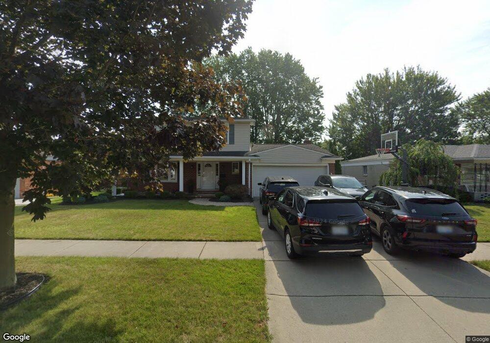
10407 Michael St Taylor, MI 48180
Estimated Value: $245,181 - $323,000
Studio
1
Bath
1,751
Sq Ft
$165/Sq Ft
Est. Value
About This Home
This home is located at 10407 Michael St, Taylor, MI 48180 and is currently estimated at $289,545, approximately $165 per square foot. 10407 Michael St is a home located in Wayne County with nearby schools including Holland Elementary School, Hoover Middle School, and Taylor High School.
Ownership History
Date
Name
Owned For
Owner Type
Purchase Details
Closed on
Aug 24, 2012
Sold by
Marchywka Corinne M and Marchywka Donavan A
Bought by
Marchywka Corinne M and Marchywka Donavan A
Current Estimated Value
Home Financials for this Owner
Home Financials are based on the most recent Mortgage that was taken out on this home.
Original Mortgage
$129,700
Outstanding Balance
$20,621
Interest Rate
3.52%
Mortgage Type
New Conventional
Estimated Equity
$268,924
Purchase Details
Closed on
Oct 12, 2000
Sold by
Christine A Shuback
Bought by
Donavan A Marchywka
Create a Home Valuation Report for This Property
The Home Valuation Report is an in-depth analysis detailing your home's value as well as a comparison with similar homes in the area
Home Values in the Area
Average Home Value in this Area
Purchase History
| Date | Buyer | Sale Price | Title Company |
|---|---|---|---|
| Marchywka Corinne M | -- | Peoples First Title Agency L | |
| Donavan A Marchywka | $150,000 | -- |
Source: Public Records
Mortgage History
| Date | Status | Borrower | Loan Amount |
|---|---|---|---|
| Open | Marchywka Corinne M | $129,700 |
Source: Public Records
Tax History
| Year | Tax Paid | Tax Assessment Tax Assessment Total Assessment is a certain percentage of the fair market value that is determined by local assessors to be the total taxable value of land and additions on the property. | Land | Improvement |
|---|---|---|---|---|
| 2025 | $2,641 | $128,400 | $0 | $0 |
| 2024 | $2,557 | $124,200 | $0 | $0 |
| 2023 | $3,078 | $108,300 | $0 | $0 |
| 2022 | $2,440 | $98,000 | $0 | $0 |
| 2021 | $2,709 | $89,700 | $0 | $0 |
| 2020 | $2,685 | $81,600 | $0 | $0 |
| 2019 | $268,690 | $74,200 | $0 | $0 |
| 2018 | $2,096 | $63,100 | $0 | $0 |
| 2017 | $1,197 | $60,700 | $0 | $0 |
| 2016 | $2,619 | $58,900 | $0 | $0 |
| 2015 | $4,735 | $53,600 | $0 | $0 |
| 2013 | $4,720 | $49,000 | $0 | $0 |
| 2012 | $2,080 | $47,800 | $14,000 | $33,800 |
Source: Public Records
Map
Nearby Homes
- 10352 Gulley St
- 25112 Madden St
- 25556 Rusty St
- 25519 Rusty St
- 25315 Baker St
- 10935 Westlake St
- 25737 Rusty St
- 25790 Madden St
- 9756 Janet St
- 0 Goddard Unit 20251010304
- 25830 Belledale St
- 000 Pine Lot A St
- 000 Beechdaly
- 000 Pine Lot B St
- Telegraph Telegraph Rd
- 9828 Rose St
- 9690 Cornell St
- 26376 Partridge Dr Unit 89
- 26400 Partridge Dr Unit 88
- 24342 Wick Rd
- 10387 Michael St
- 10444 Cherokee St
- 0000 Cherokee St
- 10375 Michael St
- 10431 Michael St
- 10420 Cherokee St
- 25151 Kensington St
- 10396 Cherokee St
- 10363 Michael St
- 10404 Michael St
- 10416 Michael St
- 10382 Michael St
- 10428 Michael St
- 25152 Melody St
- 25140 Melody St
- 10372 Cherokee St
- 10370 Michael St
- 25128 Melody St
- 10351 Michael St
- 25139 Kensington St
Your Personal Tour Guide
Ask me questions while you tour the home.