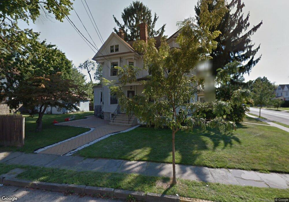
1041 Bryant St Rahway, NJ 07065
Estimated Value: $499,437 - $616,000
--
Bed
--
Bath
2,028
Sq Ft
$275/Sq Ft
Est. Value
About This Home
This home is located at 1041 Bryant St, Rahway, NJ 07065 and is currently estimated at $557,109, approximately $274 per square foot. 1041 Bryant St is a home located in Union County with nearby schools including Rahway High School.
Ownership History
Date
Name
Owned For
Owner Type
Purchase Details
Closed on
Jul 22, 1998
Sold by
Rodger John and Rodger Ellen
Bought by
Noruthun Navin K
Current Estimated Value
Home Financials for this Owner
Home Financials are based on the most recent Mortgage that was taken out on this home.
Original Mortgage
$112,475
Outstanding Balance
$22,997
Interest Rate
6.99%
Mortgage Type
FHA
Estimated Equity
$534,112
Create a Home Valuation Report for This Property
The Home Valuation Report is an in-depth analysis detailing your home's value as well as a comparison with similar homes in the area
Home Values in the Area
Average Home Value in this Area
Purchase History
| Date | Buyer | Sale Price | Title Company |
|---|---|---|---|
| Noruthun Navin K | $125,000 | -- |
Source: Public Records
Mortgage History
| Date | Status | Borrower | Loan Amount |
|---|---|---|---|
| Open | Noruthun Navin K | $112,475 |
Source: Public Records
Tax History Compared to Growth
Tax History
| Year | Tax Paid | Tax Assessment Tax Assessment Total Assessment is a certain percentage of the fair market value that is determined by local assessors to be the total taxable value of land and additions on the property. | Land | Improvement |
|---|---|---|---|---|
| 2025 | $10,204 | $137,800 | $51,800 | $86,000 |
| 2024 | $9,883 | $137,800 | $51,800 | $86,000 |
| 2023 | $9,883 | $137,800 | $51,800 | $86,000 |
| 2022 | $9,676 | $137,800 | $51,800 | $86,000 |
| 2021 | $9,578 | $137,800 | $51,800 | $86,000 |
| 2020 | $9,543 | $137,800 | $51,800 | $86,000 |
| 2019 | $9,421 | $137,800 | $51,800 | $86,000 |
| 2018 | $9,223 | $137,800 | $51,800 | $86,000 |
| 2017 | $8,996 | $137,800 | $51,800 | $86,000 |
| 2016 | $8,804 | $137,800 | $51,800 | $86,000 |
| 2015 | $8,705 | $137,800 | $51,800 | $86,000 |
| 2014 | $8,549 | $137,800 | $51,800 | $86,000 |
Source: Public Records
Map
Nearby Homes
- 139 Maple Ave Unit 104
- 156 W Emerson Ave
- 1016 Jaques Ave
- 163 Stanton St
- 48 W Hazelwood Ave
- 181 W Stearns St
- 372 W Hazelwood Ave
- 182 W Lake Ave
- 1025 New Brunswick Ave
- 91 Elm Ave
- 1 Carriage City Plaza Unit 1502
- 1 Carriage City Plaza Unit 1212
- 1 Carriage City Plaza Unit 503
- 245 William St
- 656 Central Ave
- 275 Forbes St
- 593 W Hazelwood Ave
- 280 E Hazelwood Ave
- 935 Thorn St
- 591 Harris Dr