Estimated Value: $154,000 - $201,000
3
Beds
1
Bath
962
Sq Ft
$191/Sq Ft
Est. Value
About This Home
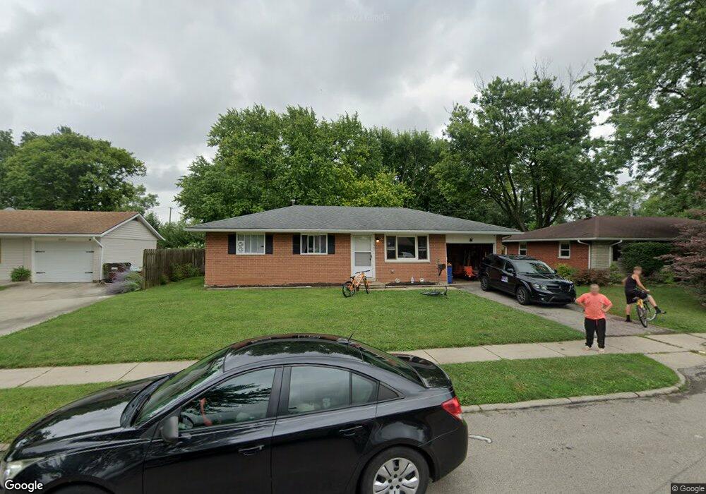
This home is located at 1041 Buckskin Trail, Xenia, OH 45385 and is currently estimated at $183,530, approximately $190 per square foot. 1041 Buckskin Trail is a home located in Greene County with nearby schools including Xenia High School, Summit Academy Community School for Alternative Learners - Xenia, and Legacy Christian Academy.
Ownership History
Date
Name
Owned For
Owner Type
Purchase Details
Closed on
May 31, 2022
Sold by
Westlund and Madyson
Bought by
Edwards Katharine and Edwards Dereck
Current Estimated Value
Purchase Details
Closed on
Feb 23, 2018
Sold by
Clark Jason C and Clark Kimberly J
Bought by
Westlund Tyler and Hollon Madyson
Home Financials for this Owner
Home Financials are based on the most recent Mortgage that was taken out on this home.
Original Mortgage
$94,999
Interest Rate
4.15%
Mortgage Type
VA
Purchase Details
Closed on
Oct 28, 2005
Sold by
Thompson Randall G and Thompson Selva J
Bought by
Clark Jason C and Clark Kimberly J
Home Financials for this Owner
Home Financials are based on the most recent Mortgage that was taken out on this home.
Original Mortgage
$63,040
Interest Rate
5.89%
Mortgage Type
Unknown
Purchase Details
Closed on
May 5, 2003
Sold by
Wm Specialty Mortgage Llc
Bought by
Thompson Randall G and Thompson Selva J
Home Financials for this Owner
Home Financials are based on the most recent Mortgage that was taken out on this home.
Original Mortgage
$61,110
Interest Rate
5.78%
Mortgage Type
Unknown
Purchase Details
Closed on
Feb 13, 2003
Sold by
Hammer Donald A and Hammer Robyn S
Bought by
Washington Mutual Bank
Purchase Details
Closed on
Jun 16, 2000
Sold by
Strickland Robyn S and Strickland Robyn S
Bought by
Hammer Donald A and Hammer Robyn S
Home Financials for this Owner
Home Financials are based on the most recent Mortgage that was taken out on this home.
Original Mortgage
$73,950
Interest Rate
11.25%
Create a Home Valuation Report for This Property
The Home Valuation Report is an in-depth analysis detailing your home's value as well as a comparison with similar homes in the area
Home Values in the Area
Average Home Value in this Area
Purchase History
| Date | Buyer | Sale Price | Title Company |
|---|---|---|---|
| Edwards Katharine | -- | Yonas John J | |
| Westlund Tyler | $593,000 | -- | |
| Clark Jason C | $78,800 | -- | |
| Thompson Randall G | $67,900 | -- | |
| Wm Specialty Mortgage Llc | -- | -- | |
| Washington Mutual Bank | $48,000 | -- | |
| Hammer Donald A | -- | -- |
Source: Public Records
Mortgage History
| Date | Status | Borrower | Loan Amount |
|---|---|---|---|
| Previous Owner | Westlund Tyler | $94,999 | |
| Previous Owner | Clark Jason C | $63,040 | |
| Previous Owner | Thompson Randall G | $61,110 | |
| Previous Owner | Hammer Donald A | $73,950 | |
| Closed | Edwards Katharine | $0 |
Source: Public Records
Tax History Compared to Growth
Tax History
| Year | Tax Paid | Tax Assessment Tax Assessment Total Assessment is a certain percentage of the fair market value that is determined by local assessors to be the total taxable value of land and additions on the property. | Land | Improvement |
|---|---|---|---|---|
| 2024 | $2,163 | $50,560 | $12,580 | $37,980 |
| 2023 | $2,163 | $50,560 | $12,580 | $37,980 |
| 2022 | $763 | $33,100 | $7,400 | $25,700 |
| 2021 | $773 | $33,100 | $7,400 | $25,700 |
| 2020 | $740 | $33,100 | $7,400 | $25,700 |
| 2019 | $739 | $32,160 | $7,130 | $25,030 |
| 2018 | $1,671 | $32,160 | $7,130 | $25,030 |
| 2017 | $1,503 | $32,160 | $7,130 | $25,030 |
| 2016 | $1,504 | $28,410 | $7,130 | $21,280 |
| 2015 | $1,508 | $28,410 | $7,130 | $21,280 |
| 2014 | $1,444 | $28,410 | $7,130 | $21,280 |
Source: Public Records
Map
Nearby Homes
- 1272 Bellbrook Ave
- 1208 Bellbrook Ave
- 1618 Navajo Dr
- 1708 Ottawa Dr
- 1881 Commonwealth Dr
- 1653 Seneca Dr
- 1454 Kylemore Dr
- 1568 Cheyenne Dr
- 1342 Kylemore Dr
- 1766 Gayhart Dr
- 1829 Gayhart Dr
- 1908 Whitt St
- 646 Glady Ave
- 1255 Colorado Dr
- 1223 June Dr
- 1283 June Dr
- 1391 June Dr
- 1861 Iowa Dr
- 1107 Arkansas Dr
- 530 Cincinnati Ave
- 1029 Buckskin Trail
- 1055 Buckskin Trail
- 1015 Buckskin Trail
- 1067 Buckskin Trail
- 1248 Bellbrook Ave
- 1234 Bellbrook Ave
- 1260 Bellbrook Ave
- 1222 Bellbrook Ave
- 1046 Buckskin Trail
- 1032 Buckskin Trail
- 1077 Buckskin Trail
- 1060 Buckskin Trail
- 991 Deerfield Ct
- 999 Buckskin Trail
- 1006 Buckskin Trail
- 1082 Buckskin Trail
- 1286 Bellbrook Ave
- 1091 Buckskin Trail
- 1196 Bellbrook Ave
- 985 Deerfield Ct