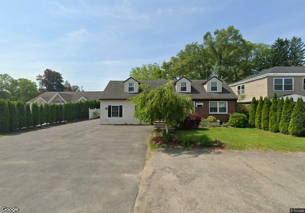
1041 Community Rd Schenectady, NY 12303
Estimated Value: $291,000 - $309,000
3
Beds
3
Baths
3,129
Sq Ft
$96/Sq Ft
Est. Value
About This Home
This home is located at 1041 Community Rd, Schenectady, NY 12303 and is currently estimated at $301,374, approximately $96 per square foot. 1041 Community Rd is a home located in Schenectady County with nearby schools including Pinewood Elementary School, Herman L Bradt Elementary School, and Draper Middle School.
Ownership History
Date
Name
Owned For
Owner Type
Purchase Details
Closed on
Jun 8, 2017
Sold by
Dyer Laurie R
Bought by
Dyer Laurie R
Current Estimated Value
Purchase Details
Closed on
Nov 3, 2012
Sold by
Dyer John R and Dyer Laurie R
Bought by
Dyer Laurie R
Purchase Details
Closed on
Dec 4, 2008
Sold by
Dyer John
Bought by
Dyer Laurie
Purchase Details
Closed on
Oct 4, 2004
Sold by
Durand Harry
Bought by
Dyer John R
Purchase Details
Closed on
Jul 31, 1997
Purchase Details
Closed on
Sep 21, 1994
Sold by
Loehr Robert C and Loehr Elizabet
Bought by
Loehr Joseph
Create a Home Valuation Report for This Property
The Home Valuation Report is an in-depth analysis detailing your home's value as well as a comparison with similar homes in the area
Home Values in the Area
Average Home Value in this Area
Purchase History
| Date | Buyer | Sale Price | Title Company |
|---|---|---|---|
| Dyer Laurie R | -- | None Available | |
| Dyer Laurie R | -- | None Available | |
| Dyer Laurie | -- | -- | |
| Dyer John R | -- | Thomas L Herkenham | |
| -- | -- | -- | |
| Loehr Joseph | $67,000 | -- |
Source: Public Records
Tax History
| Year | Tax Paid | Tax Assessment Tax Assessment Total Assessment is a certain percentage of the fair market value that is determined by local assessors to be the total taxable value of land and additions on the property. | Land | Improvement |
|---|---|---|---|---|
| 2024 | $6,166 | $168,000 | $9,500 | $158,500 |
| 2023 | $56 | $168,000 | $9,500 | $158,500 |
| 2022 | $6,215 | $168,000 | $9,500 | $158,500 |
| 2021 | $6,049 | $168,000 | $9,500 | $158,500 |
| 2020 | $5,338 | $168,000 | $9,500 | $158,500 |
| 2019 | $5,588 | $168,000 | $9,500 | $158,500 |
| 2018 | $3,099 | $168,000 | $9,500 | $158,500 |
| 2017 | $5,125 | $168,000 | $9,500 | $158,500 |
| 2016 | $5,106 | $168,000 | $9,500 | $158,500 |
| 2015 | -- | $168,000 | $10,200 | $157,800 |
| 2014 | -- | $168,000 | $10,200 | $157,800 |
Source: Public Records
Map
Nearby Homes
- 1032 Bill Rd
- 1008 Peter Rd
- L.18 Climax Ave
- 1044 Climax Ave
- 517 Kings Rd
- 3323 McDonald Ave
- 476 Bradford Rd
- 1109 St Jude Dr
- 349 Gifford Rd
- 318 Chiswell Rd
- 1000 Kings Rd
- 247 Chiswell Rd
- 413 E Campbell Rd Extension
- 304 Dearborn Ave
- 1083 Mckinley Ave
- 1161 Jerry Ave
- 3307 Woodlawn Ave
- 150 Gifford Rd
- 1020 6th St
- 126 Manchester Rd
- 1037 Community Rd
- 1786 Fred Rd
- 1033 Community Rd
- 1040 Bill Rd
- 1036 Bill Rd
- 1029 Community Rd
- 00 Fred Rd
- 1046 Community Rd
- 1781 Sherwood Rd
- 1042 Bill Rd
- 1028 Bill Rd
- 1025 Community Rd
- 1052 Community Rd Unit 4
- 1052 Community Rd Unit 3
- 1052 Community Rd Unit y Rd 4
- 1030 Community Rd
- 1769 Sherwood Rd
- 1024 Bill Rd
- 0 Fred Rd
- 1021 Community Rd
Your Personal Tour Guide
Ask me questions while you tour the home.