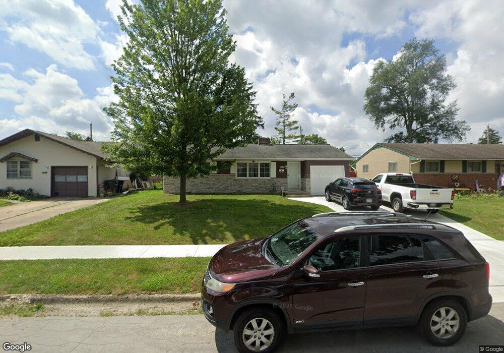
1041 Fordham Rd Columbus, OH 43224
Maize-Morse NeighborhoodEstimated Value: $222,686 - $278,000
3
Beds
2
Baths
1,125
Sq Ft
$220/Sq Ft
Est. Value
About This Home
This home is located at 1041 Fordham Rd, Columbus, OH 43224 and is currently estimated at $247,672, approximately $220 per square foot. 1041 Fordham Rd is a home located in Franklin County with nearby schools including Maize Road Elementary School, Medina Middle School, and Mifflin High School.
Ownership History
Date
Name
Owned For
Owner Type
Purchase Details
Closed on
Apr 16, 2009
Sold by
Buoni Frank P
Bought by
Buoni Diane R
Current Estimated Value
Home Financials for this Owner
Home Financials are based on the most recent Mortgage that was taken out on this home.
Original Mortgage
$111,750
Outstanding Balance
$69,835
Interest Rate
5.05%
Mortgage Type
New Conventional
Estimated Equity
$177,837
Purchase Details
Closed on
Feb 17, 2000
Sold by
Snyder Diane R and Snyder Diane R
Bought by
Buoni Frank P and Buoni Diane R
Home Financials for this Owner
Home Financials are based on the most recent Mortgage that was taken out on this home.
Original Mortgage
$92,000
Interest Rate
8.21%
Purchase Details
Closed on
Jun 11, 1991
Bought by
Snyder Diane R
Create a Home Valuation Report for This Property
The Home Valuation Report is an in-depth analysis detailing your home's value as well as a comparison with similar homes in the area
Home Values in the Area
Average Home Value in this Area
Purchase History
| Date | Buyer | Sale Price | Title Company |
|---|---|---|---|
| Buoni Diane R | -- | Hbi | |
| Buoni Frank P | -- | -- | |
| Snyder Diane R | -- | -- |
Source: Public Records
Mortgage History
| Date | Status | Borrower | Loan Amount |
|---|---|---|---|
| Open | Buoni Diane R | $111,750 | |
| Closed | Buoni Frank P | $92,000 |
Source: Public Records
Tax History
| Year | Tax Paid | Tax Assessment Tax Assessment Total Assessment is a certain percentage of the fair market value that is determined by local assessors to be the total taxable value of land and additions on the property. | Land | Improvement |
|---|---|---|---|---|
| 2025 | $3,423 | $76,270 | $19,250 | $57,020 |
| 2024 | $3,423 | $76,270 | $19,250 | $57,020 |
| 2023 | $3,379 | $76,265 | $19,250 | $57,015 |
| 2022 | $2,575 | $49,640 | $7,880 | $41,760 |
| 2021 | $2,579 | $49,640 | $7,880 | $41,760 |
| 2020 | $2,582 | $49,640 | $7,880 | $41,760 |
| 2019 | $2,402 | $39,590 | $6,300 | $33,290 |
| 2018 | $2,290 | $39,590 | $6,300 | $33,290 |
| 2017 | $2,400 | $39,590 | $6,300 | $33,290 |
| 2016 | $2,405 | $36,300 | $5,950 | $30,350 |
| 2015 | $2,183 | $36,300 | $5,950 | $30,350 |
| 2014 | $2,188 | $36,300 | $5,950 | $30,350 |
| 2013 | $1,137 | $38,220 | $6,265 | $31,955 |
Source: Public Records
Map
Nearby Homes
- 1144 Reed Circle Dr
- 4450 N 4th St
- 4605 Glenmawr Ave
- 4615 Glenmawr Ave
- 4320 Sandy Lane Rd
- 1116 Tulsa Dr
- 1130 Carbone Dr
- 827 Inwood Place
- 899 Meadowview Dr
- 4231 Glenmawr Ave Unit 233
- 601 Morse Rd
- 4143 Karl Rd Unit 215
- 4143 Karl Rd Unit 314
- 4145 Karl Rd Unit 223
- 4795 Colonel Perry Dr
- 522 E Beechwold Blvd
- 1485 Norma Rd
- 435 E Beaumont Rd
- 3941 Karl Rd Unit 133
- 3967 Karl Rd Unit 224
- 1049 Fordham Rd
- 1033 Fordham Rd
- 1025 Fordham Rd
- 1036 Marland Dr N
- 1057 Fordham Rd
- 1028 Marland Dr N
- 1044 Marland Dr N
- 1020 Marland Dr N
- 1052 Marland Dr N
- 1042 Fordham Rd
- 1017 Fordham Rd
- 1065 Fordham Rd
- 1036 Fordham Rd
- 1050 Fordham Rd
- 1028 Fordham Rd
- 1058 Fordham Rd
- 1012 Marland Dr N
- 1060 Marland Dr N
- 1009 Fordham Rd
- 1073 Fordham Rd
Your Personal Tour Guide
Ask me questions while you tour the home.