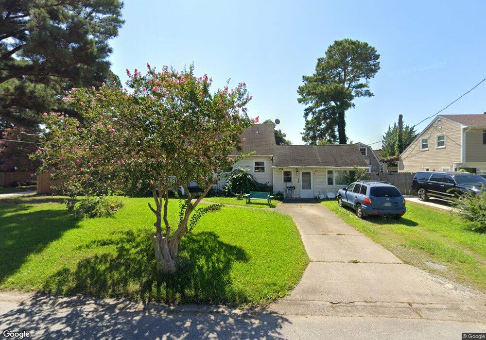
1041 Georgetown Rd Norfolk, VA 23502
Lake Taylor NeighborhoodEstimated Value: $315,000 - $375,485
3
Beds
4
Baths
2,378
Sq Ft
$149/Sq Ft
Est. Value
About This Home
This home is located at 1041 Georgetown Rd, Norfolk, VA 23502 and is currently estimated at $353,871, approximately $148 per square foot. 1041 Georgetown Rd is a home located in Norfolk City with nearby schools including Fairlawn Elementary School and Lake Taylor High School.
Ownership History
Date
Name
Owned For
Owner Type
Purchase Details
Closed on
Oct 22, 2009
Sold by
Johnson Kenneth A and Johnson Michelle
Bought by
Popard Glen A and Smith Norma Jean
Current Estimated Value
Home Financials for this Owner
Home Financials are based on the most recent Mortgage that was taken out on this home.
Original Mortgage
$224,730
Outstanding Balance
$146,820
Interest Rate
5.09%
Mortgage Type
VA
Estimated Equity
$207,051
Create a Home Valuation Report for This Property
The Home Valuation Report is an in-depth analysis detailing your home's value as well as a comparison with similar homes in the area
Home Values in the Area
Average Home Value in this Area
Purchase History
| Date | Buyer | Sale Price | Title Company |
|---|---|---|---|
| Popard Glen A | $220,000 | Lawyers Title Insurance Corp |
Source: Public Records
Mortgage History
| Date | Status | Borrower | Loan Amount |
|---|---|---|---|
| Open | Popard Glen A | $224,730 |
Source: Public Records
Tax History Compared to Growth
Tax History
| Year | Tax Paid | Tax Assessment Tax Assessment Total Assessment is a certain percentage of the fair market value that is determined by local assessors to be the total taxable value of land and additions on the property. | Land | Improvement |
|---|---|---|---|---|
| 2025 | $3,875 | $310,000 | $81,400 | $228,600 |
| 2024 | $3,535 | $282,800 | $81,400 | $201,400 |
| 2023 | $3,431 | $274,500 | $81,400 | $193,100 |
| 2022 | $3,265 | $261,200 | $71,400 | $189,800 |
| 2021 | $2,741 | $219,300 | $52,000 | $167,300 |
| 2020 | $2,741 | $219,300 | $52,000 | $167,300 |
| 2019 | $2,629 | $210,300 | $47,300 | $163,000 |
| 2018 | $2,571 | $205,700 | $47,300 | $158,400 |
| 2017 | $2,381 | $207,000 | $47,300 | $159,700 |
| 2016 | $2,347 | $203,000 | $47,300 | $155,700 |
| 2015 | $2,335 | $203,000 | $47,300 | $155,700 |
| 2014 | $2,335 | $203,000 | $47,300 | $155,700 |
Source: Public Records
Map
Nearby Homes
- 6288 Hudson Ave
- 6340 Hudson Ave
- 1209 George St
- 1100 George St
- 1228 George St
- 6428 Hudson Ave
- 412 Wellman St
- 5803 W Hastings Ct
- 5956 Blackpoole Ln
- 5800 W Hastings Ct
- 601 Charles Ct
- 5813 W Hastings Arch
- 1210 Clarence St
- 6408 Stoney Point S
- 645 Red Horse Ln
- 6549 Stoney Point S
- 5900 Margate Ave
- 154 Frizzell Ave
- 6617 Hudson Ave
- 6018 Rolleston Ave
- 1045 Georgetown Rd
- 6020 Lockamy Ln
- 6016 Lockamy Ln
- 1033 Georgetown Rd
- 1049 Georgetown Rd
- 1056 Georgetown Rd
- 6028 Lockamy Ln
- 1060 Georgetown Rd
- 6012 Lockamy Ln
- 1048 Georgetown Rd
- 1029 Georgetown Rd
- 1064 Georgetown Rd
- 1053 Georgetown Rd
- 6032 Lockamy Ln
- 1053 Charlney Ave
- 6021 Lockamy Ln
- 6021 Lockamy Ln Unit 23502
- 6008 Lockamy Ln
- 6017 Lockamy Ln
- 6025 Lockamy Ln