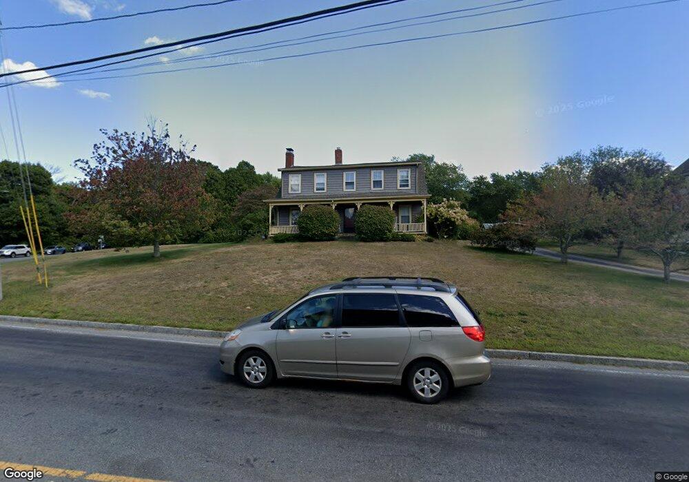
1041 Main St Hanover, MA 02339
Estimated Value: $1,137,524 - $1,327,000
5
Beds
3
Baths
3,626
Sq Ft
$338/Sq Ft
Est. Value
About This Home
This home is located at 1041 Main St, Hanover, MA 02339 and is currently estimated at $1,227,131, approximately $338 per square foot. 1041 Main St is a home located in Plymouth County with nearby schools including Hanover High School, South Shore Charter Public School, and Norwell KinderCare.
Ownership History
Date
Name
Owned For
Owner Type
Purchase Details
Closed on
Aug 16, 2006
Sold by
Wetzonis Kenneth M and Wetzonis Susan Maria
Bought by
1041 Main Street Rt and Bunker Christopher J
Current Estimated Value
Purchase Details
Closed on
Jul 31, 1996
Sold by
Reale Joseph A and Reale Karen J
Bought by
Wetzonis Kenneth M
Home Financials for this Owner
Home Financials are based on the most recent Mortgage that was taken out on this home.
Original Mortgage
$150,000
Interest Rate
8.27%
Mortgage Type
Purchase Money Mortgage
Purchase Details
Closed on
Oct 31, 1994
Sold by
Reale Albert H and Reale Theresa F
Bought by
Reale Karen J
Create a Home Valuation Report for This Property
The Home Valuation Report is an in-depth analysis detailing your home's value as well as a comparison with similar homes in the area
Home Values in the Area
Average Home Value in this Area
Purchase History
| Date | Buyer | Sale Price | Title Company |
|---|---|---|---|
| 1041 Main Street Rt | $635,000 | -- | |
| Wetzonis Kenneth M | $250,000 | -- | |
| Reale Karen J | $195,000 | -- |
Source: Public Records
Mortgage History
| Date | Status | Borrower | Loan Amount |
|---|---|---|---|
| Previous Owner | Reale Karen J | $420,000 | |
| Previous Owner | Reale Karen J | $150,000 | |
| Previous Owner | Reale Karen J | $140,000 | |
| Previous Owner | Reale Karen J | $200,000 |
Source: Public Records
Tax History Compared to Growth
Tax History
| Year | Tax Paid | Tax Assessment Tax Assessment Total Assessment is a certain percentage of the fair market value that is determined by local assessors to be the total taxable value of land and additions on the property. | Land | Improvement |
|---|---|---|---|---|
| 2025 | $12,026 | $973,800 | $348,900 | $624,900 |
| 2024 | $11,741 | $914,400 | $348,900 | $565,500 |
| 2023 | $11,403 | $845,300 | $318,600 | $526,700 |
| 2022 | $11,178 | $733,000 | $267,700 | $465,300 |
| 2021 | $11,044 | $676,300 | $244,600 | $431,700 |
| 2020 | $10,725 | $657,600 | $244,600 | $413,000 |
| 2019 | $10,363 | $631,500 | $244,600 | $386,900 |
| 2018 | $4,925 | $594,700 | $244,600 | $350,100 |
| 2017 | $8,815 | $533,600 | $249,300 | $284,300 |
| 2016 | $8,529 | $505,900 | $227,700 | $278,200 |
| 2015 | $8,487 | $525,500 | $247,300 | $278,200 |
Source: Public Records
Map
Nearby Homes
- 70 Dillingham Way
- 375 Webster St
- 1239 Main St
- 118 Bates Way
- 276 Woodland Dr
- 80 Coolidge Rd
- 53 Chestnut St
- 7 Assinippi Ave Unit 306
- 216 Whiting St
- 214 Washington St Unit 24
- 214 Washington St Unit 28
- 120 Deerfield Ln
- 141 Deerfield Ln
- 62 High St
- 62 Larchmont Ln
- 18 Colby St
- 55 Turner Rd
- 114 Main St
- 206-208 Hinghm St
- 8 Old Farm Rd