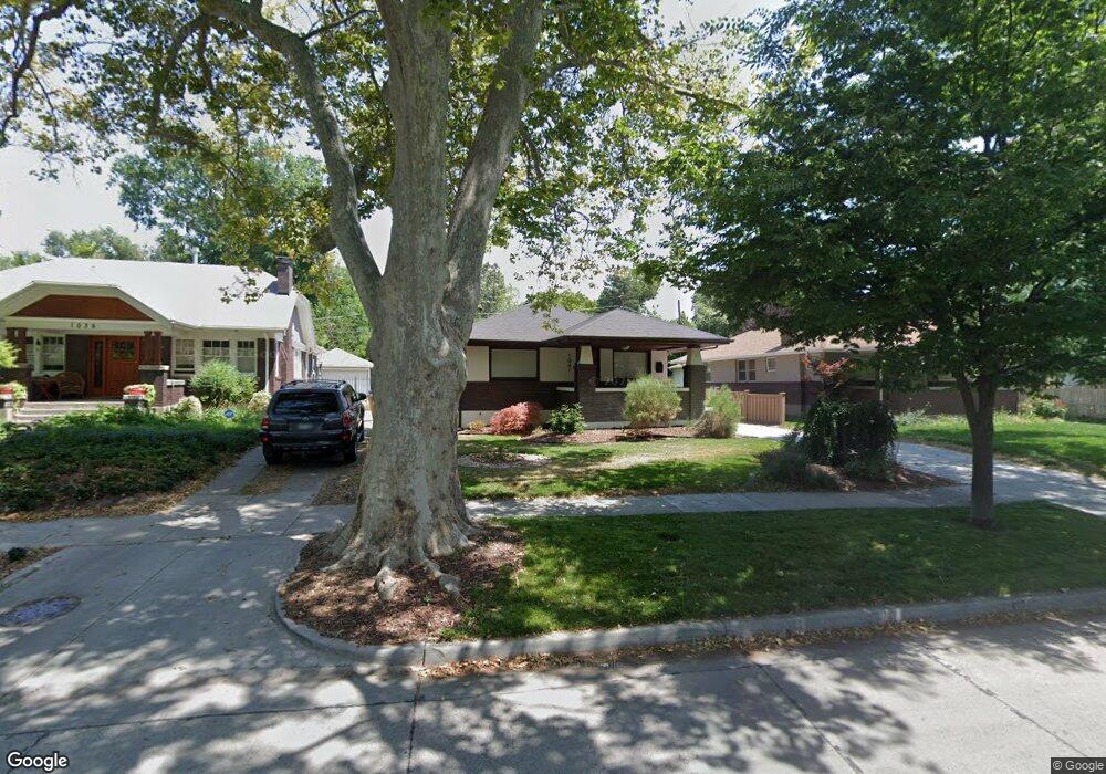
1041 Mcclelland St Salt Lake City, UT 84105
East Central NeighborhoodEstimated Value: $811,000 - $913,714
4
Beds
3
Baths
1,190
Sq Ft
$723/Sq Ft
Est. Value
About This Home
This home is located at 1041 Mcclelland St, Salt Lake City, UT 84105 and is currently estimated at $860,179, approximately $722 per square foot. 1041 Mcclelland St is a home located in Salt Lake County with nearby schools including Emerson School, Clayton Middle School, and East High School.
Ownership History
Date
Name
Owned For
Owner Type
Purchase Details
Closed on
Apr 10, 2025
Sold by
Zigar Rhonda T
Bought by
Rhonda Zigar Trust and Zigar
Current Estimated Value
Purchase Details
Closed on
Aug 9, 2024
Sold by
Pfost Adam and Tomlinson Eric
Bought by
Zigar Rhonda T
Purchase Details
Closed on
Jun 24, 2021
Sold by
Collins Brent S and Tran Hoa
Bought by
Pfost Adam and Tomlinson Eric
Home Financials for this Owner
Home Financials are based on the most recent Mortgage that was taken out on this home.
Original Mortgage
$450,000
Interest Rate
2.9%
Mortgage Type
New Conventional
Purchase Details
Closed on
Nov 5, 2014
Sold by
Baayd Mohamed and Baayd Jami
Bought by
Collins Brent S and Tran Hoa
Home Financials for this Owner
Home Financials are based on the most recent Mortgage that was taken out on this home.
Original Mortgage
$358,720
Interest Rate
4.17%
Mortgage Type
New Conventional
Purchase Details
Closed on
Mar 22, 2011
Sold by
The Secretary Of Housing & Urban Develop
Bought by
Baayd Mohamed and Baayd Jami
Home Financials for this Owner
Home Financials are based on the most recent Mortgage that was taken out on this home.
Original Mortgage
$238,500
Interest Rate
5.02%
Mortgage Type
VA
Purchase Details
Closed on
Sep 29, 2010
Sold by
Wells Fargo Bank Na
Bought by
Secretary Of Housing & Urban Development
Purchase Details
Closed on
Sep 2, 2010
Sold by
Lundevall Jeremy B and Lundevall Rachel M
Bought by
Wells Fargo Bank Na
Purchase Details
Closed on
Jan 27, 2005
Sold by
The Carrie Bergeson Jolley Trust and Jolley Carrie Bergeson
Bought by
Lundevall Jeremy B and Lundevall Rachel
Home Financials for this Owner
Home Financials are based on the most recent Mortgage that was taken out on this home.
Original Mortgage
$23,400
Interest Rate
5.67%
Mortgage Type
Stand Alone Second
Create a Home Valuation Report for This Property
The Home Valuation Report is an in-depth analysis detailing your home's value as well as a comparison with similar homes in the area
Home Values in the Area
Average Home Value in this Area
Purchase History
| Date | Buyer | Sale Price | Title Company |
|---|---|---|---|
| Rhonda Zigar Trust | -- | None Listed On Document | |
| Zigar Rhonda T | -- | Old Republic Title | |
| Pfost Adam | -- | Vanguard Title Union Park | |
| Collins Brent S | -- | Old Republic Title So Jordan | |
| Baayd Mohamed | -- | Monument Title Ins Co | |
| Secretary Of Housing & Urban Development | -- | Backman Title Services | |
| Wells Fargo Bank Na | $392,067 | Etitle Insurance Agency | |
| Lundevall Jeremy B | -- | Bonneville Title Co |
Source: Public Records
Mortgage History
| Date | Status | Borrower | Loan Amount |
|---|---|---|---|
| Previous Owner | Pfost Adam | $450,000 | |
| Previous Owner | Collins Brent S | $358,720 | |
| Previous Owner | Baayd Mohamed | $238,500 | |
| Previous Owner | Lundevall Jeremy B | $23,400 | |
| Previous Owner | Lundevall Jeremy B | $187,200 |
Source: Public Records
Tax History Compared to Growth
Tax History
| Year | Tax Paid | Tax Assessment Tax Assessment Total Assessment is a certain percentage of the fair market value that is determined by local assessors to be the total taxable value of land and additions on the property. | Land | Improvement |
|---|---|---|---|---|
| 2025 | $4,045 | $841,000 | $266,200 | $574,800 |
| 2024 | $4,045 | $771,900 | $251,800 | $520,100 |
| 2023 | $4,045 | $742,600 | $242,200 | $500,400 |
| 2022 | $0 | $749,600 | $237,400 | $512,200 |
| 2021 | $4,798 | $526,700 | $184,100 | $342,600 |
| 2020 | $3,233 | $480,800 | $182,200 | $298,600 |
| 2019 | $3,324 | $465,100 | $171,500 | $293,600 |
| 2018 | $3,241 | $441,600 | $171,500 | $270,100 |
| 2017 | $3,403 | $434,300 | $171,500 | $262,800 |
| 2016 | $3,440 | $417,000 | $126,500 | $290,500 |
| 2015 | $3,027 | $347,800 | $130,200 | $217,600 |
| 2014 | -- | $259,500 | $127,700 | $131,800 |
Source: Public Records
Map
Nearby Homes
- 1041 Yale Ave S
- 1120 E Yale Ave
- 946 E Princeton Ave
- 1216 S 1100 E
- 1099 S 900 E
- 940 S 1000 E
- 931 Laird Ave S
- 1143 E 1300 S
- 1330 S 1100 E
- 1267 Yale Ave S
- 855 E Belmont Ave
- 1130 S 1300 E Unit 1134
- 1354 S 1100 E
- 1120 E Sunnyside Ave
- 1013 S 1300 E
- 1361 S Lincoln St
- 815 S 1100 E
- 1306 Harvard Ave S
- 1261 E Sherman Ave
- 1031 E 800 S
- 1041 S Mcclelland St
- 1035 Mcclelland St
- 1047 Mcclelland St
- 1029 S Mcclelland St
- 1029 Mcclelland St
- 1041 Yale Ave
- 1025 Mcclelland St
- 1025 S Mcclelland St
- 1047 E Yale Ave
- 1047 Yale Ave
- 1039 Yale Ave
- 1039 E Yale Ave
- 1057 E Yale Ave
- 1057 Yale Ave
- 1021 Mcclelland St
- 1028 Herbert Ave
- 1061 Yale Ave
- 1027 Herbert Ave
- 1028 S 1100 E
- 1044 S 1100 E