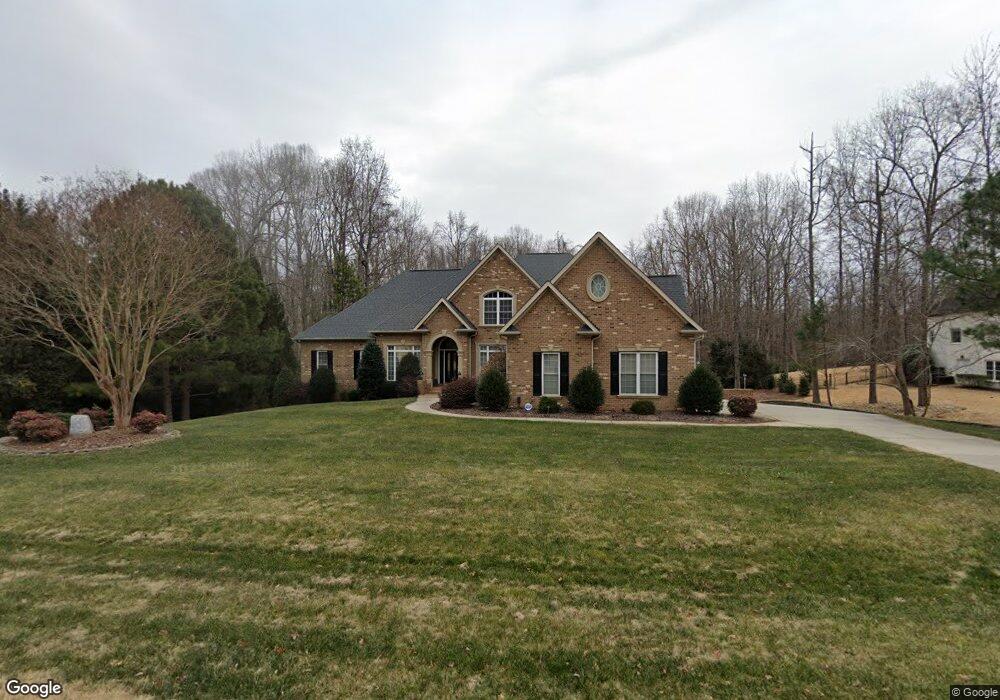
1041 Rolling Park Ln Fort Mill, SC 29715
Estimated Value: $1,132,968 - $1,367,000
--
Bed
1
Bath
4,334
Sq Ft
$282/Sq Ft
Est. Value
About This Home
This home is located at 1041 Rolling Park Ln, Fort Mill, SC 29715 and is currently estimated at $1,223,323, approximately $282 per square foot. 1041 Rolling Park Ln is a home located in York County with nearby schools including Doby's Bridge Elementary School and Catawba Ridge High School.
Ownership History
Date
Name
Owned For
Owner Type
Purchase Details
Closed on
Jun 30, 2005
Sold by
Palmetto Land Consultants Llc
Bought by
Cruse C Lansford and Cruse Stephanie W
Current Estimated Value
Home Financials for this Owner
Home Financials are based on the most recent Mortgage that was taken out on this home.
Original Mortgage
$328,950
Interest Rate
5.57%
Mortgage Type
New Conventional
Purchase Details
Closed on
Jun 27, 2005
Sold by
Minini Moretti Julie J and Moretti Pedro G
Bought by
Cruse C Lansford and Cruse Stephanie W
Home Financials for this Owner
Home Financials are based on the most recent Mortgage that was taken out on this home.
Original Mortgage
$328,950
Interest Rate
5.57%
Mortgage Type
New Conventional
Purchase Details
Closed on
Oct 20, 2004
Sold by
Oz Custom Built Homes Inc
Bought by
Minini Moretti Julie J and Moretti Pedro G
Purchase Details
Closed on
Feb 12, 2004
Sold by
Palmetto Land Consultans Llc
Bought by
Oz Custom Built Homes Inc
Create a Home Valuation Report for This Property
The Home Valuation Report is an in-depth analysis detailing your home's value as well as a comparison with similar homes in the area
Home Values in the Area
Average Home Value in this Area
Purchase History
| Date | Buyer | Sale Price | Title Company |
|---|---|---|---|
| Cruse C Lansford | -- | -- | |
| Cruse C Lansford | $628,950 | -- | |
| Minini Moretti Julie J | $607,705 | -- | |
| Oz Custom Built Homes Inc | $34,000 | -- |
Source: Public Records
Mortgage History
| Date | Status | Borrower | Loan Amount |
|---|---|---|---|
| Previous Owner | Cruse C Lansford | $328,950 | |
| Previous Owner | Cruse C Lansford | $328,950 |
Source: Public Records
Tax History Compared to Growth
Tax History
| Year | Tax Paid | Tax Assessment Tax Assessment Total Assessment is a certain percentage of the fair market value that is determined by local assessors to be the total taxable value of land and additions on the property. | Land | Improvement |
|---|---|---|---|---|
| 2024 | $3,608 | $23,667 | $3,290 | $20,377 |
| 2023 | $3,491 | $23,667 | $3,290 | $20,377 |
| 2022 | $3,458 | $23,667 | $3,290 | $20,377 |
| 2021 | -- | $23,667 | $3,290 | $20,377 |
| 2020 | $4,073 | $23,667 | $0 | $0 |
| 2019 | $4,097 | $20,580 | $0 | $0 |
| 2018 | $4,346 | $20,580 | $0 | $0 |
| 2017 | $4,108 | $20,580 | $0 | $0 |
| 2016 | $4,083 | $20,580 | $0 | $0 |
| 2014 | $3,139 | $20,580 | $2,600 | $17,980 |
| 2013 | $3,139 | $22,680 | $2,600 | $20,080 |
Source: Public Records
Map
Nearby Homes
- 2760 Holbrook Rd
- 1427 Doe Ridge Ln
- 1042 Croyden Ct
- 1227 Cabin Creek Ct
- lot 5 Holbrook Rd Unit 5
- lot 4 Holbrook Rd
- lot 6 Holbrook Rd
- lot 3 Holbrook Rd Unit 3
- 627 Bolick Rd
- 1737 Felts Pkwy
- 1761 Felts Pkwy
- 1786 Felts Pkwy
- 5009 Saint Clair St
- 8737 Whippoorwill Ln
- 831 Tyne Dr
- 1098 Kings Bottom Dr
- 837 Tyne Dr
- 9142 Drayton Ln
- 1026 Arges River Dr
- 7311 Barrington Ridge Dr
- 1047 Rolling Park Ln
- 1035 Rolling Park Ln
- 1044 Rolling Park Ln
- 1053 Rolling Park Ln
- 1029 Rolling Park Ln Unit 99
- 1032 Rolling Park Ln
- 1050 Rolling Park Ln
- 1200 Silver Arrow Ct
- 1028 Rolling Park Ln
- 1023 Rolling Park Ln
- 1059 Rolling Park Ln
- 1020 Rolling Park Ln
- 457 Farm Branch Dr
- 644 Elmhurst Dr
- 1017 Rolling Park Ln
- 1206 Silver Arrow Ct
- 449 Farm Branch Dr
- 650 Elmhurst Dr
- 1203 Silver Arrow Ct
- 1016 Rolling Park Ln