Estimated Value: $248,000 - $280,000
3
Beds
2
Baths
1,658
Sq Ft
$159/Sq Ft
Est. Value
About This Home
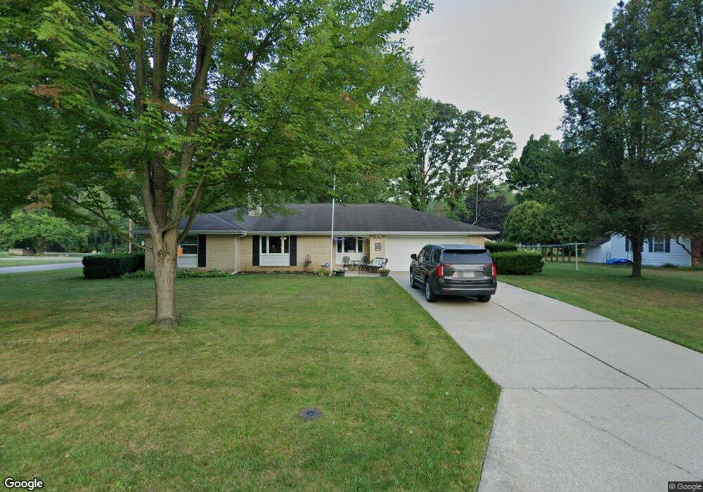
This home is located at 1041 Tomahawk Ln, Niles, MI 49120 and is currently estimated at $263,554, approximately $158 per square foot. 1041 Tomahawk Ln is a home located in Berrien County with nearby schools including Ballard Elementary School, Oak Manor Sixth Grade Center, and Ring Lardner Middle School.
Ownership History
Date
Name
Owned For
Owner Type
Purchase Details
Closed on
Dec 18, 2019
Sold by
Gadd Dale F and Gadd Karen D
Bought by
Gadd Dale F and Gadd Karen D
Current Estimated Value
Purchase Details
Closed on
Aug 25, 2004
Sold by
Miller Carl M and Miller Linda J
Bought by
Gadd Dale F and Gadd Karen D
Home Financials for this Owner
Home Financials are based on the most recent Mortgage that was taken out on this home.
Original Mortgage
$133,371
Outstanding Balance
$67,350
Interest Rate
6.17%
Mortgage Type
VA
Estimated Equity
$196,204
Purchase Details
Closed on
Mar 13, 2004
Sold by
Conn Stephen C and Conn Karen S
Bought by
Miller Carl M and Miller Linda J
Purchase Details
Closed on
Mar 28, 2003
Sold by
Steiner Lorraine L
Bought by
Miller Carl and Miller Linda
Purchase Details
Closed on
Oct 19, 2001
Create a Home Valuation Report for This Property
The Home Valuation Report is an in-depth analysis detailing your home's value as well as a comparison with similar homes in the area
Home Values in the Area
Average Home Value in this Area
Purchase History
| Date | Buyer | Sale Price | Title Company |
|---|---|---|---|
| Gadd Dale F | -- | None Available | |
| Gadd Dale F | $133,000 | -- | |
| Miller Carl M | -- | -- | |
| Miller Carl | $86,000 | -- | |
| -- | $100 | -- |
Source: Public Records
Mortgage History
| Date | Status | Borrower | Loan Amount |
|---|---|---|---|
| Open | Gadd Dale F | $133,371 |
Source: Public Records
Tax History Compared to Growth
Tax History
| Year | Tax Paid | Tax Assessment Tax Assessment Total Assessment is a certain percentage of the fair market value that is determined by local assessors to be the total taxable value of land and additions on the property. | Land | Improvement |
|---|---|---|---|---|
| 2025 | $2,768 | $117,700 | $0 | $0 |
| 2024 | $2,202 | $109,400 | $0 | $0 |
| 2023 | $2,111 | $100,000 | $0 | $0 |
| 2022 | $2,010 | $99,700 | $0 | $0 |
| 2021 | $2,448 | $98,500 | $9,300 | $89,200 |
| 2020 | $2,422 | $94,500 | $0 | $0 |
| 2019 | $2,392 | $70,900 | $4,300 | $66,600 |
| 2018 | $2,312 | $70,900 | $0 | $0 |
| 2017 | $2,273 | $60,100 | $0 | $0 |
| 2016 | $2,259 | $60,500 | $0 | $0 |
| 2015 | $2,336 | $65,100 | $0 | $0 |
| 2014 | $1,839 | $67,800 | $0 | $0 |
Source: Public Records
Map
Nearby Homes
- 1010 Tomahawk Ln
- V/L Wesaw Rd
- 1604 Orchard Ln
- 1619 Orchard Ln
- 1551 Cedar Point Dr
- 1695 Signal Point Dr
- 0 Cedar Point Dr
- 413 S Street Joseph Ave
- 1402 Niles Buchanan Rd
- 314 S Saint Joseph Ave
- 0 Bond St
- 124 S State St
- 1806 Bond St
- 115 S State St
- 537 Grant St
- 23 Market St
- 1834 Bond St
- 43 N Lincoln Ave
- 300 Carefree Ct
- Integrity 1605 Plan at Carefree Villas
- 1035 Tomahawk Ln
- 1324 W River Rd
- 1320 W River Rd
- 1040 Tomahawk Ln
- 1316 W River Rd
- 1165 Sassafras Ln
- 1034 Tomahawk Ln
- 1159 Sassafras Ln
- 1023 Tomahawk Ln
- 1028 Tomahawk Ln
- 1152 Sassafras Ln
- 1312 W River Rd
- 1247 Otis Dr
- 1225 Otis Dr
- 1308 W River Rd
- 1022 Tomahawk Ln
- 1153 Sassafras Ln
- 1146 Sassafras Ln
- 1015 Tomahawk Ln
- 1350 W River Rd