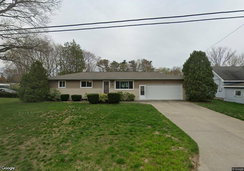
1041 Vick Rd Norton Shores, MI 49441
Estimated Value: $196,000 - $246,000
3
Beds
2
Baths
1,144
Sq Ft
$199/Sq Ft
Est. Value
About This Home
This home is located at 1041 Vick Rd, Norton Shores, MI 49441 and is currently estimated at $228,072, approximately $199 per square foot. 1041 Vick Rd is a home located in Muskegon County with nearby schools including Mona Shores High School, Edgewood Elementary Academy, and Dr. Martin Luther King Academy.
Ownership History
Date
Name
Owned For
Owner Type
Purchase Details
Closed on
Aug 15, 2024
Sold by
Price Trust and Price Dorothy Judith
Bought by
Janusiewicz Alyssa and Janusiewicz Tyler
Current Estimated Value
Purchase Details
Closed on
Jan 29, 2013
Sold by
Price Lester L and Judith Price D
Bought by
Price Lester L and Price Dorothy Judith
Purchase Details
Closed on
Jul 16, 2008
Sold by
Hart Robert A and Hart Thomas J
Bought by
Price Lester L and Judith Price D
Create a Home Valuation Report for This Property
The Home Valuation Report is an in-depth analysis detailing your home's value as well as a comparison with similar homes in the area
Home Values in the Area
Average Home Value in this Area
Purchase History
| Date | Buyer | Sale Price | Title Company |
|---|---|---|---|
| Janusiewicz Alyssa | $184,000 | Lighthouse Title | |
| Price Lester L | -- | None Available | |
| Price Lester L | -- | None Available |
Source: Public Records
Tax History Compared to Growth
Tax History
| Year | Tax Paid | Tax Assessment Tax Assessment Total Assessment is a certain percentage of the fair market value that is determined by local assessors to be the total taxable value of land and additions on the property. | Land | Improvement |
|---|---|---|---|---|
| 2025 | $2,023 | $100,700 | $0 | $0 |
| 2024 | $1,586 | $92,700 | $0 | $0 |
| 2023 | $1,515 | $82,200 | $0 | $0 |
| 2022 | $1,846 | $69,400 | $0 | $0 |
| 2021 | $1,794 | $63,000 | $0 | $0 |
| 2020 | $1,774 | $58,500 | $0 | $0 |
| 2019 | $1,741 | $53,400 | $0 | $0 |
| 2018 | $1,701 | $49,100 | $0 | $0 |
| 2017 | $1,661 | $48,200 | $0 | $0 |
| 2016 | $1,286 | $45,000 | $0 | $0 |
| 2015 | -- | $42,000 | $0 | $0 |
| 2014 | $1,543 | $42,200 | $0 | $0 |
| 2013 | -- | $41,100 | $0 | $0 |
Source: Public Records
Map
Nearby Homes
- 4468 Spruce Ct
- 1068 Englewood Ave
- 1130 Englewood Ave
- 1067 Aspen Dr
- 4476 Cedar Ln Unit 54
- 945 Petrie Ave
- 1065 Wilson Ct
- V/L 4535 Thompson Rd
- 4535 Thompson Rd
- 4638 Lauren Dr
- 1201 Shettler Rd
- 4102 Highgate Rd
- 4060 Buck St
- 1454 Airport Rd
- 3920 Highgate Rd
- 4677 Harvey St
- 1404 E Ellis Rd
- V/L E Ellis Rd
- 4769 Harvey St
- 4875 Paul Ct
- 1031 Vick Rd
- 1042 Vick Rd
- 1058 Walnut Grove Dr
- 1065 Vick Rd
- 1064 Walnut Grove Dr
- 1052 Vick Rd
- 1054 Walnut Grove Dr
- 1050 Walnut Grove Dr
- 1081 Vick Rd
- 1062 Vick Rd
- 1084 Walnut Grove Dr Unit 17
- 1082 Walnut Grove Dr
- 1076 Vick Rd
- 1070 Walnut Grove Dr Unit 24
- 1055 Walnut Grove Dr Unit A6
- 1055 Walnut Grove Dr Unit 6
- 1091 Vick Rd
- 1072 Walnut Grove Dr Unit 23
- 1053 Walnut Grove Dr
- 1051 Walnut Grove Dr