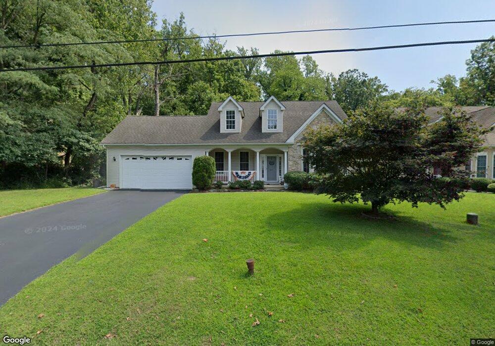
1041 West Ave Springfield, PA 19064
Estimated Value: $591,780 - $730,000
3
Beds
4
Baths
2,677
Sq Ft
$243/Sq Ft
Est. Value
About This Home
This home is located at 1041 West Ave, Springfield, PA 19064 and is currently estimated at $650,695, approximately $243 per square foot. 1041 West Ave is a home located in Delaware County with nearby schools including Springfield High School, St Francis Of Assisi School, and Holy Cross School.
Ownership History
Date
Name
Owned For
Owner Type
Purchase Details
Closed on
Mar 16, 2011
Sold by
Antenucci Mark and Estate Of Peter J Antenucci
Bought by
Wang Cong and Yang Weifang
Current Estimated Value
Home Financials for this Owner
Home Financials are based on the most recent Mortgage that was taken out on this home.
Original Mortgage
$268,100
Interest Rate
4.84%
Mortgage Type
New Conventional
Create a Home Valuation Report for This Property
The Home Valuation Report is an in-depth analysis detailing your home's value as well as a comparison with similar homes in the area
Home Values in the Area
Average Home Value in this Area
Purchase History
| Date | Buyer | Sale Price | Title Company |
|---|---|---|---|
| Wang Cong | $383,000 | None Available |
Source: Public Records
Mortgage History
| Date | Status | Borrower | Loan Amount |
|---|---|---|---|
| Closed | Wang Cong | $268,100 |
Source: Public Records
Tax History
| Year | Tax Paid | Tax Assessment Tax Assessment Total Assessment is a certain percentage of the fair market value that is determined by local assessors to be the total taxable value of land and additions on the property. | Land | Improvement |
|---|---|---|---|---|
| 2025 | $9,416 | $335,000 | $102,930 | $232,070 |
| 2024 | $9,416 | $335,000 | $102,930 | $232,070 |
| 2023 | $9,066 | $335,000 | $102,930 | $232,070 |
| 2022 | $8,870 | $335,000 | $102,930 | $232,070 |
| 2021 | $13,737 | $335,000 | $102,930 | $232,070 |
| 2020 | $8,528 | $188,188 | $51,460 | $136,728 |
| 2019 | $8,327 | $188,188 | $51,460 | $136,728 |
| 2018 | $8,208 | $188,188 | $0 | $0 |
| 2017 | $10,477 | $245,886 | $0 | $0 |
| 2016 | $1,349 | $245,886 | $0 | $0 |
| 2015 | $1,349 | $245,886 | $0 | $0 |
| 2014 | $1,349 | $245,886 | $0 | $0 |
Source: Public Records
Map
Nearby Homes
- 978 Westfield Rd
- 838 West Ave
- 202-203 Sycamore Ave
- 114 Providence Rd
- 111 Broad St
- 507 School St
- 2323 Mole Rd
- 2379 Mole Rd
- 880 Quaint St
- 933 Greenbriar Ln
- 2143 Haig Ave
- 514 Springview Ln
- 7 & 0 Woodland Ave
- 173 Rambling Way
- 1045 Edgerton Rd
- 2 Yale Ave
- 332 Franklin Ave
- 1102 Primos Ave
- 1015 Mitchell Ave
- 1020 Edgerton Rd
Your Personal Tour Guide
Ask me questions while you tour the home.