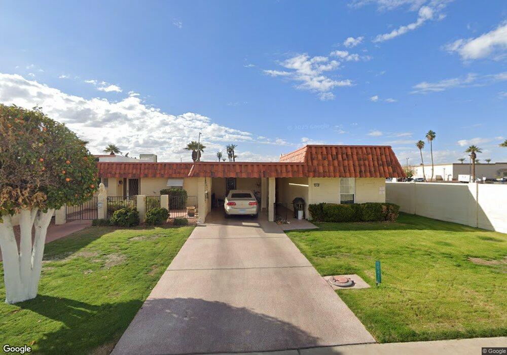
10410 N 106th Dr Unit 50 Sun City, AZ 85351
Estimated Value: $153,000 - $184,000
1
Bed
1
Bath
988
Sq Ft
$173/Sq Ft
Est. Value
About This Home
This home is located at 10410 N 106th Dr Unit 50, Sun City, AZ 85351 and is currently estimated at $170,917, approximately $172 per square foot. 10410 N 106th Dr Unit 50 is a home located in Maricopa County with nearby schools including Desert Mirage Elementary School, Ombudsman - Northwest Charter, and Peoria Accelerated High School.
Ownership History
Date
Name
Owned For
Owner Type
Purchase Details
Closed on
Mar 3, 2015
Sold by
Mundstock William R and Mundstock Gloria A
Bought by
Peterson David
Current Estimated Value
Purchase Details
Closed on
Dec 10, 2007
Sold by
Mundstock William R and Mundstock Gloria A
Bought by
Mundstock William R and Mundstock Gloria A
Purchase Details
Closed on
Mar 25, 2003
Sold by
Biegenwald Todd W
Bought by
Mundstock William R and Mundstock Gloria A
Home Financials for this Owner
Home Financials are based on the most recent Mortgage that was taken out on this home.
Original Mortgage
$20,000
Interest Rate
5.79%
Mortgage Type
New Conventional
Purchase Details
Closed on
May 17, 2002
Sold by
Smithback Herbert and Smithback Avis
Bought by
Biegenwald Todd W
Create a Home Valuation Report for This Property
The Home Valuation Report is an in-depth analysis detailing your home's value as well as a comparison with similar homes in the area
Home Values in the Area
Average Home Value in this Area
Purchase History
| Date | Buyer | Sale Price | Title Company |
|---|---|---|---|
| Peterson David | $71,000 | First American Title Ins Co | |
| Mundstock William R | -- | None Available | |
| Mundstock William R | $61,000 | Capital Title Agency Inc | |
| Biegenwald Todd W | $48,000 | Capital Title Agency Inc |
Source: Public Records
Mortgage History
| Date | Status | Borrower | Loan Amount |
|---|---|---|---|
| Previous Owner | Mundstock William R | $20,000 |
Source: Public Records
Tax History Compared to Growth
Tax History
| Year | Tax Paid | Tax Assessment Tax Assessment Total Assessment is a certain percentage of the fair market value that is determined by local assessors to be the total taxable value of land and additions on the property. | Land | Improvement |
|---|---|---|---|---|
| 2025 | $488 | $6,277 | -- | -- |
| 2024 | $504 | $5,978 | -- | -- |
| 2023 | $504 | $13,080 | $2,610 | $10,470 |
| 2022 | $473 | $10,200 | $2,040 | $8,160 |
| 2021 | $484 | $9,260 | $1,850 | $7,410 |
| 2020 | $471 | $8,910 | $1,780 | $7,130 |
| 2019 | $468 | $7,250 | $1,450 | $5,800 |
| 2018 | $452 | $6,280 | $1,250 | $5,030 |
| 2017 | $437 | $5,320 | $1,060 | $4,260 |
| 2016 | $410 | $4,860 | $970 | $3,890 |
| 2015 | $390 | $4,350 | $870 | $3,480 |
Source: Public Records
Map
Nearby Homes
- 10230 N 106th Dr
- 10236 N 105th Dr Unit 8
- 10709 W Clair Dr Unit 1
- 10613 W Clair Dr
- 10222 N 105th Dr Unit 5
- 10616 W Camden Ave
- 10711 W Abbott Ave Unit 2
- 10535 W Clair Dr
- 10202 N 105th Dr Unit 1
- 10516 W Peoria Ave
- 10743 W Clair Dr Unit 8
- 10235 N 108th Dr Unit 45
- 10522 W Camden Ave Unit 6
- 10510 W Camden Ave
- 10417 W Deanne Dr Unit 5
- 10426 W Deanne Dr Unit 15
- 10724 W Cheryl Dr
- 10829 N Fairway Ct W Unit 106
- 10728 W Cheryl Dr
- 10847 N Fairway Ct E Unit 211
- 10410 N 106th Dr
- 10406 N 106th Dr
- 10402 N 106th Ave
- 10636 W Deanne Dr
- 10236 N 106th Dr Unit 4
- 10632 W Deanne Dr
- 10232 N 106th Dr Unit 5D
- 10628 W Deanne Dr
- 10635 W Deanne Dr Unit 8
- 10624 W Deanne Dr
- 10631 W Deanne Dr
- 10226 N 106th Dr
- 10620 W Deanne Dr
- 10636 W Audrey Dr
- 10632 W Audrey Dr Unit 10
- 10616 W Deanne Dr
- 10626 W Audrey Dr Unit 5
- 10614 W Deanne Dr Unit 14
- 10622 W Audrey Dr Unit 12
- 10645 W Audrey Dr Unit 2