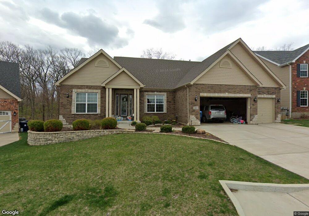
10412 Appomattox Station Ct Saint Louis, MO 63123
Estimated Value: $970,000 - $1,083,000
4
Beds
6
Baths
6,074
Sq Ft
$169/Sq Ft
Est. Value
About This Home
This home is located at 10412 Appomattox Station Ct, Saint Louis, MO 63123 and is currently estimated at $1,026,688, approximately $169 per square foot. 10412 Appomattox Station Ct is a home with nearby schools including Sappington Elementary School, Sperreng Middle School, and Lindbergh High School.
Ownership History
Date
Name
Owned For
Owner Type
Purchase Details
Closed on
Sep 30, 2021
Sold by
The Young Family Trust
Bought by
Dobbins Joseph and Dobbins Kayla
Current Estimated Value
Home Financials for this Owner
Home Financials are based on the most recent Mortgage that was taken out on this home.
Original Mortgage
$605,319
Outstanding Balance
$551,994
Interest Rate
2.8%
Mortgage Type
Seller Take Back
Estimated Equity
$474,694
Purchase Details
Closed on
Jun 17, 2016
Sold by
Young Raymond and Young Linda M
Bought by
Young Raymond and Young Linda M
Purchase Details
Closed on
Oct 22, 2015
Sold by
Mcbride Grants View Llc
Bought by
Young Ray and Young Linda
Create a Home Valuation Report for This Property
The Home Valuation Report is an in-depth analysis detailing your home's value as well as a comparison with similar homes in the area
Home Values in the Area
Average Home Value in this Area
Purchase History
| Date | Buyer | Sale Price | Title Company |
|---|---|---|---|
| Dobbins Joseph | $750,000 | Security Title Ins Agcy | |
| Young Raymond | -- | None Available | |
| Young Ray | -- | Title Partners Agency Llc |
Source: Public Records
Mortgage History
| Date | Status | Borrower | Loan Amount |
|---|---|---|---|
| Open | Dobbins Joseph | $605,319 |
Source: Public Records
Tax History Compared to Growth
Tax History
| Year | Tax Paid | Tax Assessment Tax Assessment Total Assessment is a certain percentage of the fair market value that is determined by local assessors to be the total taxable value of land and additions on the property. | Land | Improvement |
|---|---|---|---|---|
| 2025 | $12,306 | $188,910 | $29,560 | $159,350 |
| 2024 | $12,306 | $188,450 | $15,850 | $172,600 |
| 2023 | $12,274 | $188,450 | $15,850 | $172,600 |
| 2022 | $12,844 | $175,240 | $21,450 | $153,790 |
| 2021 | $11,371 | $175,240 | $21,450 | $153,790 |
| 2020 | $10,563 | $157,040 | $17,880 | $139,160 |
| 2019 | $10,536 | $157,040 | $17,880 | $139,160 |
| 2018 | $9,785 | $132,640 | $10,740 | $121,900 |
| 2017 | $7,251 | $99,280 | $10,740 | $88,540 |
| 2016 | $7,420 | $96,480 | $16,090 | $80,390 |
| 2015 | $1,238 | $16,090 | $16,090 | $0 |
| 2014 | $21 | $270 | $270 | $0 |
Source: Public Records
Map
Nearby Homes
- 10360 Roscommon Dr
- 10300 Grant Forest Ln
- 10016 Kilmeade Dr
- 10161 Squire Meadows Dr Unit E
- 10161 Squire Meadows Dr Unit C
- 10649 W Knollshire Dr
- 9742 Croftwood Dr
- 3 Grantview Ln
- 10560 Crecelius Dr
- 5 Grantview Ln
- 10814 Galena Ct
- 11000 Torigney Dr
- 10354 Jade Forest Dr
- 9920 Wolff Dr
- 7508 Bull Run Dr
- 10835 Mallory Dr
- 9008 Fernald Dr
- 7369 Whitehaven Dr
- 11042 Wylestone Ct
- 10915 Concord Circle Dr
- 10424 Appomattox Station Ct
- 10408 Appomattox Station Ct
- 10428 Appomattox Station Ct
- 10404 Appomattox Station Ct
- 10413 Appomattox Station Ct
- 10409 Appomattox Station Ct
- 10405 Appomattox Station Ct
- 10421 Appomattox Station Ct
- 9964 Vicksburg Siege Ct
- 10432 Appomattox Station Ct
- 9970 Vicksburg Siege Ct
- 9958 Vicksburg Siege Ct
- 10436 Appomattox Station Ct
- 9976 Vicksburg Siege Ct
- 10429 Appomattox Station Ct
- 9952 Vicksburg Siege Ct
- 10440 Appomattox Station Ct
- 10407 Antrim Dr
- 10411 Antrim Dr
- 10403 Antrim Dr