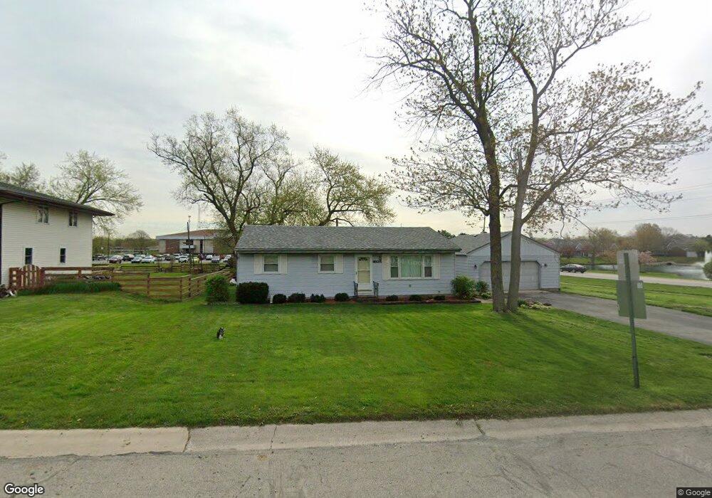
10415 Jennings Place Crown Point, IN 46307
Estimated Value: $214,000 - $275,347
3
Beds
1
Bath
1,400
Sq Ft
$180/Sq Ft
Est. Value
About This Home
This home is located at 10415 Jennings Place, Crown Point, IN 46307 and is currently estimated at $252,587, approximately $180 per square foot. 10415 Jennings Place is a home located in Lake County with nearby schools including Timothy Ball Elementary School, Robert Taft Middle School, and Crown Point High School.
Ownership History
Date
Name
Owned For
Owner Type
Purchase Details
Closed on
Nov 6, 2024
Sold by
Burke Joseph T
Bought by
Burke Daniel Wayne
Current Estimated Value
Home Financials for this Owner
Home Financials are based on the most recent Mortgage that was taken out on this home.
Original Mortgage
$185,000
Outstanding Balance
$182,997
Interest Rate
6.08%
Mortgage Type
New Conventional
Estimated Equity
$69,590
Create a Home Valuation Report for This Property
The Home Valuation Report is an in-depth analysis detailing your home's value as well as a comparison with similar homes in the area
Home Values in the Area
Average Home Value in this Area
Purchase History
| Date | Buyer | Sale Price | Title Company |
|---|---|---|---|
| Burke Daniel Wayne | $185,000 | Chicago Title Insurance Compan |
Source: Public Records
Mortgage History
| Date | Status | Borrower | Loan Amount |
|---|---|---|---|
| Open | Burke Daniel Wayne | $185,000 |
Source: Public Records
Tax History Compared to Growth
Tax History
| Year | Tax Paid | Tax Assessment Tax Assessment Total Assessment is a certain percentage of the fair market value that is determined by local assessors to be the total taxable value of land and additions on the property. | Land | Improvement |
|---|---|---|---|---|
| 2024 | $3,547 | $174,500 | $42,000 | $132,500 |
| 2023 | $1,043 | $166,900 | $42,000 | $124,900 |
| 2022 | $1,099 | $161,200 | $42,000 | $119,200 |
| 2021 | $935 | $151,400 | $34,500 | $116,900 |
| 2020 | $1,021 | $154,200 | $34,500 | $119,700 |
| 2019 | $1,077 | $149,100 | $34,500 | $114,600 |
| 2018 | $1,069 | $144,000 | $34,500 | $109,500 |
| 2017 | $1,082 | $144,100 | $34,500 | $109,600 |
| 2016 | $1,034 | $140,000 | $34,500 | $105,500 |
| 2014 | $984 | $146,000 | $34,500 | $111,500 |
| 2013 | $966 | $144,600 | $34,500 | $110,100 |
Source: Public Records
Map
Nearby Homes
- 771 Kenmare Pkwy
- 767 Kenmare Pkwy
- 3725 W 105th Ave
- 3604 W 104th Place
- 7830 W 106th Ln
- 7770 W 106th Ln
- 621 Pratt St
- 312 Summit Park Ct S
- 222 Maple St
- 808 N West St
- 301 Hoffman St
- 206 Birch St
- 511 N West St
- 221 Cedar St
- 1206 Sycamore St
- 10813 Lane St
- 306 Holton Ridge
- 515 Holley Dr
- 221 N West St
- 114 S Chase Dr
- 10413 Jennings Place
- 10416 Jennings Place
- 10411 Jennings Place
- 3110 W 105th Ave
- 3598 W 105th Ave
- 10412 Jennings Place
- 849 Rosslare Place
- 10409 Jennings Place
- 845 Rosslare Place
- 10410 Jennings Place
- 851 Kenmare Pkwy
- 3600 W 105th Ave
- 835 Rosslare Place
- 824 Rosslare Place
- 843 Kenmare Pkwy
- 831 Rosslare Place
- 831 Rosslare Place Unit 15-2
- 10407 Jennings Place
- 814 Rosslare Place
- 835 Kenmare Pkwy