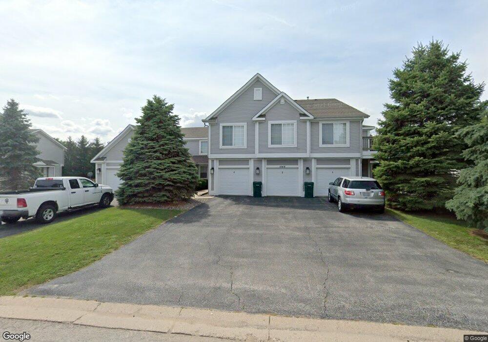
10416 Monarch Rd Roscoe, IL 61073
Estimated Value: $439,000 - $526,000
9
Beds
7
Baths
2,448
Sq Ft
$197/Sq Ft
Est. Value
About This Home
This home is located at 10416 Monarch Rd, Roscoe, IL 61073 and is currently estimated at $482,500, approximately $197 per square foot. 10416 Monarch Rd is a home located in Winnebago County with nearby schools including Rockton Elementary School, Whitman Post Elementary School, and Stephen Mack Middle School.
Ownership History
Date
Name
Owned For
Owner Type
Purchase Details
Closed on
Nov 2, 2018
Sold by
Trust No 1989
Bought by
Dyn Commercial Holdings Llc
Current Estimated Value
Home Financials for this Owner
Home Financials are based on the most recent Mortgage that was taken out on this home.
Original Mortgage
$2,700,000
Outstanding Balance
$2,369,253
Interest Rate
4.7%
Mortgage Type
New Conventional
Estimated Equity
-$1,886,753
Create a Home Valuation Report for This Property
The Home Valuation Report is an in-depth analysis detailing your home's value as well as a comparison with similar homes in the area
Home Values in the Area
Average Home Value in this Area
Purchase History
| Date | Buyer | Sale Price | Title Company |
|---|---|---|---|
| Dyn Commercial Holdings Llc | $2,717,000 | Security First Title | |
| Dyn Commercial Holdings Llc | $2,717,000 | Security First Title |
Source: Public Records
Mortgage History
| Date | Status | Borrower | Loan Amount |
|---|---|---|---|
| Open | Dyn Commercial Holdings Llc | $2,700,000 |
Source: Public Records
Tax History Compared to Growth
Tax History
| Year | Tax Paid | Tax Assessment Tax Assessment Total Assessment is a certain percentage of the fair market value that is determined by local assessors to be the total taxable value of land and additions on the property. | Land | Improvement |
|---|---|---|---|---|
| 2024 | $10,418 | $127,126 | $16,239 | $110,887 |
| 2022 | $8,952 | $95,735 | $13,322 | $82,413 |
| 2021 | $8,607 | $89,934 | $12,515 | $77,419 |
| 2020 | $8,485 | $86,666 | $12,060 | $74,606 |
| 2019 | $8,290 | $82,784 | $11,520 | $71,264 |
| 2018 | $9,810 | $98,152 | $11,069 | $87,083 |
| 2017 | $9,957 | $94,668 | $10,676 | $83,992 |
| 2016 | $9,630 | $93,150 | $10,505 | $82,645 |
| 2015 | $9,479 | $90,490 | $10,205 | $80,285 |
| 2014 | $9,138 | $89,346 | $10,076 | $79,270 |
Source: Public Records
Map
Nearby Homes
- 664 Elberon Way
- 638 Merrion Rd
- 10662 Chicory Ridge Way
- 653 Yosemite Ave
- 9968 Leana Dr
- 832 Kenai Ct
- 840 Kenai Ct
- 844 Kenai Ct
- 11728 Freedlund Ct
- 1128 Royal Aberdeen Dr
- 215 Judy Ct
- 11748 Cedarbrook Rd
- 10683 Main St
- 11807 Ventura Blvd
- 9.41 Acres Bluestem Rd
- 10458 Main St
- 10313 Ventura Blvd
- 11173 Downing Ln
- XXXX Brentwood Rd
- 0000 N Main Rd
- 10404 Monarch Rd
- 10440 Monarch Rd
- 10413 Metalmark Ln
- 10389 Metalmark Ln
- 686 Morning Cloak St
- 10421 Metalmark Ln
- 10394 Monarch Rd
- 10409 Monarch Rd
- 715 Morning Cloak St
- 640 Roscoe Rd
- 10375 Metalmark Ln
- 10391 Monarch Rd
- 677 Morning Cloak St
- 630 Morning Cloak St
- 10362 Monarch Rd
- 10406 Clearwing Ln
- 10467 Metalmark Ln
- 10361 Metalmark Ln
- 10392 Metalmark Ln
- 10387 Clearwing Ln