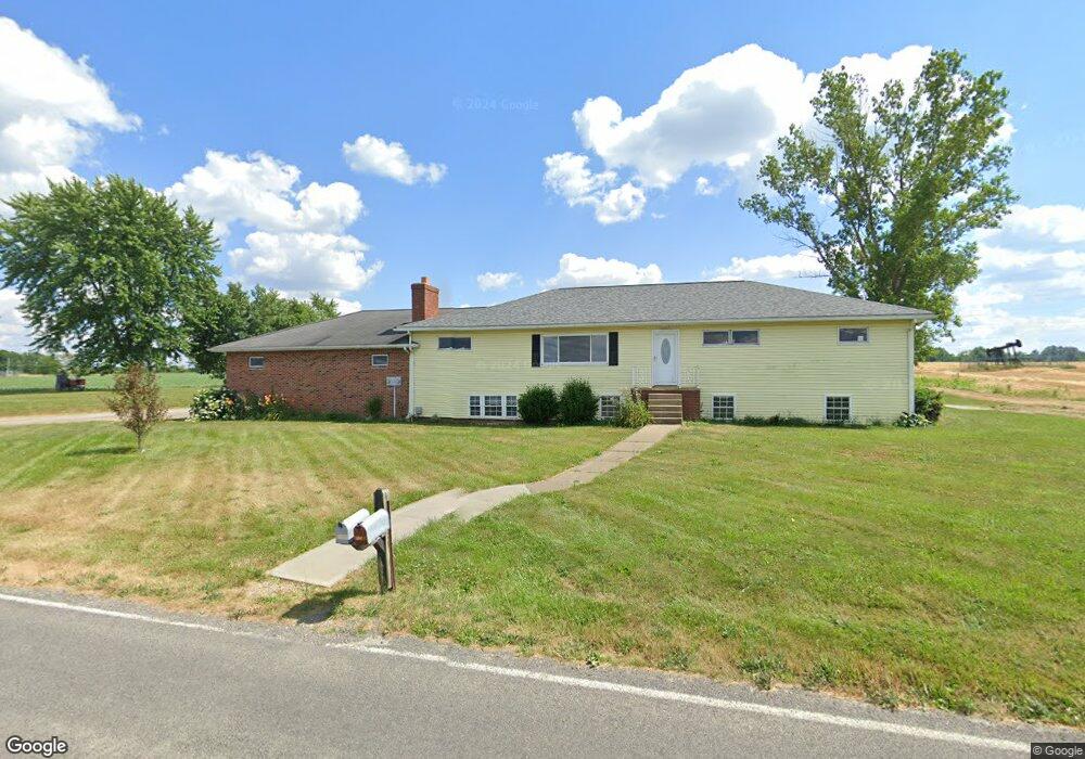
10418 Beeson St NE Alliance, OH 44601
Estimated Value: $204,000 - $387,000
6
Beds
2
Baths
1,984
Sq Ft
$142/Sq Ft
Est. Value
About This Home
This home is located at 10418 Beeson St NE, Alliance, OH 44601 and is currently estimated at $282,208, approximately $142 per square foot. 10418 Beeson St NE is a home located in Stark County with nearby schools including Marlington High School and Regina Coeli/St Joseph School.
Ownership History
Date
Name
Owned For
Owner Type
Purchase Details
Closed on
Dec 21, 1995
Sold by
Bishop Timothy M
Bought by
Hagan John P and Hagan Tina
Current Estimated Value
Home Financials for this Owner
Home Financials are based on the most recent Mortgage that was taken out on this home.
Original Mortgage
$49,000
Interest Rate
7.43%
Mortgage Type
New Conventional
Create a Home Valuation Report for This Property
The Home Valuation Report is an in-depth analysis detailing your home's value as well as a comparison with similar homes in the area
Home Values in the Area
Average Home Value in this Area
Purchase History
| Date | Buyer | Sale Price | Title Company |
|---|---|---|---|
| Hagan John P | $70,000 | -- |
Source: Public Records
Mortgage History
| Date | Status | Borrower | Loan Amount |
|---|---|---|---|
| Closed | Hagan John P | $49,000 |
Source: Public Records
Tax History Compared to Growth
Tax History
| Year | Tax Paid | Tax Assessment Tax Assessment Total Assessment is a certain percentage of the fair market value that is determined by local assessors to be the total taxable value of land and additions on the property. | Land | Improvement |
|---|---|---|---|---|
| 2025 | -- | $78,200 | $16,840 | $61,360 |
| 2024 | -- | $78,200 | $16,840 | $61,360 |
| 2023 | $2,719 | $72,350 | $12,810 | $59,540 |
| 2022 | $2,729 | $72,350 | $12,810 | $59,540 |
| 2021 | $2,738 | $72,350 | $12,810 | $59,540 |
| 2020 | $2,455 | $59,330 | $10,780 | $48,550 |
| 2019 | $2,440 | $59,330 | $10,780 | $48,550 |
| 2018 | $2,332 | $59,330 | $10,780 | $48,550 |
| 2017 | $1,898 | $44,700 | $9,380 | $35,320 |
| 2016 | $1,900 | $44,700 | $9,380 | $35,320 |
| 2015 | $1,903 | $44,700 | $9,380 | $35,320 |
| 2014 | $1,794 | $38,930 | $8,160 | $30,770 |
| 2013 | $878 | $38,930 | $8,160 | $30,770 |
Source: Public Records
Map
Nearby Homes
- 0 Reeder Ave NE
- 10666 Wilma Ave NE
- 12355 Edison St NE
- 11960 Freshley Ave NE
- 12415 Snode St NE
- 13334 Cindy St NE
- 0 Meadow St NE
- 2377 Ansley St Unit 2377
- 13109 Edison St NE
- 1430 Westwood Ave
- 2851 Patriots Path Unit 3D
- 2081 Marwood Cir
- 2435 Queensbury Rd
- 11480 Aebi Ave NE
- 0 W Main St Unit 5090123
- 0 Valewood Cir Unit 5006281
- 7844 Morningstar Dr
- 0 Easton St NE
- 000 Klinger Ave
- 1201 Overlook Dr
- 10371 Beeson St NE
- 10465 Beeson St NE
- 10583 Beeson St NE
- 10514 Columbus Rd
- 10353 Reeder Ave
- 10684 Beeson St NE
- 10455 Columbus Rd
- 10725 Reeder Ave NE
- 10440 Columbus Rd NE
- 10440 Columbus Rd NE
- 10751 Reeder Ave NE
- 10304 Reeder Ave
- 10211 Reeder Ave
- 10680 Reeder Ave NE
- 10070 Beeson St NE
- 10375 Columbus Rd NE
- 10071 Beeson St NE
- 10752 Beeson St NE
- 10795 Reeder Ave NE
- 10199 Reeder Ave