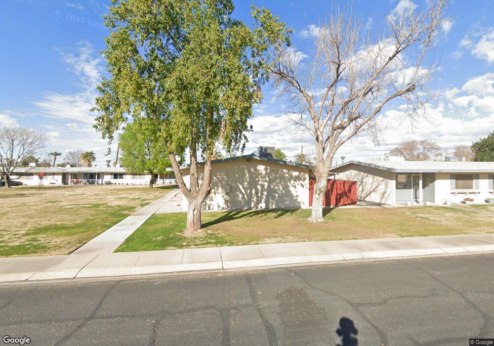
10418 W Deanne Dr Unit 19 Sun City, AZ 85351
Estimated Value: $138,982 - $187,000
--
Bed
1
Bath
708
Sq Ft
$220/Sq Ft
Est. Value
About This Home
This home is located at 10418 W Deanne Dr Unit 19, Sun City, AZ 85351 and is currently estimated at $155,746, approximately $219 per square foot. 10418 W Deanne Dr Unit 19 is a home located in Maricopa County with nearby schools including Desert Mirage Elementary School, Ombudsman - Northwest Charter, and Peoria Accelerated High School.
Ownership History
Date
Name
Owned For
Owner Type
Purchase Details
Closed on
Apr 26, 2016
Sold by
Diane L Slater Revocable Living Trust
Bought by
Cathey Elizabeth L
Current Estimated Value
Home Financials for this Owner
Home Financials are based on the most recent Mortgage that was taken out on this home.
Original Mortgage
$94,575
Outstanding Balance
$75,116
Interest Rate
3.59%
Estimated Equity
$80,630
Purchase Details
Closed on
Jan 21, 1998
Sold by
Parsons Thomas A and Parsons Myrtle G
Bought by
Jones Joseph R
Home Financials for this Owner
Home Financials are based on the most recent Mortgage that was taken out on this home.
Original Mortgage
$41,850
Interest Rate
6.97%
Mortgage Type
New Conventional
Create a Home Valuation Report for This Property
The Home Valuation Report is an in-depth analysis detailing your home's value as well as a comparison with similar homes in the area
Home Values in the Area
Average Home Value in this Area
Purchase History
| Date | Buyer | Sale Price | Title Company |
|---|---|---|---|
| Cathey Elizabeth L | $111,300 | -- | |
| Jones Joseph R | $46,500 | Ati Title Agency |
Source: Public Records
Mortgage History
| Date | Status | Borrower | Loan Amount |
|---|---|---|---|
| Open | Cathey Elizabeth L | $94,575 | |
| Closed | Cathey Elizabeth L | -- | |
| Previous Owner | Jones Joseph R | $41,850 |
Source: Public Records
Tax History Compared to Growth
Tax History
| Year | Tax Paid | Tax Assessment Tax Assessment Total Assessment is a certain percentage of the fair market value that is determined by local assessors to be the total taxable value of land and additions on the property. | Land | Improvement |
|---|---|---|---|---|
| 2025 | $343 | $3,877 | -- | -- |
| 2024 | $312 | $3,692 | -- | -- |
| 2023 | $312 | $10,470 | $2,090 | $8,380 |
| 2022 | $264 | $8,420 | $1,680 | $6,740 |
| 2021 | $272 | $7,660 | $1,530 | $6,130 |
| 2020 | $265 | $6,230 | $1,240 | $4,990 |
| 2019 | $263 | $5,350 | $1,070 | $4,280 |
| 2018 | $254 | $4,730 | $940 | $3,790 |
| 2017 | $245 | $3,830 | $760 | $3,070 |
| 2016 | $129 | $2,950 | $590 | $2,360 |
| 2015 | $219 | $2,380 | $470 | $1,910 |
Source: Public Records
Map
Nearby Homes
- 10417 W Deanne Dr Unit 5
- 10426 W Deanne Dr Unit 15
- 10414 W Audrey Dr
- 10410 W Audrey Dr Unit 8
- 10404 W Audrey Dr
- 10323 W Deanne Dr
- 10318 W Corte Del Sol Este Unit 21
- 10236 N 105th Dr Unit 8
- 10345 W Peoria Ave Unit 5
- 10222 N 105th Dr Unit 5
- 10202 N 105th Dr Unit 1
- 10341 W Clair Dr
- 10314 W Deanne Dr
- 10510 W Camden Ave
- 10516 W Peoria Ave
- 10522 W Camden Ave Unit 6
- 10535 W Clair Dr
- 10821 N Fairway Ct E
- 10613 W Clair Dr
- 10351 W Pinehurst Dr
- 10420 W Deanne Dr Unit 18
- 10416 W Deanne Dr
- 10416 W Deanne Dr Unit 20
- 10422 W Deanne Dr
- 10414 W Deanne Dr Unit 21
- 10412 W Deanne Dr
- 10408 W Deanne Dr
- 10424 W Deanne Dr
- 10410 W Deanne Dr
- 10406 W Deanne Dr
- 10404 W Deanne Dr Unit 26
- 10428 W Deanne Dr
- 10402 W Deanne Dr
- 10430 W Deanne Dr Unit 13
- 10438 W Deanne Dr Unit 9
- 10436 W Deanne Dr
- 10440 W Deanne Dr
- 10434 W Deanne Dr Unit 5
- 10434 W Deanne Dr Unit 26
- 10434 W Deanne Dr