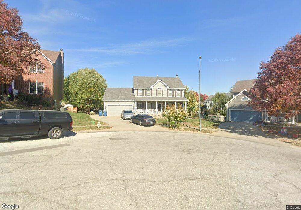
1042 Fox Run Terrace Liberty, MO 64068
Estimated Value: $384,348 - $414,000
4
Beds
3
Baths
1,132
Sq Ft
$351/Sq Ft
Est. Value
About This Home
This home is located at 1042 Fox Run Terrace, Liberty, MO 64068 and is currently estimated at $397,837, approximately $351 per square foot. 1042 Fox Run Terrace is a home located in Clay County with nearby schools including Manor Hill Elementary School, Liberty Middle School, and Liberty High School.
Ownership History
Date
Name
Owned For
Owner Type
Purchase Details
Closed on
Jan 12, 2020
Sold by
Croce Nunzio and Croce Jomarie
Bought by
Croce Nunzio
Current Estimated Value
Home Financials for this Owner
Home Financials are based on the most recent Mortgage that was taken out on this home.
Original Mortgage
$200,000
Outstanding Balance
$177,149
Interest Rate
3.73%
Mortgage Type
New Conventional
Estimated Equity
$220,688
Purchase Details
Closed on
Sep 24, 2002
Sold by
Mcbride & Son Homes Kansas City Llc
Bought by
Croce Nunzio and Croce Jomarie
Home Financials for this Owner
Home Financials are based on the most recent Mortgage that was taken out on this home.
Original Mortgage
$164,599
Interest Rate
6.21%
Create a Home Valuation Report for This Property
The Home Valuation Report is an in-depth analysis detailing your home's value as well as a comparison with similar homes in the area
Home Values in the Area
Average Home Value in this Area
Purchase History
| Date | Buyer | Sale Price | Title Company |
|---|---|---|---|
| Croce Nunzio | -- | None Available | |
| Croce Nunzio | -- | Stewart Title |
Source: Public Records
Mortgage History
| Date | Status | Borrower | Loan Amount |
|---|---|---|---|
| Open | Croce Nunzio | $200,000 | |
| Closed | Croce Nunzio | $164,599 |
Source: Public Records
Tax History Compared to Growth
Tax History
| Year | Tax Paid | Tax Assessment Tax Assessment Total Assessment is a certain percentage of the fair market value that is determined by local assessors to be the total taxable value of land and additions on the property. | Land | Improvement |
|---|---|---|---|---|
| 2025 | $4,252 | $62,510 | -- | -- |
| 2024 | $4,252 | $55,290 | -- | -- |
| 2023 | $4,324 | $55,290 | $0 | $0 |
| 2022 | $3,892 | $49,130 | $0 | $0 |
| 2021 | $3,861 | $49,134 | $7,600 | $41,534 |
| 2020 | $3,857 | $46,080 | $0 | $0 |
| 2019 | $3,856 | $46,075 | $7,600 | $38,475 |
| 2018 | $3,584 | $42,050 | $0 | $0 |
| 2017 | $3,426 | $42,050 | $5,700 | $36,350 |
| 2016 | $3,426 | $40,560 | $5,700 | $34,860 |
| 2015 | $3,426 | $40,560 | $5,700 | $34,860 |
| 2014 | $3,276 | $38,490 | $5,320 | $33,170 |
Source: Public Records
Map
Nearby Homes
- 1588 Columbine Ct
- 1505 Glen Brook Ln
- 1030 Maple Woods Dr
- 977 Wellington Way
- 753 Todd Ct
- McKinley Plan at Homestead of Liberty - Homestead
- Monroe Plan at Homestead of Liberty - Homestead
- Chestnut Plan at Homestead of Liberty - Homestead
- The Brooklyn Plan at Homestead of Liberty - Homestead
- Cypress Plan at Homestead of Liberty - Homestead
- The Linden Plan at Homestead of Liberty - Homestead
- Spruce Plan at Homestead of Liberty - Homestead
- Ashton Plan at Homestead of Liberty - Homestead
- Meg Plan at Homestead of Liberty - Homestead
- The Hillsdale Plan at Homestead of Liberty - Homestead
- The Maple Plan at Homestead of Liberty - Homestead
- Redbud Plan at Homestead of Liberty - Homestead
- Hawthorn II Plan at Homestead of Liberty - Homestead
- The Sycamore Plan at Homestead of Liberty - Homestead
- 507 Vivian St
- 1038 Fox Run Terrace
- 1046 Fox Run Terrace
- 1539 Ashton Dr
- 1535 Ashton Dr
- 1037 Ashton Terrace
- 1543 Ashton Dr
- 1033 Ashton Terrace
- 1531 Ashton Dr
- 1050 Fox Run Terrace
- 1037 Fox Run Terrace
- 1547 Ashton Dr
- 1029 Ashton Terrace
- 1045 Fox Run Terrace
- 1041 Fox Run Terrace
- 1049 Fox Run Terrace
- 1023 Ashton Terrace
- 1538 Ashton Dr
- 1528 Glen Brook Ln
- 1534 Ashton Dr
- 1542 Ashton Dr