Estimated Value: $193,382 - $245,000
3
Beds
2
Baths
1,108
Sq Ft
$199/Sq Ft
Est. Value
About This Home
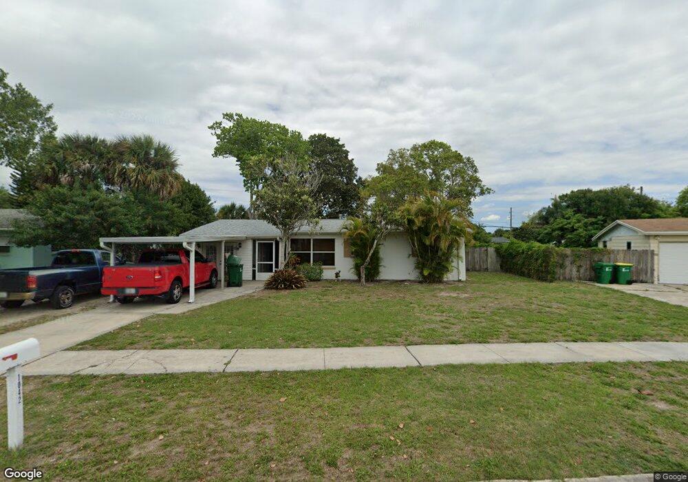
This home is located at 1042 Illinois Rd, Cocoa, FL 32927 and is currently estimated at $220,346, approximately $198 per square foot. 1042 Illinois Rd is a home located in Brevard County with nearby schools including Atlantis Elementary School, Space Coast Junior/Senior High School, and East Atlantic Prep of Brevard County.
Ownership History
Date
Name
Owned For
Owner Type
Purchase Details
Closed on
Oct 3, 1995
Sold by
Berry Oliver M and Berry Erika
Bought by
Poe Cherrie L
Current Estimated Value
Home Financials for this Owner
Home Financials are based on the most recent Mortgage that was taken out on this home.
Original Mortgage
$41,500
Outstanding Balance
$298
Interest Rate
7.83%
Estimated Equity
$220,048
Create a Home Valuation Report for This Property
The Home Valuation Report is an in-depth analysis detailing your home's value as well as a comparison with similar homes in the area
Home Values in the Area
Average Home Value in this Area
Purchase History
| Date | Buyer | Sale Price | Title Company |
|---|---|---|---|
| Poe Cherrie L | $42,000 | -- |
Source: Public Records
Mortgage History
| Date | Status | Borrower | Loan Amount |
|---|---|---|---|
| Open | Poe Cherrie L | $41,500 |
Source: Public Records
Tax History Compared to Growth
Tax History
| Year | Tax Paid | Tax Assessment Tax Assessment Total Assessment is a certain percentage of the fair market value that is determined by local assessors to be the total taxable value of land and additions on the property. | Land | Improvement |
|---|---|---|---|---|
| 2025 | $711 | $40,940 | -- | -- |
| 2024 | $728 | $39,790 | -- | -- |
| 2023 | $728 | $38,640 | $0 | $0 |
| 2022 | $692 | $37,520 | $0 | $0 |
| 2021 | $672 | $36,430 | $0 | $0 |
| 2020 | $619 | $35,930 | $0 | $0 |
| 2019 | $555 | $35,130 | $0 | $0 |
| 2018 | $545 | $34,480 | $0 | $0 |
| 2017 | $529 | $33,780 | $0 | $0 |
| 2016 | $518 | $33,090 | $18,000 | $15,090 |
| 2015 | $508 | $32,860 | $15,000 | $17,860 |
| 2014 | $506 | $32,600 | $11,000 | $21,600 |
Source: Public Records
Map
Nearby Homes
- 1029 Illinois Rd
- 361 Payne Ave
- 1010 Illinois Rd
- 1008 Jersey St
- 453 Camel Cir
- 977 Poinsetta St
- 973 Poinsetta St
- 7060 N Highway 1 Unit AA206
- 7060 N Highway 1 Unit Aa-201
- 7030 N Highway 1 Unit 101
- 7030 N Highway 1 Unit DD102
- 973 Kaufman St
- 7210 N Highway 1 Unit 102
- 7240 N Highway 1 Unit 106
- 7170 N Highway 1 Unit 103
- 1015 Hibiscus St
- 7000 N Highway 1 Unit 104
- 7000 N Highway 1 Unit Gg-205
- 7000 N Highway 1 Unit GG103
- 7020 U S 1 Unit Ee-202
- 1038 Illinois Rd
- 1046 Illinois Rd
- 1049 Poinsetta St
- 1034 Illinois Rd
- 1061 Poinsetta St
- 1041 Illinois Rd
- 1037 Illinois Rd
- 1025 Poinsetta St
- 1048 Illinois Rd
- 1033 Illinois Rd
- 1030 Illinois Rd
- 660 Ponce de Leon Ave
- 1013 Poinsetta St
- 1050 Illinois Rd
- 1044 Jersey St
- 656 Ponce de Leon Ave
- 1040 Jersey St
- 668 Ponce de Leon Ave
- 1036 Jersey St
- 1026 Illinois Rd