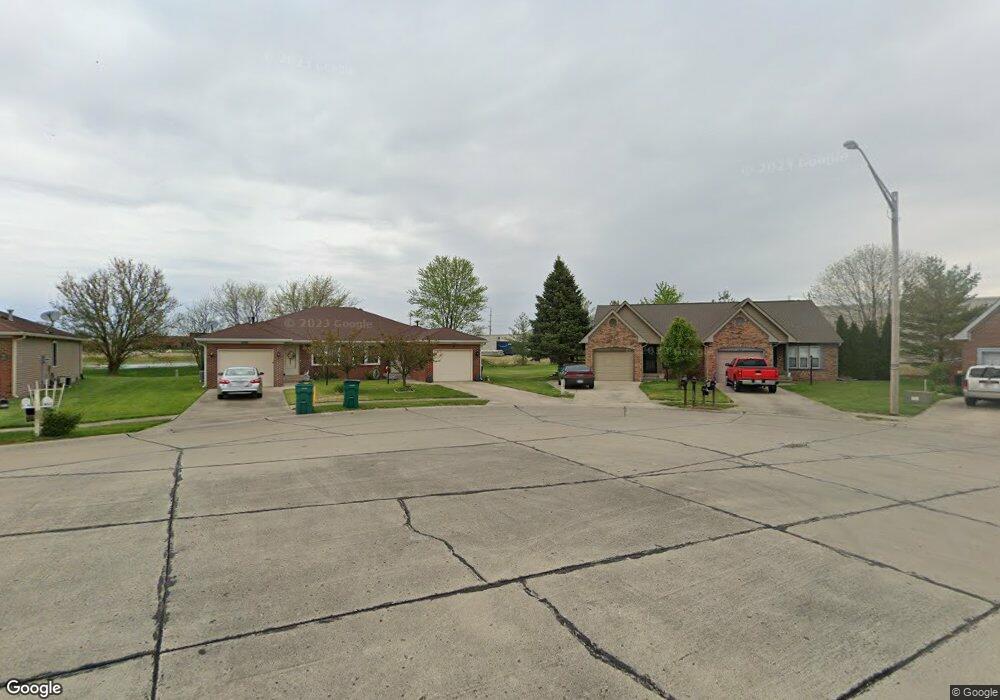
1042 Mustang Ct Franklin, IN 46131
Estimated Value: $255,000 - $304,883
3
Beds
1
Bath
2,080
Sq Ft
$133/Sq Ft
Est. Value
About This Home
This home is located at 1042 Mustang Ct, Franklin, IN 46131 and is currently estimated at $275,721, approximately $132 per square foot. 1042 Mustang Ct is a home located in Johnson County with nearby schools including Northwood Elementary School, Franklin Community Middle School, and Custer Baker Intermediate School.
Ownership History
Date
Name
Owned For
Owner Type
Purchase Details
Closed on
Apr 12, 2024
Sold by
Greenwalt Paula K
Bought by
Burkett Property Mgmt Llc
Current Estimated Value
Home Financials for this Owner
Home Financials are based on the most recent Mortgage that was taken out on this home.
Original Mortgage
$196,000
Outstanding Balance
$193,071
Interest Rate
6.88%
Mortgage Type
Credit Line Revolving
Estimated Equity
$82,650
Purchase Details
Closed on
Sep 30, 2022
Sold by
Greenwalt Paula K
Bought by
Burkett Property Management Llc
Create a Home Valuation Report for This Property
The Home Valuation Report is an in-depth analysis detailing your home's value as well as a comparison with similar homes in the area
Home Values in the Area
Average Home Value in this Area
Purchase History
| Date | Buyer | Sale Price | Title Company |
|---|---|---|---|
| Burkett Property Mgmt Llc | -- | None Listed On Document | |
| Burkett Property Management Llc | $245,000 | None Listed On Document |
Source: Public Records
Mortgage History
| Date | Status | Borrower | Loan Amount |
|---|---|---|---|
| Open | Burkett Property Mgmt Llc | $196,000 |
Source: Public Records
Tax History Compared to Growth
Tax History
| Year | Tax Paid | Tax Assessment Tax Assessment Total Assessment is a certain percentage of the fair market value that is determined by local assessors to be the total taxable value of land and additions on the property. | Land | Improvement |
|---|---|---|---|---|
| 2025 | $4,667 | $282,900 | $16,000 | $266,900 |
| 2024 | $4,667 | $290,100 | $32,000 | $258,100 |
| 2023 | $4,061 | $252,800 | $32,000 | $220,800 |
| 2022 | $3,683 | $229,500 | $32,000 | $197,500 |
| 2021 | $2,763 | $170,600 | $13,200 | $157,400 |
| 2020 | $2,762 | $170,600 | $13,200 | $157,400 |
| 2019 | $2,833 | $174,800 | $13,200 | $161,600 |
| 2018 | $2,206 | $165,900 | $13,200 | $152,700 |
| 2017 | $1,962 | $140,900 | $13,200 | $127,700 |
| 2016 | $1,685 | $140,900 | $13,200 | $127,700 |
| 2014 | $1,816 | $132,800 | $19,800 | $113,000 |
| 2013 | $1,816 | $129,600 | $19,800 | $109,800 |
Source: Public Records
Map
Nearby Homes
- 1081 Country Meadow Ct
- 1115 Cobra Dr
- 1134 Spring Meadow Ct
- 1181 Harvest Ridge Cir
- 2087 Mach Ln
- 1804 Acorn Rd
- 1942 Turning Leaf Dr
- 1195 S Aberdeen Dr
- 1151 N Aberdeen Dr
- 315 Schoolhouse Rd
- 2638 Fielding Ct
- 1624 Roberts Rd
- 1278 Northcraft Ct
- 1213 Greenbriar Way
- 1664 Woodside Cir
- 1338 Swan Dr
- 1283 Crabapple Rd
- 1450 Roberts Rd
- 1618 Woodside Cir
- 2855 Fieldstone Ct
- 1042 Mustang Ct
- 1046 Mustang Ct
- 1038 Mustang Ct
- 1034 Mustang Ct
- 1050 Mustang - 1054 Ct
- 1050 Mustang Ct
- 1054 Mustang Ct
- 1054 Mustang Ct
- 1033 Mustang Ct
- 1041 Mustang Ct
- 1037 Mustang Ct
- 1045 Mustang Ct
- 2159 Galaxy Dr Unit 2163
- 1053 Mustang Ct
- 2169 Galaxy Dr Unit 2173
- 2147 Galaxy - 2141 Dr
- 2147 Galaxy Dr
- 2147 Galaxy Dr
- 1049 Mustang Ct
- 2177 Galaxy Dr