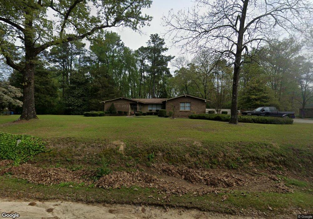
1042 Pughsley Rd Stapleton, GA 30823
Estimated Value: $155,144 - $245,000
Studio
2
Baths
2,057
Sq Ft
$101/Sq Ft
Est. Value
About This Home
This home is located at 1042 Pughsley Rd, Stapleton, GA 30823 and is currently estimated at $207,036, approximately $100 per square foot. 1042 Pughsley Rd is a home located in Jefferson County with nearby schools including Jefferson County High School.
Ownership History
Date
Name
Owned For
Owner Type
Purchase Details
Closed on
Jun 14, 2022
Sold by
Brown Charlie W
Bought by
Brown Roberta C
Current Estimated Value
Purchase Details
Closed on
Nov 21, 2007
Sold by
Boyd D Bruce
Bought by
Boyd Donald Bruce and Boyd Krista Charleen
Home Financials for this Owner
Home Financials are based on the most recent Mortgage that was taken out on this home.
Original Mortgage
$90,000
Interest Rate
6.29%
Mortgage Type
New Conventional
Purchase Details
Closed on
Nov 16, 2006
Sold by
Boyd D Bruce
Bought by
Boyd James T
Purchase Details
Closed on
Dec 29, 2005
Sold by
Boyd D Bruce
Bought by
Boyd Jenibel and Boyd James T
Create a Home Valuation Report for This Property
The Home Valuation Report is an in-depth analysis detailing your home's value as well as a comparison with similar homes in the area
Purchase History
| Date | Buyer | Sale Price | Title Company |
|---|---|---|---|
| Brown Roberta C | -- | -- | |
| Boyd Donald Bruce | -- | -- | |
| Boyd Donald Bruce | -- | -- | |
| Boyd Donald Bruce | -- | -- | |
| Boyd Donald Bruce | -- | -- | |
| Boyd James T | -- | -- | |
| Boyd Jenibel | -- | -- |
Source: Public Records
Mortgage History
| Date | Status | Borrower | Loan Amount |
|---|---|---|---|
| Previous Owner | Boyd Donald Bruce | $90,000 |
Source: Public Records
Tax History
| Year | Tax Paid | Tax Assessment Tax Assessment Total Assessment is a certain percentage of the fair market value that is determined by local assessors to be the total taxable value of land and additions on the property. | Land | Improvement |
|---|---|---|---|---|
| 2025 | $1,505 | $47,601 | $1,514 | $46,087 |
| 2024 | $1,369 | $45,023 | $1,316 | $43,707 |
| 2023 | $1,435 | $44,292 | $3,356 | $40,936 |
| 2022 | $1,281 | $39,688 | $3,356 | $36,332 |
| 2021 | $1,293 | $38,496 | $2,796 | $35,700 |
| 2020 | $1,325 | $39,356 | $2,796 | $36,560 |
| 2019 | $1,355 | $39,588 | $2,796 | $36,792 |
| 2018 | $1,374 | $39,505 | $2,658 | $36,847 |
| 2017 | $1,404 | $40,314 | $2,517 | $37,797 |
| 2016 | $1,286 | $40,404 | $2,658 | $37,746 |
| 2015 | -- | $40,480 | $2,796 | $37,684 |
| 2014 | -- | $41,806 | $2,796 | $39,010 |
| 2013 | -- | $42,133 | $2,796 | $39,336 |
Source: Public Records
Map
Nearby Homes
- 1167 Shaunee Ln
- 203 S Wrens Cir
- 0 Kings Mill Rd Unit 4 10547512
- 0 Kings Mill Rd Unit 6 10547516
- 0 Kings Mill Rd Unit 1 10547502
- 0 Kings Mill Rd Unit 5 10547515
- 0 Kings Mill Rd Unit 3 10547507
- 0 Kings Mill Rd
- 204 Hudson St
- 0 Hwy 80 and Old Stapleton Rd Unit 10622530
- 1041 Fairway Ridge Dr
- 0 Howard St Unit 548508
- 109 Matthews St
- 12546 US Highway 1 N
- 10199 Ga Highway 296
- 80 Georgia 80
- 102 Ellis St
- 1289 Brittany St
- 407 Russell St
- 0 Broad St
- 1088 Pughsley Rd
- 2194 Ga Highway 88 W
- 2549 Ga Highway 88 W
- 2553 Ga Highway 88 W
- 2624 Ga Highway 88 W
- 1170 Helen Ct
- 1059 Helen Ct
- 1105 Helen Ct
- 1235 Bonnie Ln
- 1078 Shelby Ln
- 1788 Pughsley Rd
- 1159 Kelli Ln
- 1084 Amelia Ln
- 1151 Amelia Ln
- 2827 Ga Highway 88 W
- 1100 Amelia Ln
- 1131 Kelli Ln
- 3143 Ga Highway 88 W
- 1276 Amelia Ln
- 1042 NW Kelli
Your Personal Tour Guide
Ask me questions while you tour the home.