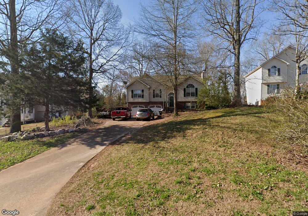
1042 Queensbury Run Unit 2 Acworth, GA 30102
Oak Grove NeighborhoodEstimated Value: $403,545 - $404,000
3
Beds
3
Baths
2,204
Sq Ft
$183/Sq Ft
Est. Value
About This Home
This home is located at 1042 Queensbury Run Unit 2, Acworth, GA 30102 and is currently estimated at $403,773, approximately $183 per square foot. 1042 Queensbury Run Unit 2 is a home located in Cherokee County with nearby schools including Oak Grove Elementary School, E. T. Booth Middle School, and Etowah High School.
Ownership History
Date
Name
Owned For
Owner Type
Purchase Details
Closed on
Mar 31, 1999
Sold by
Boling Chad L
Bought by
Douglas Scott J
Current Estimated Value
Home Financials for this Owner
Home Financials are based on the most recent Mortgage that was taken out on this home.
Original Mortgage
$148,046
Outstanding Balance
$35,282
Interest Rate
6.82%
Mortgage Type
New Conventional
Estimated Equity
$368,491
Purchase Details
Closed on
Aug 26, 1996
Sold by
Bobo Leasing
Bought by
Boling Chad L
Create a Home Valuation Report for This Property
The Home Valuation Report is an in-depth analysis detailing your home's value as well as a comparison with similar homes in the area
Home Values in the Area
Average Home Value in this Area
Purchase History
| Date | Buyer | Sale Price | Title Company |
|---|---|---|---|
| Douglas Scott J | $149,900 | -- | |
| Boling Chad L | $117,900 | -- |
Source: Public Records
Mortgage History
| Date | Status | Borrower | Loan Amount |
|---|---|---|---|
| Open | Douglas Scott J | $148,046 | |
| Closed | Boling Chad L | $0 |
Source: Public Records
Tax History Compared to Growth
Tax History
| Year | Tax Paid | Tax Assessment Tax Assessment Total Assessment is a certain percentage of the fair market value that is determined by local assessors to be the total taxable value of land and additions on the property. | Land | Improvement |
|---|---|---|---|---|
| 2025 | $3,594 | $155,524 | $32,000 | $123,524 |
| 2024 | $3,487 | $151,032 | $28,000 | $123,032 |
| 2023 | $3,090 | $152,820 | $28,000 | $124,820 |
| 2022 | $2,711 | $112,648 | $18,800 | $93,848 |
| 2021 | $2,577 | $97,200 | $18,800 | $78,400 |
| 2020 | $2,443 | $91,308 | $17,600 | $73,708 |
| 2019 | $2,324 | $86,200 | $17,600 | $68,600 |
| 2018 | $2,035 | $73,440 | $14,400 | $59,040 |
| 2017 | $2,024 | $181,300 | $14,400 | $58,120 |
| 2016 | $1,844 | $164,100 | $14,400 | $51,240 |
| 2015 | $1,881 | $165,700 | $14,400 | $51,880 |
| 2014 | $1,816 | $159,900 | $13,760 | $50,200 |
Source: Public Records
Map
Nearby Homes
- 307 Queensbury Walk
- 304 Queensbury Walk
- 756 Coventry Cove Way
- 752 Coventry Cove Way
- 341 Brighton Bend Ln
- 337 Brighton Bend Ln
- 222 Gallant Fox Way
- 6390 Woodstock Rd
- 302 Victory Commons Overlook
- 148 Sable Trace Trail
- 145 Winner St
- 585 Lee Dr
- The Fenton Plan at Buice Lake - Madison
- The Davis Plan at Buice Lake - Madison
- 1216 Marlo Way
- 3094 Cambridge Mill St
- 3070 Cambridge Mill St
- 849 York Aly
- 544 Aberdeen Meadow Ln
- 648 Devon Aly
- 1040 Queensbury Run Unit 2
- 1044 Queensbury Run
- 1046 Queensbury Run
- 305 Queensbury Walk
- 102 Sable Trace Trail
- 303 Queensbury Walk
- 301 Queensbury Walk Unit 1
- 1035 Queensbury Run Unit 1
- 1048 Queensbury Run Unit 2
- 1039 Queensbury Run Unit 2
- 106 Sable Trace Trail
- 104 Sable Trace Trail
- 1037 Queensbury Run
- 0 Queensbury Walk Unit 8881864
- 0 Queensbury Walk Unit 8905915
- 1041 Queensbury Run
- 100 Sable Trace Trail
- 108 Sable Trace Trail
- 1043 Queensbury Run Unit 2
- 300 Queensbury Walk
