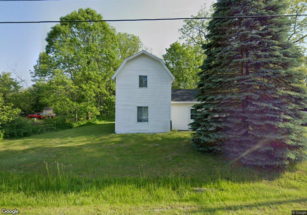
10422 W Mount Morris Rd Flushing, MI 48433
Estimated Value: $162,000 - $269,000
2
Beds
1
Bath
1,217
Sq Ft
$173/Sq Ft
Est. Value
About This Home
This home is located at 10422 W Mount Morris Rd, Flushing, MI 48433 and is currently estimated at $210,667, approximately $173 per square foot. 10422 W Mount Morris Rd is a home located in Genesee County with nearby schools including Elms Elementary School, Flushing Middle School, and Flushing High School.
Ownership History
Date
Name
Owned For
Owner Type
Purchase Details
Closed on
Nov 5, 2019
Sold by
Laponsey Kenneth D and Laponsey Rosalie K
Bought by
Lpaponsey Kenneth D and Lpaponsey Rosalie L
Current Estimated Value
Purchase Details
Closed on
Nov 2, 2011
Sold by
Most Clifford G
Bought by
The Bank Of New York Mellon and The Bank Of New York
Purchase Details
Closed on
Jan 30, 2001
Sold by
Clark Margaret and Long Ethel
Bought by
Most Clifford G
Create a Home Valuation Report for This Property
The Home Valuation Report is an in-depth analysis detailing your home's value as well as a comparison with similar homes in the area
Home Values in the Area
Average Home Value in this Area
Purchase History
| Date | Buyer | Sale Price | Title Company |
|---|---|---|---|
| Lpaponsey Kenneth D | -- | None Available | |
| The Bank Of New York Mellon | $136,341 | None Available | |
| Most Clifford G | $28,000 | Sargents Abstract & Title Co |
Source: Public Records
Tax History
| Year | Tax Paid | Tax Assessment Tax Assessment Total Assessment is a certain percentage of the fair market value that is determined by local assessors to be the total taxable value of land and additions on the property. | Land | Improvement |
|---|---|---|---|---|
| 2025 | $774 | $23,700 | $0 | $0 |
| 2024 | $562 | $22,100 | $0 | $0 |
| 2023 | $536 | $18,400 | $0 | $0 |
| 2022 | $701 | $16,500 | $0 | $0 |
| 2021 | $688 | $15,800 | $0 | $0 |
| 2020 | $489 | $15,200 | $0 | $0 |
| 2019 | $485 | $14,300 | $0 | $0 |
| 2018 | $769 | $12,600 | $0 | $0 |
| 2017 | $445 | $12,600 | $0 | $0 |
| 2016 | $726 | $12,300 | $0 | $0 |
| 2015 | $595 | $12,200 | $0 | $0 |
| 2014 | $435 | $11,900 | $0 | $0 |
| 2012 | -- | $25,400 | $25,400 | $0 |
Source: Public Records
Map
Nearby Homes
- 8073 Nichols Rd
- 11186 W Stanley Rd
- 271 Lovell Ct
- 32 Armstrong Ave Unit 32
- 255 Grissom Ct
- 8506 Duffield Rd
- 8522 Tim Tam Trail
- 9222 N Mckinley Rd
- 10045 Nichols Rd
- 6355 N Mckinley Rd
- 9207 N Island Ct Unit 12
- 0 N Island Dr Unit 20230029447
- 10149 Seymour Rd
- 9031 N Island Dr Unit 29
- 6058 N Mckinley Rd
- 12300 Dodge Rd
- Vacant Land Rd
- Vacant Land Rd
- Vacant Land Rd
- 8454 Wesley Dr
- 10430 Mt Morris Rd
- 10408 W Mount Morris Rd
- 10401 W Mount Morris Rd
- 10390 W Mount Morris Rd
- 10413 W Mount Morris Rd
- 8021 Dunham St
- 8027 Dunham St
- 10442 W Mount Morris Rd
- 8039 Dunham St
- 8022 Dunham St
- 10467 W Mount Morris Rd
- 10377 W Mount Morris Rd
- 8038 Dunham St
- 10480 W Mount Morris Rd
- 10481 W Mount Morris Rd
- 10350 W Mount Morris Rd
- 10486 W Mount Morris Rd
- 10344 W Mount Morris Rd
- 10500 W Mount Morris Rd
- 10497 W Mount Morris Rd
Your Personal Tour Guide
Ask me questions while you tour the home.