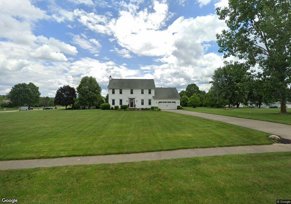
10423 Clear Brook Cir Wadsworth, OH 44281
Estimated Value: $412,348 - $498,000
4
Beds
3
Baths
2,416
Sq Ft
$193/Sq Ft
Est. Value
About This Home
This home is located at 10423 Clear Brook Cir, Wadsworth, OH 44281 and is currently estimated at $467,087, approximately $193 per square foot. 10423 Clear Brook Cir is a home located in Medina County with nearby schools including Franklin Elementary School, Central Intermediate School, and Wadsworth Middle School.
Ownership History
Date
Name
Owned For
Owner Type
Purchase Details
Closed on
Nov 14, 2002
Sold by
Draa Mark R
Bought by
Brady Steven E and Brady Adrienne E
Current Estimated Value
Home Financials for this Owner
Home Financials are based on the most recent Mortgage that was taken out on this home.
Original Mortgage
$190,825
Outstanding Balance
$80,398
Interest Rate
6.1%
Mortgage Type
New Conventional
Estimated Equity
$386,689
Purchase Details
Closed on
Apr 22, 1997
Sold by
Galehouse
Bought by
Draa Mark R and Draa Connie R
Home Financials for this Owner
Home Financials are based on the most recent Mortgage that was taken out on this home.
Original Mortgage
$145,000
Interest Rate
8.24%
Mortgage Type
Construction
Create a Home Valuation Report for This Property
The Home Valuation Report is an in-depth analysis detailing your home's value as well as a comparison with similar homes in the area
Home Values in the Area
Average Home Value in this Area
Purchase History
| Date | Buyer | Sale Price | Title Company |
|---|---|---|---|
| Brady Steven E | $224,500 | -- | |
| Draa Mark R | $29,000 | Buckeye Reserve Title Agency |
Source: Public Records
Mortgage History
| Date | Status | Borrower | Loan Amount |
|---|---|---|---|
| Open | Brady Steven E | $190,825 | |
| Previous Owner | Draa Mark R | $145,000 |
Source: Public Records
Tax History Compared to Growth
Tax History
| Year | Tax Paid | Tax Assessment Tax Assessment Total Assessment is a certain percentage of the fair market value that is determined by local assessors to be the total taxable value of land and additions on the property. | Land | Improvement |
|---|---|---|---|---|
| 2024 | $4,447 | $100,910 | $29,400 | $71,510 |
| 2023 | $4,447 | $100,910 | $29,400 | $71,510 |
| 2022 | $4,444 | $100,910 | $29,400 | $71,510 |
| 2021 | $4,422 | $84,090 | $24,500 | $59,590 |
| 2020 | $4,027 | $84,090 | $24,500 | $59,590 |
| 2019 | $4,034 | $84,090 | $24,500 | $59,590 |
| 2018 | $3,715 | $72,580 | $22,470 | $50,110 |
| 2017 | $3,717 | $72,580 | $22,470 | $50,110 |
| 2016 | $3,790 | $72,580 | $22,470 | $50,110 |
| 2015 | $3,715 | $67,830 | $21,000 | $46,830 |
| 2014 | $3,515 | $67,830 | $21,000 | $46,830 |
| 2013 | $3,518 | $67,830 | $21,000 | $46,830 |
Source: Public Records
Map
Nearby Homes
- 970 Eastern Rd
- 243 Chelley Ln
- 1014 Marissa Dr
- 1008 Barn Swallow Cir
- Amberwood Plan at Mount Eaton Estates - Mount Eaton Estates
- Newberry Plan at Mount Eaton Estates - Mount Eaton Estates
- Ascend Plan at Mount Eaton Estates - Mount Eaton Estates
- Aspire Plan at Mount Eaton Estates - Mount Eaton Estates
- Fairview Plan at Mount Eaton Estates - Mount Eaton Estates
- Mercer Plan at Mount Eaton Estates - Mount Eaton Estates
- Continental Plan at Mount Eaton Estates - Mount Eaton Estates
- Boardwalk Plan at Mount Eaton Estates - Mount Eaton Estates
- 220 Country Meadow Ln
- 10091 Dale Dr
- 877 Chardoney Dr
- 195 Johnson Rd
- 678 Wall Rd
- 15500 Freedom Dr
- 9900 Homestead Rd
- 595 Jessica Ln
- 10397 Golden Ridge Dr
- 10414 Clear Brook Cir
- 10389 Golden Ridge Dr
- 10402 Clear Brook Cir
- 10430 Clear Brook Cir
- 10369 Clear Brook Cir
- 1319 Eastern Rd
- 1349 Eastern Rd
- 10390 Clear Brook Cir
- 10387 Golden Ridge Dr
- 10388 Golden Ridge Dr
- 1305 Eastern Rd
- 1295 Eastern Rd
- 10384 Golden Ridge Dr
- 1285 Eastern Rd
- 10370 Clear Brook Cir
- 10383 Golden Ridge Dr
- 10367 Clear Brook Cir
- 1275 Eastern Rd
- 10382 Golden Ridge Dr