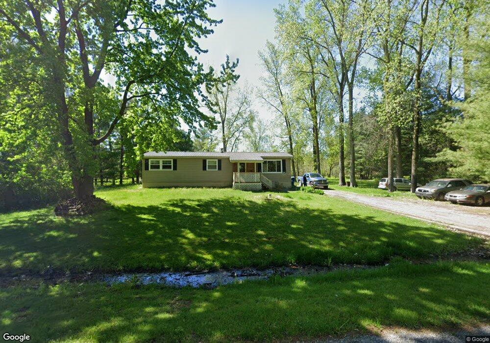
10425 Harris Rd Chesaning, MI 48616
Estimated Value: $68,648 - $176,000
3
Beds
1
Bath
1,104
Sq Ft
$112/Sq Ft
Est. Value
About This Home
This home is located at 10425 Harris Rd, Chesaning, MI 48616 and is currently estimated at $123,162, approximately $111 per square foot. 10425 Harris Rd is a home located in Saginaw County with nearby schools including Big Rock Elementary School, Chesaning Middle School, and Chesaning Union High School.
Ownership History
Date
Name
Owned For
Owner Type
Purchase Details
Closed on
Jul 16, 2021
Sold by
Braeutigan Randy L and Braeutigan Patricia A
Bought by
Martin Shamae
Current Estimated Value
Purchase Details
Closed on
May 27, 2009
Sold by
Community State Bank
Bought by
Kumar Abhinav
Purchase Details
Closed on
Feb 8, 2008
Sold by
Mccormick Roselle A
Bought by
Community State Bank
Purchase Details
Closed on
Feb 21, 1996
Sold by
Ly Tou and May Vang
Bought by
Mccormick Roselle A
Home Financials for this Owner
Home Financials are based on the most recent Mortgage that was taken out on this home.
Original Mortgage
$39,000
Interest Rate
7.07%
Create a Home Valuation Report for This Property
The Home Valuation Report is an in-depth analysis detailing your home's value as well as a comparison with similar homes in the area
Home Values in the Area
Average Home Value in this Area
Purchase History
| Date | Buyer | Sale Price | Title Company |
|---|---|---|---|
| Martin Shamae | $50,000 | Area Title Agency | |
| Kumar Abhinav | $34,000 | -- | |
| Community State Bank | $64,500 | -- | |
| Mccormick Roselle A | -- | -- | |
| Mccormic Roselle A | -- | -- |
Source: Public Records
Mortgage History
| Date | Status | Borrower | Loan Amount |
|---|---|---|---|
| Previous Owner | Mccormic Roselle A | $39,000 |
Source: Public Records
Tax History Compared to Growth
Tax History
| Year | Tax Paid | Tax Assessment Tax Assessment Total Assessment is a certain percentage of the fair market value that is determined by local assessors to be the total taxable value of land and additions on the property. | Land | Improvement |
|---|---|---|---|---|
| 2025 | $1,403 | $41,400 | $0 | $0 |
| 2024 | $397 | $38,900 | $0 | $0 |
| 2023 | $379 | $35,200 | $0 | $0 |
| 2022 | $1,255 | $32,900 | $0 | $0 |
| 2021 | $1,004 | $29,700 | $0 | $0 |
| 2020 | $1,044 | $28,500 | $0 | $0 |
| 2019 | $1,418 | $28,000 | $5,900 | $22,100 |
| 2018 | $280 | $26,000 | $0 | $0 |
| 2017 | $1,303 | $26,200 | $0 | $0 |
| 2016 | $1,438 | $38,600 | $0 | $0 |
| 2014 | -- | $31,400 | $0 | $0 |
| 2013 | -- | $31,400 | $0 | $0 |
Source: Public Records
Map
Nearby Homes
- 14600 Corunna Rd
- 0 Arrowhead 1-A Dr Unit 50184284
- 0 Arrowhead 1-A Dr Unit 50184274
- 1017 N Line St
- 887 N 4th St
- 0 N 4th St
- 0 N 1st St
- 300 Brady St
- V/L W Liberty St
- 829 Brady St
- V/L #4 Brookshire Dr
- V/L #5 Brookshire Dr
- 910 W Brady Rd
- 202 S Clark St
- 128 Pearl St
- 317 S Clark St
- 119 Andres St
- 423 S Line St
- 631 Center St
- 705 E Liberty St
- 10415 Harris Rd
- 14580 Sharon Rd
- 10475 Harris Rd
- 10450 Harris Rd
- 10504 Harris Rd
- 14582 Sharon Rd
- 10511 Harris Rd
- 14585 Sharon Rd
- 10512 Harris Rd
- 10512 Harris Rd
- 14584 Sharon Rd
- 10530 Harris Rd
- 14403 Sharon Rd
- 10540 Harris Rd
- 10700 Harris Rd
- 14777 Sharon Rd
- 10709 Harris Rd
- 10730 Harris Rd
- 14799 Sharon Rd
- 14000 Corunna Rd