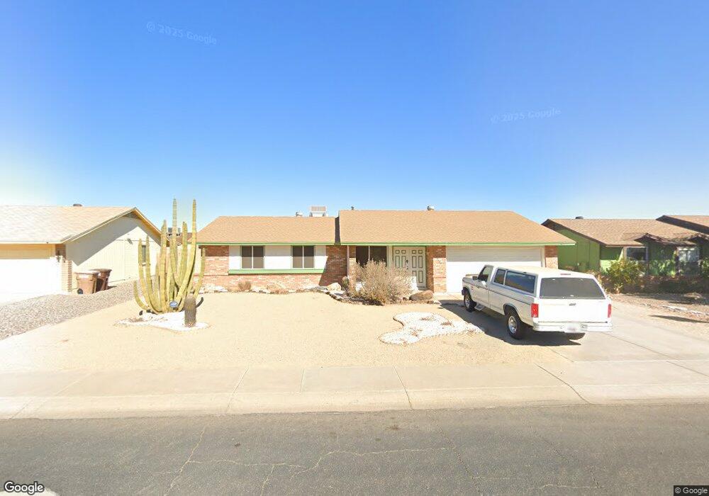
10426 W Diana Ave Peoria, AZ 85345
Estimated Value: $285,821 - $354,000
--
Bed
2
Baths
1,243
Sq Ft
$266/Sq Ft
Est. Value
About This Home
This home is located at 10426 W Diana Ave, Peoria, AZ 85345 and is currently estimated at $330,705, approximately $266 per square foot. 10426 W Diana Ave is a home located in Maricopa County with nearby schools including Country Meadows Elementary School, Raymond S. Kellis, and Ombudsman - Northwest Charter.
Ownership History
Date
Name
Owned For
Owner Type
Purchase Details
Closed on
Jul 11, 2002
Sold by
Teal Jim L and Teal Jackie M
Bought by
Ranallo Larry
Current Estimated Value
Home Financials for this Owner
Home Financials are based on the most recent Mortgage that was taken out on this home.
Original Mortgage
$107,315
Outstanding Balance
$44,847
Interest Rate
6.51%
Mortgage Type
FHA
Estimated Equity
$285,858
Purchase Details
Closed on
May 4, 2001
Sold by
Fentzke Jean M
Bought by
Teal Jim L and Teal Jackie M
Create a Home Valuation Report for This Property
The Home Valuation Report is an in-depth analysis detailing your home's value as well as a comparison with similar homes in the area
Home Values in the Area
Average Home Value in this Area
Purchase History
| Date | Buyer | Sale Price | Title Company |
|---|---|---|---|
| Ranallo Larry | $109,000 | Security Title Agency | |
| Teal Jim L | $96,000 | Chicago Title Insurance Comp |
Source: Public Records
Mortgage History
| Date | Status | Borrower | Loan Amount |
|---|---|---|---|
| Open | Ranallo Larry | $107,315 |
Source: Public Records
Tax History Compared to Growth
Tax History
| Year | Tax Paid | Tax Assessment Tax Assessment Total Assessment is a certain percentage of the fair market value that is determined by local assessors to be the total taxable value of land and additions on the property. | Land | Improvement |
|---|---|---|---|---|
| 2025 | $785 | $10,084 | -- | -- |
| 2024 | $773 | $9,604 | -- | -- |
| 2023 | $773 | $25,320 | $5,060 | $20,260 |
| 2022 | $757 | $19,030 | $3,800 | $15,230 |
| 2021 | $811 | $17,060 | $3,410 | $13,650 |
| 2020 | $818 | $15,970 | $3,190 | $12,780 |
| 2019 | $792 | $14,450 | $2,890 | $11,560 |
| 2018 | $766 | $12,720 | $2,540 | $10,180 |
| 2017 | $766 | $11,160 | $2,230 | $8,930 |
| 2016 | $758 | $10,200 | $2,040 | $8,160 |
| 2015 | $707 | $9,360 | $1,870 | $7,490 |
Source: Public Records
Map
Nearby Homes
- 10512 W Ruth Ave
- 10512 W Butler Dr
- 8803 N 105th Dr
- 8435 N 104th Dr Unit 3
- 8828 N 102nd Ln
- 10603 W Ruth Ave
- 10625 W Alice Ave
- 10621 W Lawrence Ln
- 8601 N 103rd Ave Unit 72
- 8601 N 103rd Ave Unit 313
- 8601 N 103rd Ave Unit 166
- 10221 W Puget Ave
- 8301 N 103rd Ave Unit 177
- 8301 N 103rd Ave Unit 53
- 10448 W Caron Dr
- 10326 W Caron Dr
- 8800 N 107th Ave Unit 17
- 8800 N 107th Ave Unit 19
- 10201 W Caron Dr
- 10516 W Griswold Rd
- 10422 W Diana Ave
- 10432 W Diana Ave
- 10431 W Ruth Ave
- 10423 W Ruth Ave
- 10437 W Ruth Ave
- 10416 W Diana Ave
- 10436 W Diana Ave
- 10431 W Diana Ave
- 10417 W Ruth Ave
- 10423 W Diana Ave
- 10437 W Diana Ave
- 10439 W Ruth Ave
- 10410 W Diana Ave
- 10411 W Ruth Ave
- 10417 W Diana Ave
- 10442 W Diana Ave
- 10443 W Diana Ave
- 10443 W Ruth Ave
- 10432 W Orchid Ln
- 10438 W Orchid Ln