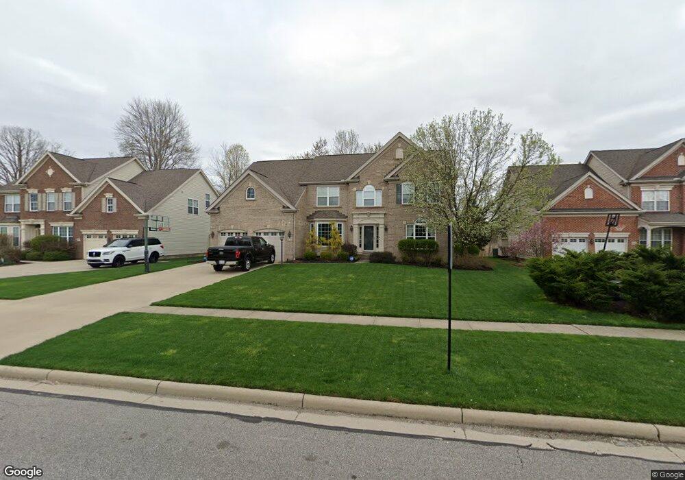
10429 Tolland Dr Aurora, OH 44202
Estimated Value: $523,587 - $566,000
4
Beds
3
Baths
3,059
Sq Ft
$180/Sq Ft
Est. Value
About This Home
This home is located at 10429 Tolland Dr, Aurora, OH 44202 and is currently estimated at $549,647, approximately $179 per square foot. 10429 Tolland Dr is a home located in Summit County with nearby schools including Wilcox Primary School, Samuel Bissell Elementary School, and Dodge Intermediate School.
Ownership History
Date
Name
Owned For
Owner Type
Purchase Details
Closed on
Apr 30, 2008
Sold by
The Drees Co
Bought by
Cummings Chad W and Cummings Julie D
Current Estimated Value
Home Financials for this Owner
Home Financials are based on the most recent Mortgage that was taken out on this home.
Original Mortgage
$282,000
Outstanding Balance
$179,056
Interest Rate
5.93%
Mortgage Type
Purchase Money Mortgage
Estimated Equity
$370,591
Purchase Details
Closed on
Sep 15, 2005
Sold by
Kimball Hill Homes Ohio Inc
Bought by
The Drees Co
Create a Home Valuation Report for This Property
The Home Valuation Report is an in-depth analysis detailing your home's value as well as a comparison with similar homes in the area
Home Values in the Area
Average Home Value in this Area
Purchase History
| Date | Buyer | Sale Price | Title Company |
|---|---|---|---|
| Cummings Chad W | $352,500 | First American Title Ins Co | |
| The Drees Co | $1,155,000 | -- |
Source: Public Records
Mortgage History
| Date | Status | Borrower | Loan Amount |
|---|---|---|---|
| Open | Cummings Chad W | $282,000 |
Source: Public Records
Tax History Compared to Growth
Tax History
| Year | Tax Paid | Tax Assessment Tax Assessment Total Assessment is a certain percentage of the fair market value that is determined by local assessors to be the total taxable value of land and additions on the property. | Land | Improvement |
|---|---|---|---|---|
| 2025 | $7,774 | $154,168 | $29,722 | $124,446 |
| 2024 | $7,774 | $154,168 | $29,722 | $124,446 |
| 2023 | $7,774 | $154,168 | $29,722 | $124,446 |
| 2022 | $6,918 | $123,337 | $23,779 | $99,558 |
| 2021 | $6,949 | $123,337 | $23,779 | $99,558 |
| 2020 | $7,033 | $123,340 | $23,780 | $99,560 |
| 2019 | $6,972 | $113,870 | $22,050 | $91,820 |
| 2018 | $6,844 | $113,870 | $22,050 | $91,820 |
| 2017 | $5,988 | $113,870 | $22,050 | $91,820 |
| 2016 | $5,934 | $105,520 | $22,050 | $83,470 |
| 2015 | $5,988 | $105,850 | $22,050 | $83,800 |
| 2014 | $5,972 | $105,850 | $22,050 | $83,800 |
| 2013 | $5,477 | $96,940 | $25,730 | $71,210 |
Source: Public Records
Map
Nearby Homes
- 3336 Blossom Trail
- 10265 Beaver Trail
- 3082 Willowbrook Dr
- 3331 Shale Dr
- 10358 Townley Ct
- 3209 Fenmore Ln
- 10269 Smugglers Cove
- 3522 Castaway Cove
- 3624 Nautilus Trail
- 3660 Ivy Ct
- 11239 Stanley Ln
- 3784 Firethorn Dr
- 10202 Brighton Cir Unit 9
- 2969 Country Club Ln Unit 14
- 9795 Burton Dr
- 3110 Blue Jaye Ln
- 9740 Burton Dr
- 10502 White Ash Trail
- 1174 Bryce Ave
- 2975 Waterford Dr Unit 5
- 10437 Tolland Dr
- 10445 Tolland Dr
- 10413 Tolland Dr
- 10413 Tolland Dr Unit 79
- 10430 Tolland Dr
- 10422 Tolland Dr
- 10414 Tolland Dr
- 10471 Tolland Dr
- 10462 Tolland Dr
- 10524 Crisfield Ct
- 10313 Meriden Ct
- 10321 Meriden Ct
- 10481 Tolland Dr
- 10329 Meriden Ct
- 24 Ledges Dr
- 27 Liberty Ledges Dr
- 3275 Glenbrook Dr
- 3275 Glenbrook Dr
- 10470 Tolland Dr
- 10516 Crisfield Ct