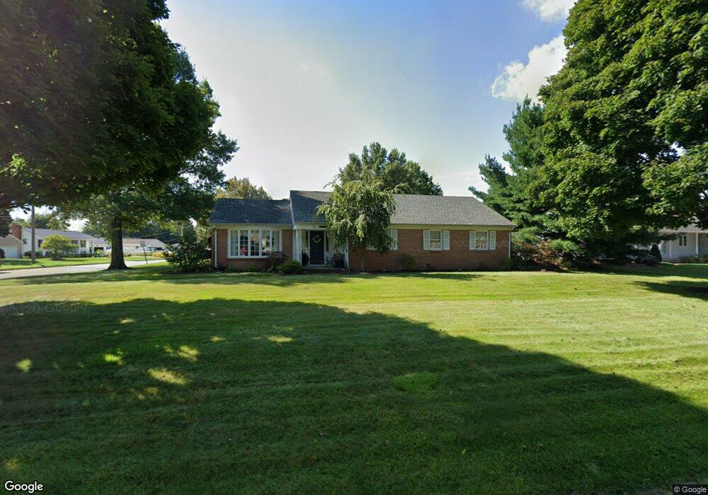
1043 Maumee Ave Mansfield, OH 44906
Estimated Value: $219,725 - $270,000
3
Beds
2
Baths
1,988
Sq Ft
$122/Sq Ft
Est. Value
About This Home
This home is located at 1043 Maumee Ave, Mansfield, OH 44906 and is currently estimated at $243,181, approximately $122 per square foot. 1043 Maumee Ave is a home located in Richland County with nearby schools including Mansfield Elective Academy, Interactive Media & Construction (IMAC) Academy, and Cypress High School.
Ownership History
Date
Name
Owned For
Owner Type
Purchase Details
Closed on
Jul 18, 2005
Sold by
Strong David L
Bought by
Gopp Daniel L and Gopp Barbara A
Current Estimated Value
Purchase Details
Closed on
Apr 9, 1999
Sold by
Hammer John W
Bought by
Strong David L
Home Financials for this Owner
Home Financials are based on the most recent Mortgage that was taken out on this home.
Original Mortgage
$120,050
Outstanding Balance
$30,146
Interest Rate
6.94%
Mortgage Type
New Conventional
Estimated Equity
$213,035
Purchase Details
Closed on
Apr 27, 1998
Sold by
Est Mary O'Donnell
Bought by
Hammer John W and Hammer Margaret G
Create a Home Valuation Report for This Property
The Home Valuation Report is an in-depth analysis detailing your home's value as well as a comparison with similar homes in the area
Home Values in the Area
Average Home Value in this Area
Purchase History
| Date | Buyer | Sale Price | Title Company |
|---|---|---|---|
| Gopp Daniel L | $156,000 | Chicago Title | |
| Strong David L | $126,400 | -- | |
| Hammer John W | $126,500 | -- |
Source: Public Records
Mortgage History
| Date | Status | Borrower | Loan Amount |
|---|---|---|---|
| Open | Strong David L | $120,050 |
Source: Public Records
Tax History Compared to Growth
Tax History
| Year | Tax Paid | Tax Assessment Tax Assessment Total Assessment is a certain percentage of the fair market value that is determined by local assessors to be the total taxable value of land and additions on the property. | Land | Improvement |
|---|---|---|---|---|
| 2024 | $2,144 | $55,590 | $8,310 | $47,280 |
| 2023 | $2,144 | $55,590 | $8,310 | $47,280 |
| 2022 | $1,928 | $43,260 | $7,130 | $36,130 |
| 2021 | $1,942 | $43,260 | $7,130 | $36,130 |
| 2020 | $1,985 | $43,260 | $7,130 | $36,130 |
| 2019 | $2,200 | $43,260 | $7,130 | $36,130 |
| 2018 | $2,170 | $43,260 | $7,130 | $36,130 |
| 2017 | $2,024 | $43,260 | $7,130 | $36,130 |
| 2016 | $1,937 | $39,440 | $7,530 | $31,910 |
| 2015 | $1,850 | $39,440 | $7,530 | $31,910 |
| 2014 | $1,826 | $39,440 | $7,530 | $31,910 |
| 2012 | $695 | $39,430 | $7,920 | $31,510 |
Source: Public Records
Map
Nearby Homes
- 142 Grasmere Ave
- 216 S Trimble Rd Unit 218
- 232 S Trimble Rd Unit 234
- 1068 Linwood Place
- 244 S Trimble Rd Unit 246
- 143 Kingwood Place
- 190 S Linden Rd
- 212 Marlow Rd
- 37 S Linden Rd
- 191 Fairlawn Ave
- 143 Fairlawn Ave
- 135 Fairlawn Ave
- 129 Fairlawn Ave
- 1157 Deer Run Rd
- 0 Old Mill Run Rd Unit 9067543
- 0 Old Mill Run Rd Unit 9067542
- 408 Fairlawn Ave
- 143 Buckeye Ave
- 0 Deer Run Rd
- 147 Wimbledon Dr
- 1055 Maumee Ave
- 1040 Maumee Ave
- 1025 Maumee Ave
- 1065 Grasmere Ave
- 220 Westgate Dr
- 1069 Grasmere Cir
- 209 Westgate Dr
- 1065 Grasmere Cir
- 1026 Maumee Ave
- 169 Grasmere Ave
- 1015 Maumee Ave
- 232 Westgate Dr
- 215 Westgate Dr
- 1071 Grasmere Cir
- 1016 Maumee Ave
- 1075 Maumee Ave
- 219 Westgate Dr
- 242 Westgate Dr
- 167 Grasmere Ave
- 160 Westgate Dr